MyTopo
Lafayette Alabama US Topo Map
Couldn't load pickup availability
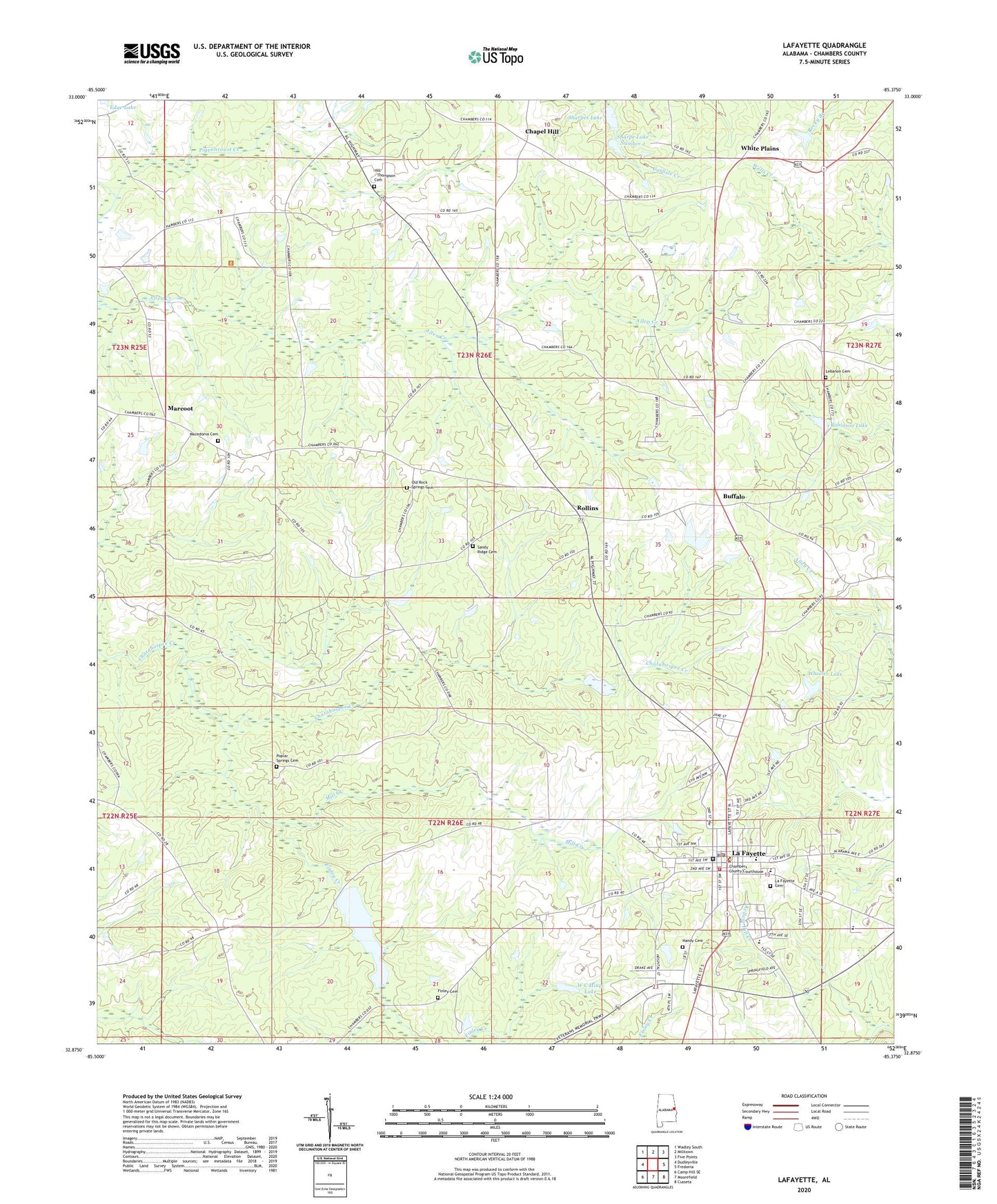
2024 topographic map quadrangle Lafayette in the state of Alabama. Scale: 1:24000. Based on the newly updated USGS 7.5' US Topo map series, this map is in the following counties: Chambers. The map contains contour data, water features, and other items you are used to seeing on USGS maps, but also has updated roads and other features. This is the next generation of topographic maps. Printed on high-quality waterproof paper with UV fade-resistant inks.
Quads adjacent to this one:
West: Dudleyville
Northwest: Wadley South
North: Milltown
Northeast: Five Points
East: Fredonia
Southeast: Cusseta
South: Moorefield
Southwest: Camp Hill SE
This map covers the same area as the classic USGS quad with code o32085h4.
Contains the following named places: Batson Memorial Sanitarium, Buffalo, Chambers County, Chambers County Courthouse, Chambers County Hospital, Chambers County Jail, Chambers County Sheriff's Office, Chapel Hill, Chapel Hill Church, Cherry Grove Church, City of La Fayette, Community Church, Eastside Elementary School, Finley Cemetery, Finley Creek, First Methodist Episcopal Church, First Presbyterian Church, Friendship Baptist Church, Friendship Church, Handy Cemetery, Hill - Thompson Cemetery, La Fayette Cemetery, La Fayette Division, La Fayette Fire Department, Lafayette, Lafayette City Hall, Lafayette City Lake Dam, Lafayette City Park, LaFayette College, Lafayette High School, Lafayette Library, LaFayette Post Office, Lafayette Reservoir, Landrum Creek, Lebanon Cemetery, Lebanon Presbyterian Church, Macedonia Cemetery, Macedonia Primitive Baptist Church, Marcoot, Mill Creek, Mount Zion Church, Nolen Dam, Nolen Lake, Old Rock Springs Cemetery, Pine Grove Church, Poplar Springs Cemetery, Poplar Springs Church, Popular Church, Powells African Methodist Episcopal Chapel, Robinson Dam, Robinson Lake, Rock Springs Baptist Church, Rollins, Sandy Ridge Cemetery, Sandy Ridge United Methodist Church, Sharpe Lake Number 2, Sharpe Number 1 Dam, Sharpe Number 2 Dam, Sharpes Lake, Slay Dam, Slay Lake, Southside School, W C Hines Dam, W C Hines Lake, Wheeler Dam, Wheeler Lake, White Hall Church, White Plains, White Plains Junior High School, WTXN-AM (Lafayette), ZIP Code: 36862