MyTopo
Wadley South Alabama US Topo Map
Couldn't load pickup availability
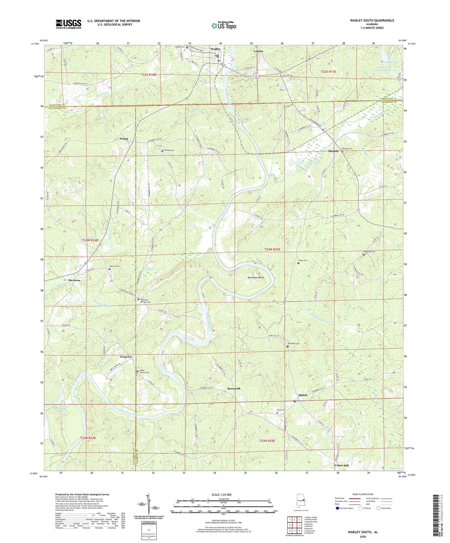
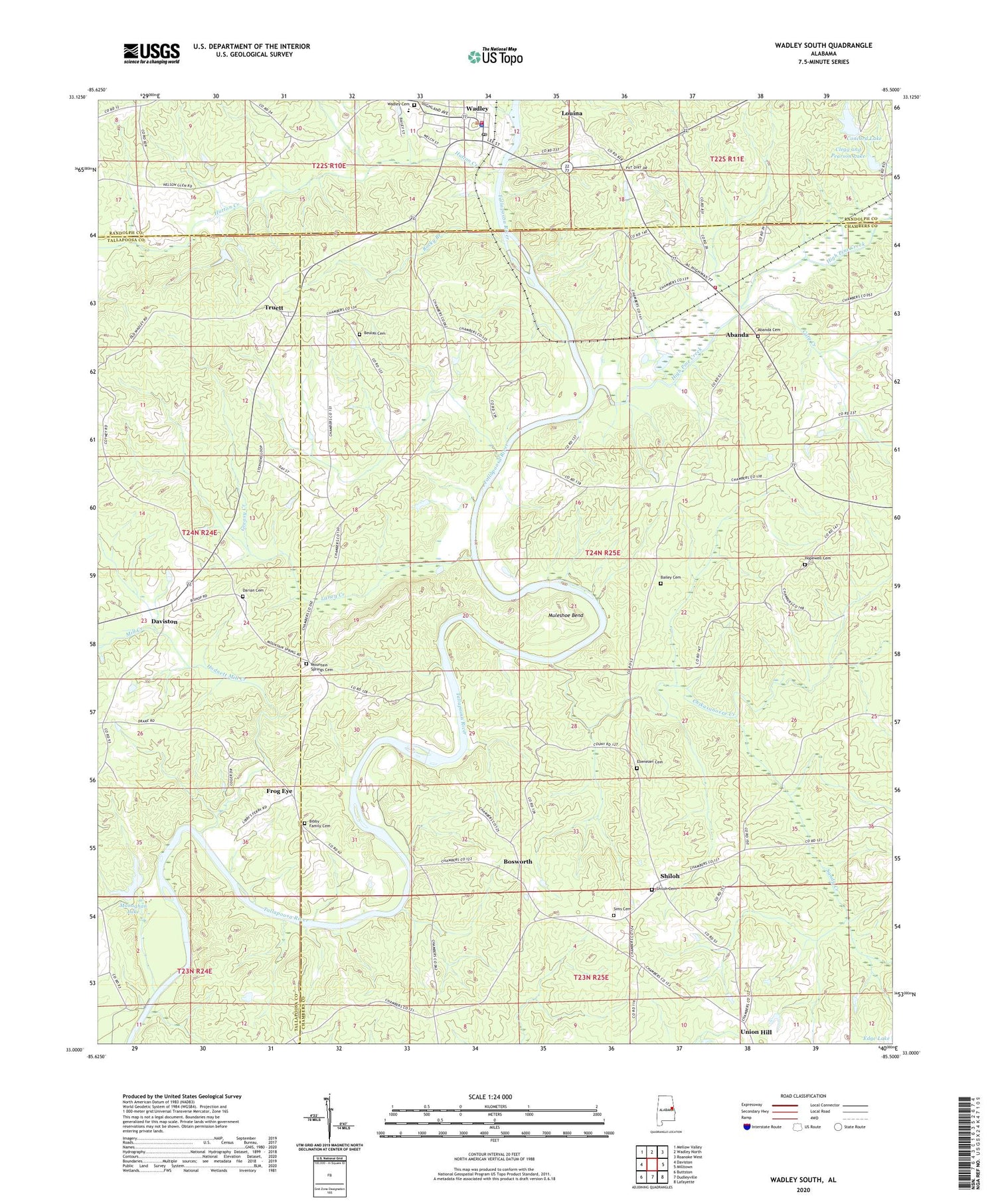
2024 topographic map quadrangle Wadley South in the state of Alabama. Scale: 1:24000. Based on the newly updated USGS 7.5' US Topo map series, this map is in the following counties: Chambers, Tallapoosa, Randolph. The map contains contour data, water features, and other items you are used to seeing on USGS maps, but also has updated roads and other features. This is the next generation of topographic maps. Printed on high-quality waterproof paper with UV fade-resistant inks.
Quads adjacent to this one:
West: Daviston
Northwest: Mellow Valley
North: Wadley North
Northeast: Roanoke West
East: Milltown
Southeast: Lafayette
South: Dudleyville
Southwest: Buttston
This map covers the same area as the classic USGS quad with code o33085a5.
Contains the following named places: Abanda, Abanda Baptist Church, Abanda Cemetery, Abanda Census Designated Place, Abanda Fire and Rescue, Antioch Church, Bailey Cemetery, Beulah Cemetery, Beulah Church, Bibby Family Cemetery, Bibbys Ferry, Bishop Ferry, Blake, Bosworth, Carlisle Branch, Caty Creek, Chesnut Fork Church, Chikasanoxee Creek, Clegg and Pearson Dam, Clegg and Pearson Lake, Concord Dam, Concord Lake, Darian Cemetery, Darian Primitive Baptist Church, Denny Ferry, Denver Church, Ebenezer Cemetery, Ebenezer Church, Fredrick Ferry, Frog Eye, Greasy Creek, High Pine Creek, Hodnett Mill Creek, Hopewell Cemetery, Hopewell Church, Hutton Creek, Johnson Ferry, Laney Creek, Louina, Mill Creek, Milltown Division, Monaghan Dam, Monaghan Lake, Mountain Spring Church, Mountain Springs Cemetery, Muleshoe Bend, Pleasant Grove Church, Rocky Branch, Sandy Creek, Shiloh, Shiloh Baptist Church, Shiloh Cemetery, Sims Cemetery, Sparkling Springs, Town of Wadley, Truett, Union Hill, Wadley, Wadley Cemetery, Wadley High School, Wadley Police Department, Wadley Post Office, Wadley Volunteer Fire Department, Wait Ferry