
MyTopo
Fredonia Alabama US Topo Map
Couldn't load pickup availability
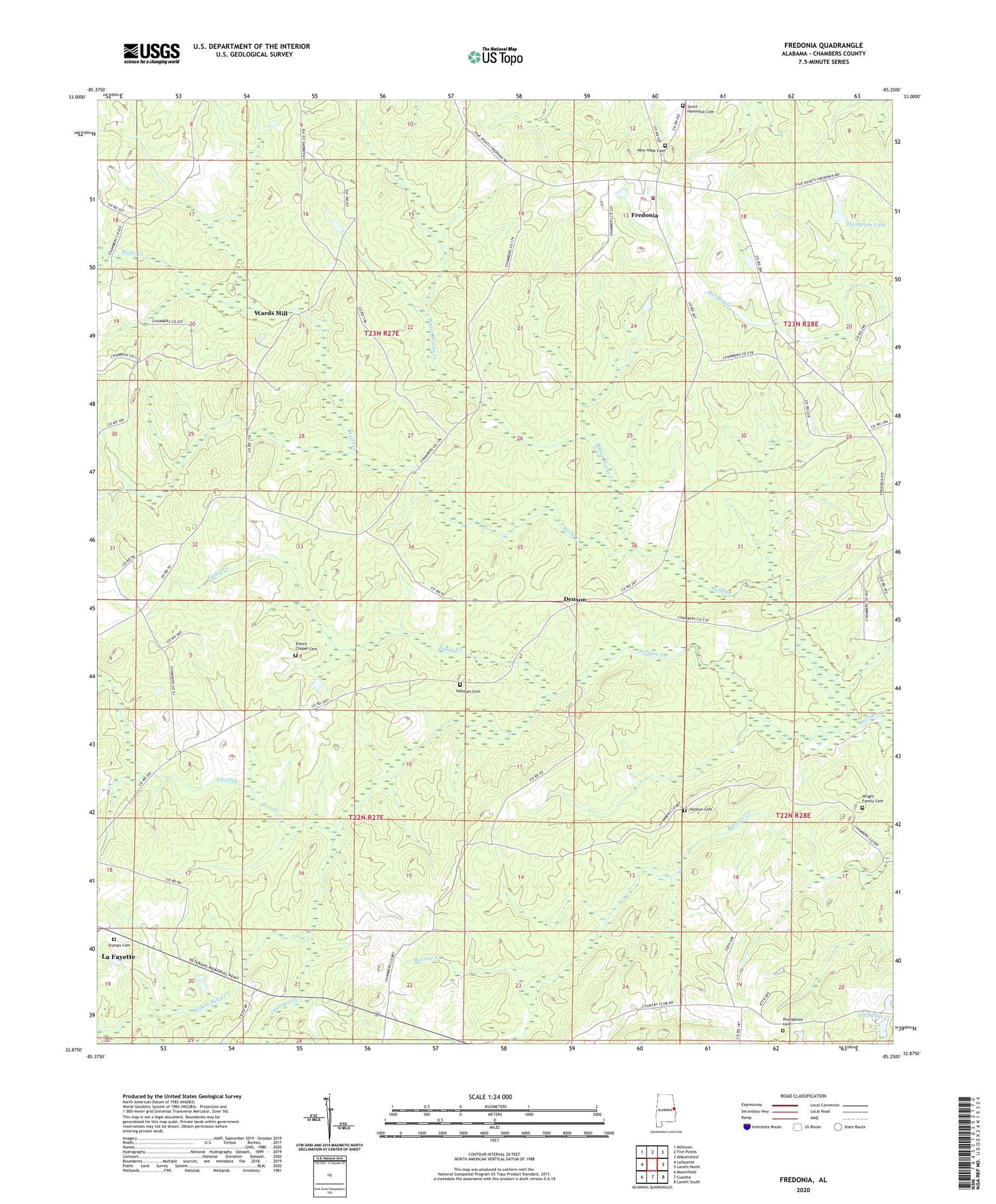
2024 topographic map quadrangle Fredonia in the state of Alabama. Scale: 1:24000. Based on the newly updated USGS 7.5' US Topo map series, this map is in the following counties: Chambers. The map contains contour data, water features, and other items you are used to seeing on USGS maps, but also has updated roads and other features. This is the next generation of topographic maps. Printed on high-quality waterproof paper with UV fade-resistant inks.
Quads adjacent to this one:
West: Lafayette
Northwest: Milltown
North: Five Points
Northeast: Abbottsford
East: Lanett North
Southeast: Lanett South
South: Cusseta
Southwest: Moorefield
This map covers the same area as the classic USGS quad with code o32085h3.
Contains the following named places: Allen Creek, Darden Dam, Dardens Lake, Denson, Emmanuel Church, Emory Chapel Cemetery, Evangel Temple Church, Finley Creek, Fredonia, Fredonia Campground and Refuge Center, Fredonia Census Designated Place, Fredonia Church, Fredonia Fire and Rescue Unit, Fredonia Fire Tower, Hills Lake, Holstum Cemetery, Holstun Cemetery, Jackson Memorial Baptist Church, Kellem Hill Creek, Kendrick-Holmes Dam, Lanett Division, Macedonia Church, Mitchell Springs Church, Mount Pisgah Church, Mount Zion Church, New Hope Baptist Church, New Hope Cemetery, New Hope Church, Providence Baptist Church, Providence Cemetery, Sharon Cemetery, Smith Dam, Stamps Cemetery, Sweet Home Methodist Church, Swint - Hammack Cemetery, Thlakalchka Cholockominne, Thompson Dam, Thompson Lake, Victory Church, Wards Mill, Water Works Creek, Wells Creek, Wright Family Cemetery, ZIP Code: 36863


