
MyTopo
Pigeon Creek Alabama US Topo Map
Couldn't load pickup availability
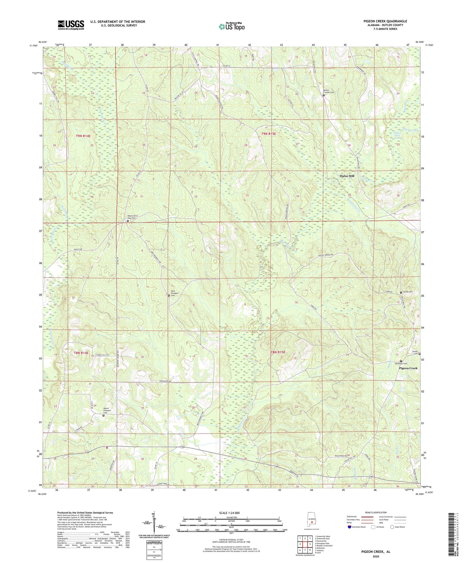
2024 topographic map quadrangle Pigeon Creek in the state of Alabama. Scale: 1:24000. Based on the newly updated USGS 7.5' US Topo map series, this map is in the following counties: Butler. The map contains contour data, water features, and other items you are used to seeing on USGS maps, but also has updated roads and other features. This is the next generation of topographic maps. Printed on high-quality waterproof paper with UV fade-resistant inks.
Quads adjacent to this one:
West: Georgiana East
Northwest: Greenville West
North: Greenville East
Northeast: Honoraville
East: Moodys Crossroads
Southeast: Leon
South: Industry
Southwest: McKenzie
This map covers the same area as the classic USGS quad with code o31086f5.
Contains the following named places: Camp Stanley, Center Hill School, Deep Step Creek, Ebenezer Cemetery, Fiw Volunteer Fire Department, Friendship Church, Friendship School, Halso Mill, Hard Labor Creek, Harrigan Creek, Hawkins Creek, Macedonia Church, Mercers Bridge, Mount Carmel Cemetery, Mount Carmel Church, Mount Olive East Cemetery, Mount Olive East Church, Mount Pleasant Baptist Church, Mount Pleasant Cemetery, New Prospect Cemetery, New Prospect Church, Pigeon Creek, Pigeon Creek Lookout Tower, Sardis, Sardis Baptist Church, Sardis Cemetery, Shiloh Cemetery, Sims School, Spring Hill Church, The Church of the Lord Jesus


