MyTopo
Moodys Crossroads Alabama US Topo Map
Couldn't load pickup availability
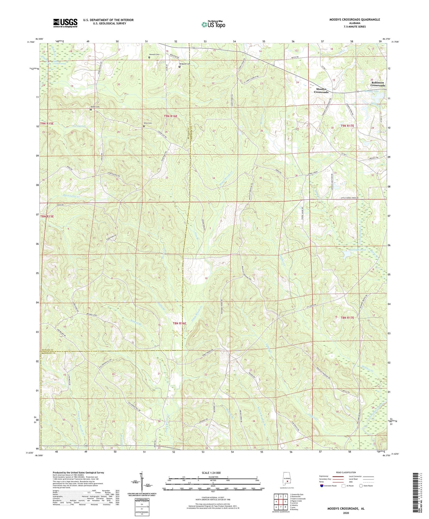
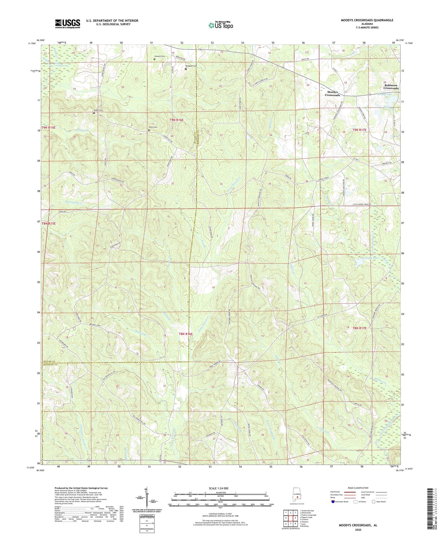
2024 topographic map quadrangle Moodys Crossroads in the state of Alabama. Scale: 1:24000. Based on the newly updated USGS 7.5' US Topo map series, this map is in the following counties: Crenshaw, Butler. The map contains contour data, water features, and other items you are used to seeing on USGS maps, but also has updated roads and other features. This is the next generation of topographic maps. Printed on high-quality waterproof paper with UV fade-resistant inks.
Quads adjacent to this one:
West: Pigeon Creek
Northwest: Greenville East
North: Honoraville
Northeast: Fullers Crossroads
East: Luverne
Southeast: Brantley
South: Leon
Southwest: Industry
This map covers the same area as the classic USGS quad with code o31086f4.
Contains the following named places: Austin Branch, Bedgood Cemetery, Boswell Branch, Butler Cemetery, Cooks Stand, Fosters Store, Free Branch, Holland School, Honey Creek, Howard Cemetery, Johns Creek, Keelough Pond, Keelough Pond Dam, Little Horse Creek, Mattox Store, Mills Chapel, Moody Lake Dam, Moodys Crossroads, Moodys Lake, Panther Creek, Pleasant Home, Pleasant Home Church, Powell School, Robinson Crossroads, Saint James Church, Siloam Church, Spring Hill Church, Wren Cemetery, ZIP Code: 36071