MyTopo
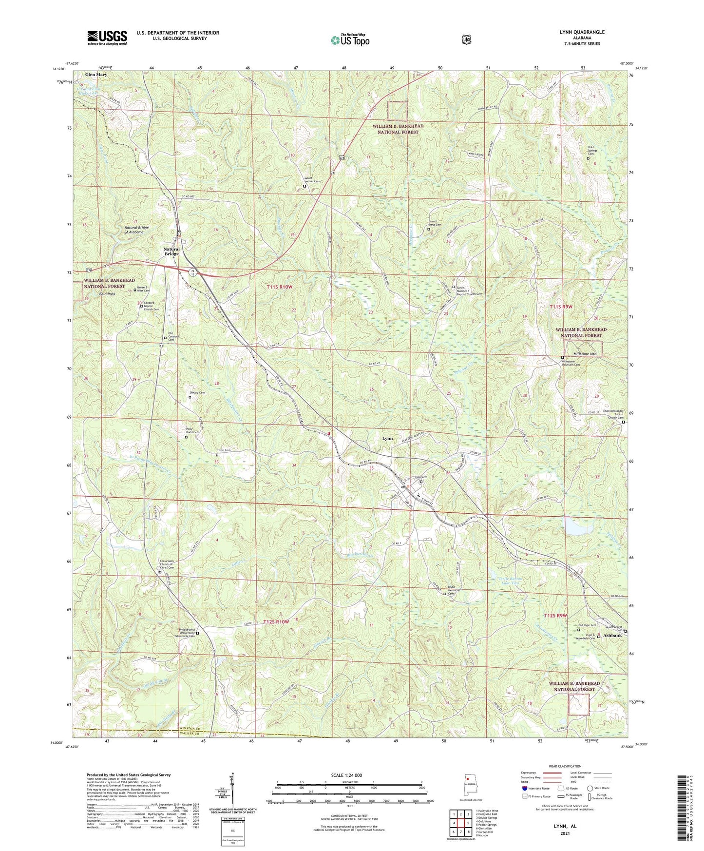
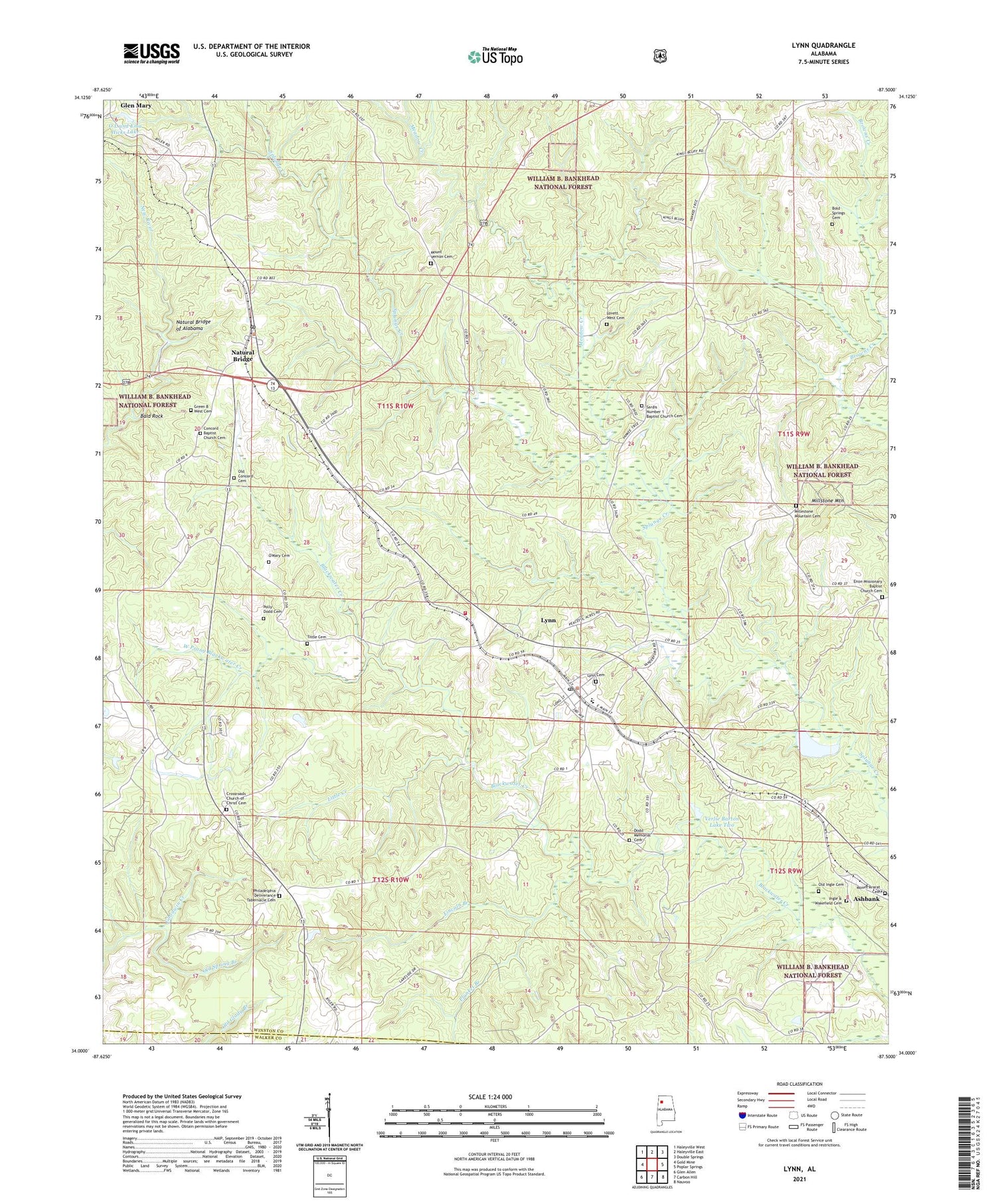
Lynn Alabama US Topo Map
Couldn't load pickup availability
Also explore the Lynn Forest Service Topo of this same quad for updated USFS data
2024 topographic map quadrangle Lynn in the state of Alabama. Scale: 1:24000. Based on the newly updated USGS 7.5' US Topo map series, this map is in the following counties: Winston, Walker. The map contains contour data, water features, and other items you are used to seeing on USGS maps, but also has updated roads and other features. This is the next generation of topographic maps. Printed on high-quality waterproof paper with UV fade-resistant inks.
Quads adjacent to this one:
West: Gold Mine
Northwest: Haleyville West
North: Haleyville East
Northeast: Double Springs
East: Poplar Springs
Southeast: Nauvoo
South: Carbon Hill
Southwest: Glen Allen
This map covers the same area as the classic USGS quad with code o34087a5.
Contains the following named places: Bald Rock, Barton Fishing Lake Dam Two, Bartons Fishing Lake Dam, Black Swamp, Bold Springs Cemetery, Bold Springs School, Chapman School, Concord Baptist Church Cemetery, Concord Church, Copperas Spring School, Crossroad Church, Crossroad School, Crossroads Church of Christ Cemetery, Crossroads School, David Posey Memorial Stadium, Dodd Drift Mine, Dodd Memorial Cemetery, Enon Church, Enon Missionary Baptist Church Cemetery, Enon School, Farriss, German Crossing, Glen Mary, Glen Mary School, Glenmary Post Office, Green B West Cemetery, High Point, Ice Berg Mine, Ingle & Wakefield Cemetery, King School, Kings Church, Kings School, Larissa, Lincoln Branch, Little Creek, Lovett West Cemetery, Low Gap, Lynn, Lynn Cemetery, Lynn Division, Lynn Elementary School, Lynn High School, Lynn Post Office, Lynn Volunteer Fire Department, Marlin Post Office, Meadow Creek, Millestone Mountain Cemetery, Millstone Mountain, Millstone Mountain Church, Millstone Mountain Freewill Baptist Church Cemetery, Mount Ararat Cemetery, Mount Vernon Cemetery, Natural Bridge, Natural Bridge Mine, Natural Bridge of Alabama, Natural Bridge Post Office, Natural Bridge School, Norris Post Office, O L and Ema Hicks Lake, O L and Ema Hicks Lake Dam, Oak Hill School, Old Concord Cemetery, Old Ingle Cemetery, Old Spring Branch, O'Mary Cemetery, Parcoal Post Office, Philadelphia Church, Philadelphia Deliverance Tabernacle Cemetery, Plunket Branch, Polly Dodd Cemetery, Sardis Church, Sardis Number 1 Baptist Church Cemetery, Splunge Post Office, Tittle Cemetery, Town of Lynn, Town of Natural Bridge, Unknown Soldiers Grave, Verlie Barton Lake One, Verlie Barton Lake Two, West Mine, West Prong Blackwater Creek, Winston County Drag Strip, ZIP Codes: 35575, 35577