MyTopo
Mellow Valley Alabama US Topo Map
Couldn't load pickup availability
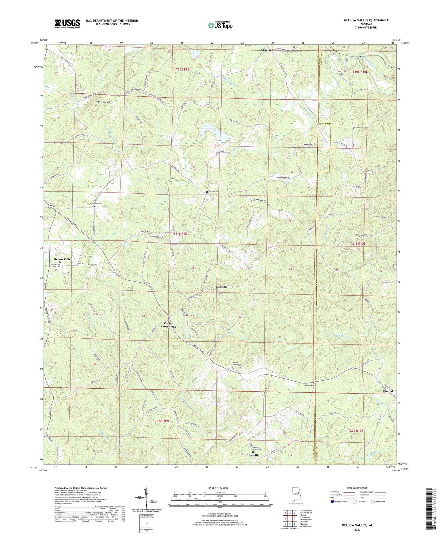
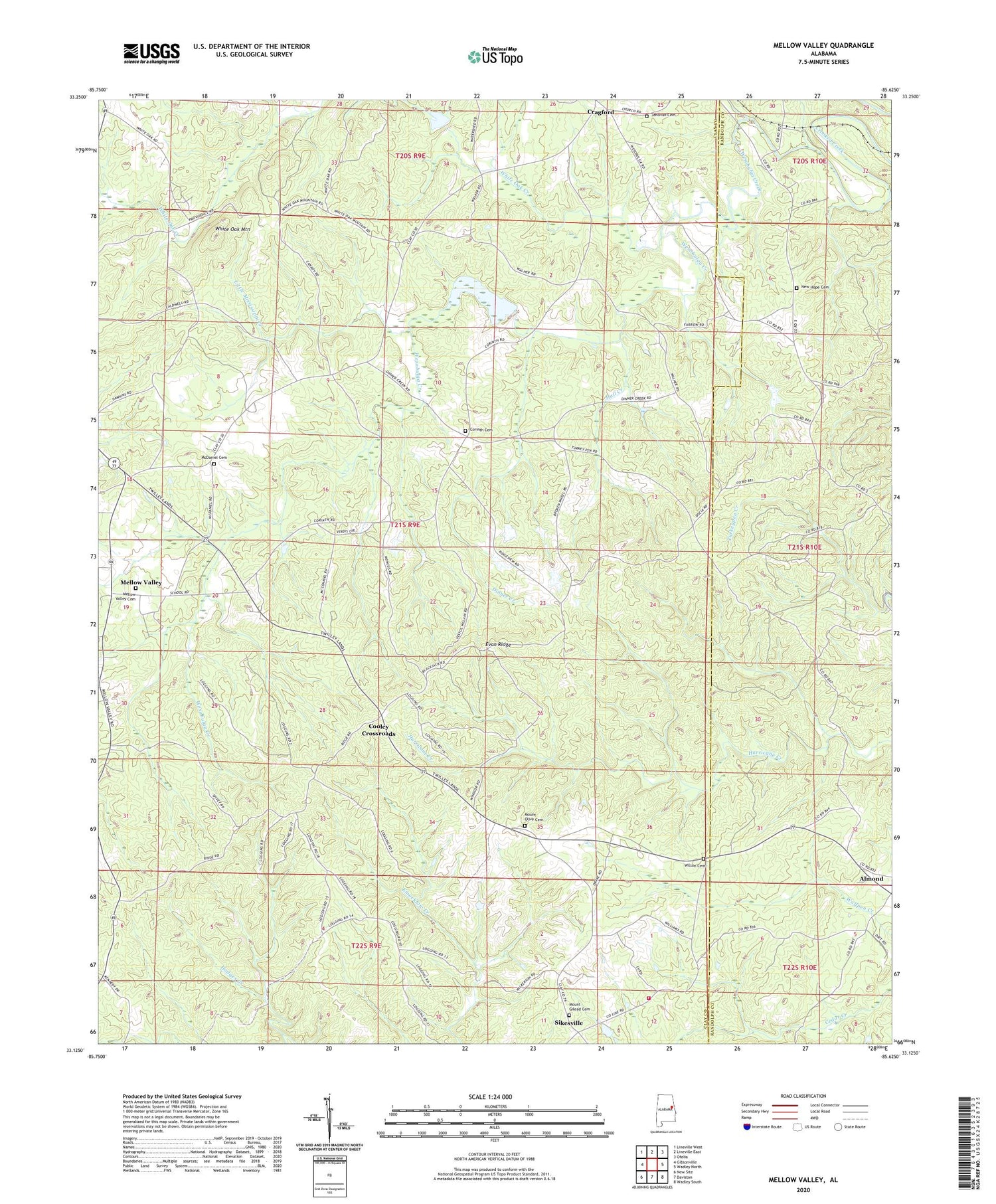
2024 topographic map quadrangle Mellow Valley in the state of Alabama. Scale: 1:24000. Based on the newly updated USGS 7.5' US Topo map series, this map is in the following counties: Clay, Randolph. The map contains contour data, water features, and other items you are used to seeing on USGS maps, but also has updated roads and other features. This is the next generation of topographic maps. Printed on high-quality waterproof paper with UV fade-resistant inks.
Quads adjacent to this one:
West: Gibsonville
Northwest: Lineville West
North: Lineville East
Northeast: Ofelia
East: Wadley North
Southeast: Wadley South
South: Daviston
Southwest: New Site
This map covers the same area as the classic USGS quad with code o33085b6.
Contains the following named places: Amason Prospect, Bells Store, Blackjack Lookout Tower, Bluff Spring Post Office, Carter Lake, Carter Prospect, Cooley Crossroads, Corinth, Corinth Baptist Church, Corinth Cemetery, County Line Volunteer Fire Department, Crooked Creek Watershed Dam Number 16, Dawkins Prospect, Dinner Creek, Evan Ridge, Farrar-Wallace Prospect, Flint Hill Church, Gum Spring Church, Hall Creek, Jehovah Cemetery, Jehovah Church, Knights Mill, Knights Mill Prospect, Landowners Hunting Club, Little Mississippi Creek, Loombeam Gin, Maitland Gin, Manning Placer Mine, McDaniel Cemetery, Mellow Valley, Mellow Valley Baptist Church, Mellow Valley Cemetery, Mellow Valley High School, Mitchell Prospect Number One, Mount Gilead Cemetery, Mount Gilead Church, Mount Olive Cemetery, Mount Olive Church, New Hope Cemetery, New Hope Church, Sikesville, Tallapoosa River Hunting Club, Walker Prospect, Wesobulga Creek, Westobulga, White Oak Creek, White Oak Mountain, Wilson Cemetery, ZIP Code: 36255