MyTopo
Wadley North Alabama US Topo Map
Couldn't load pickup availability
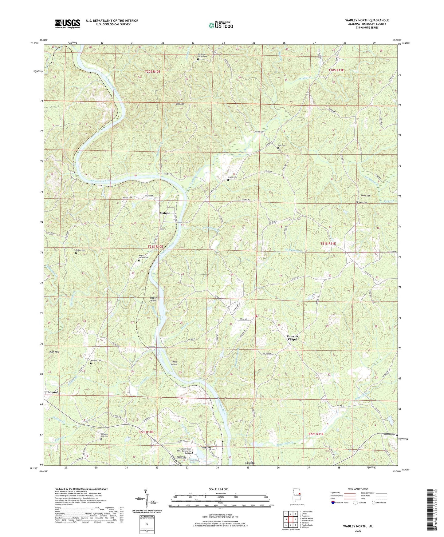
2024 topographic map quadrangle Wadley North in the state of Alabama. Scale: 1:24000. Based on the newly updated USGS 7.5' US Topo map series, this map is in the following counties: Randolph. The map contains contour data, water features, and other items you are used to seeing on USGS maps, but also has updated roads and other features. This is the next generation of topographic maps. Printed on high-quality waterproof paper with UV fade-resistant inks.
Quads adjacent to this one:
West: Mellow Valley
Northwest: Lineville East
North: Ofelia
Northeast: Wedowee
East: Roanoke West
Southeast: Milltown
South: Wadley South
Southwest: Daviston
This map covers the same area as the classic USGS quad with code o33085b5.
Contains the following named places: Almond, Almond Church, Antioch Cemetery, Atchinalgi, Beaverdam Creek, Bethlehem Church, Big Hunting Club, Buck Branch, Buck Mountain, Cedar Creek, College Lake, College Lake Dam, Concord, Concord Cemetery, Concord Church, Corinth, Corinth Church, Corinth Volunteer Fire Department, Cornhouse Creek, Crooked Creek, Dewberry Branch, Fisher Cemetery, Fixico Creek, Forester Chapel, Forester Chapel Church, Frost Dam, Frost Lake, Gay Cemetery, Hillabeehago Branch, Hodge Island, Hope Memorial Church, Hunter Branch, Hurricane Creek, Knight Cemetery, Knight Dam, Level Road, Macedonia Church, Malone, Malone Cemetery, Malone Church, Malone Ferry, No Business Creek, Oak Mountain, Pine Flat Church, Pine Grove Cemetery, Pleasant Grove Cemetery, Pleasant Grove School, Pleasant Hill Cemetery, Pleasant Hill Church, Price Branch, Price Island, Southern Union State College, Stephens Mill, Swan Cemetery, Swan Hill, Transco Dam, Turkeypen Creek, Wadley Division, Wellborne Ferry, Whites Chapel, Wildcat Creek, Wolfpen Creek, Woodville Church, ZIP Code: 36276