MyTopo
Milton Alabama US Topo Map
Couldn't load pickup availability
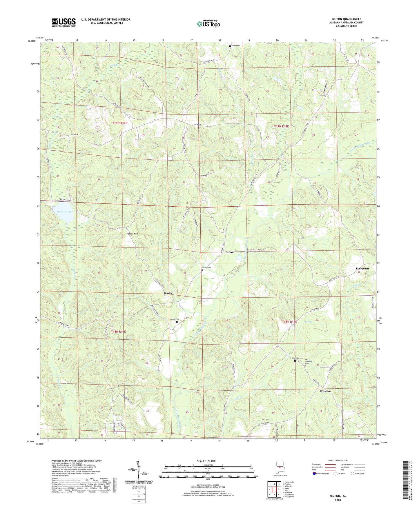
2024 topographic map quadrangle Milton in the state of Alabama. Scale: 1:24000. Based on the newly updated USGS 7.5' US Topo map series, this map is in the following counties: Autauga. The map contains contour data, water features, and other items you are used to seeing on USGS maps, but also has updated roads and other features. This is the next generation of topographic maps. Printed on high-quality waterproof paper with UV fade-resistant inks.
Quads adjacent to this one:
West: Jones
Northwest: Plantersville
North: Pletcher
Northeast: Billingsley
East: Vida
Southeast: Autaugaville
South: Durant Bend
Southwest: Burnsville
This map covers the same area as the classic USGS quad with code o32086e7.
Contains the following named places: Bethel Church, Billingsley Division, Bishop Cemetery, Bonita, Cavirs School, Coee Cemetery, Coon Creek, Dawson Mill, Evergreen, Evergreen Baptist Church, Evergreen Lookout Tower, Fig Tree Baptist Church, Friendship Church, Hamilton Post Office, Harmony Cemetery, Harmony Church, Long Branch, Milton, Milton Baptist Church, Milton Cemetery, Motley Branch, New Salem Church, New Salem School, Old Harmony Cemetery, Ousley Store, Parker Branch, Parker Mountain, Rutledge Church, Salem Church, Sand Branch, Stockton, Thompson Mine, Unity Church, Walkers Lake, Winslow, ZIP Code: 36749