MyTopo
Durant Bend Alabama US Topo Map
Couldn't load pickup availability
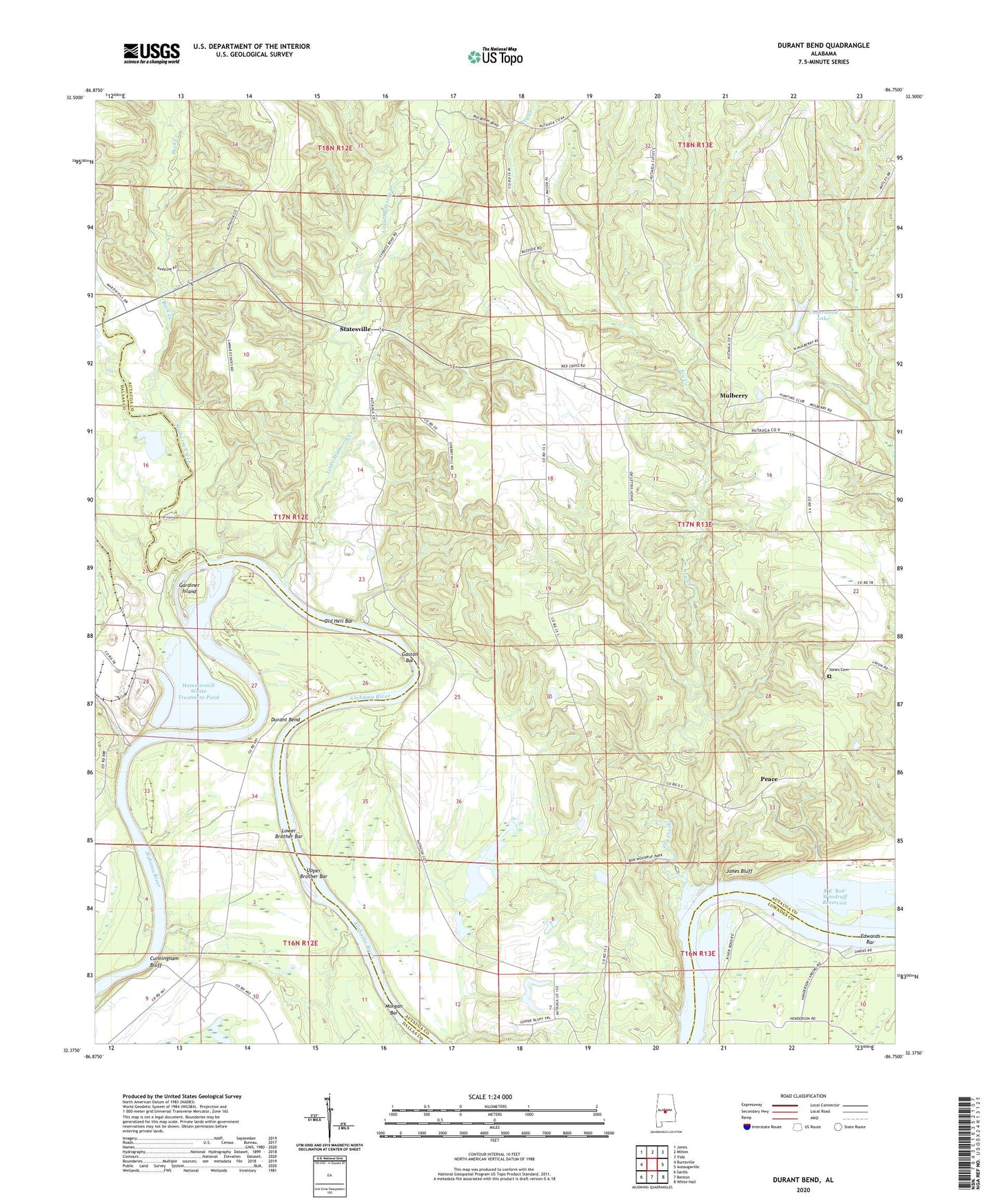
2024 topographic map quadrangle Durant Bend in the state of Alabama. Scale: 1:24000. Based on the newly updated USGS 7.5' US Topo map series, this map is in the following counties: Autauga, Dallas, Lowndes. The map contains contour data, water features, and other items you are used to seeing on USGS maps, but also has updated roads and other features. This is the next generation of topographic maps. Printed on high-quality waterproof paper with UV fade-resistant inks.
Quads adjacent to this one:
West: Burnsville
Northwest: Jones
North: Milton
Northeast: Vida
East: Autaugaville
Southeast: White Hall
South: Benton
Southwest: Sardis
This map covers the same area as the classic USGS quad with code o32086d7.
Contains the following named places: Alabama State Docks Facility, Big Springs Church, Buck Creek, Cunningham Bluff, Cunninghams Landing, Durant Bend, Edwards Bar, Gardiner Island, Gardners Landing, Gaston Bar, Hammermill Waste Treatment Dam, Hammermill Waste Treatment Pond, Henderson Landing, Ivy Creek, Ivy Creek United Methodist Church, Jim Adams Lake, Jim Adams Lake Dam, Jones Bluff, Jones Cemetery, Kalmia, Little Mulberry Creek, Lower Brother Bar, Mellards Chapel Church, Morgan Bar, Mulberry, Mulberry Creek, Old Hell Bar, Peace, Perrys Landing, Pine Grove Church, R E Bob Woodruff Park, River Bend Church, Saint Matthew Church, Selma State Park, Statesville, Steeles Farm, Steels Mill, Steezers Farm, Underwood Lake, Underwood Lake Dam, Upper Brother Bar