MyTopo
Autaugaville Alabama US Topo Map
Couldn't load pickup availability
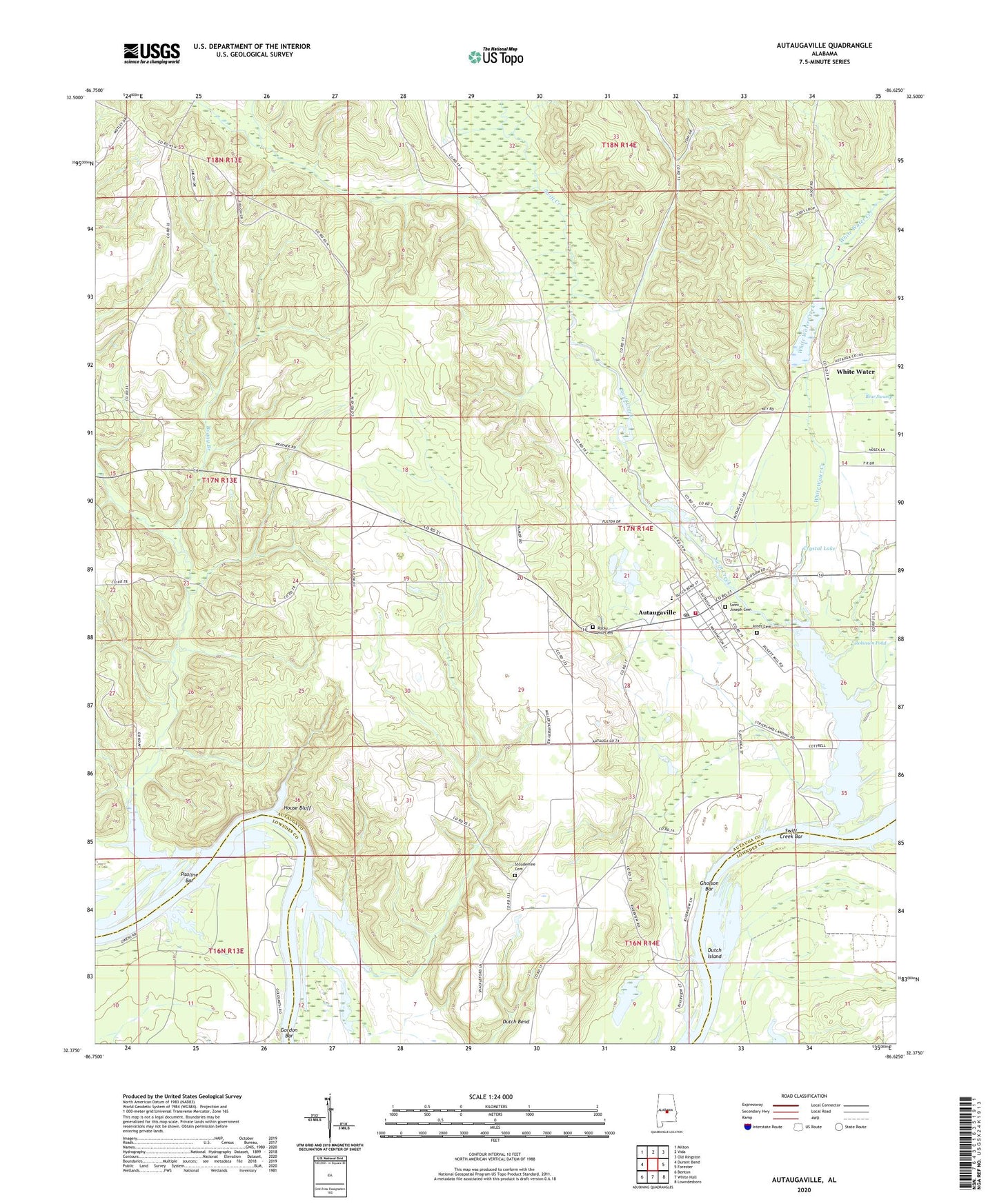
2024 topographic map quadrangle Autaugaville in the state of Alabama. Scale: 1:24000. Based on the newly updated USGS 7.5' US Topo map series, this map is in the following counties: Autauga, Lowndes. The map contains contour data, water features, and other items you are used to seeing on USGS maps, but also has updated roads and other features. This is the next generation of topographic maps. Printed on high-quality waterproof paper with UV fade-resistant inks.
Quads adjacent to this one:
West: Durant Bend
Northwest: Milton
North: Vida
Northeast: Old Kingston
East: Forester
Southeast: Lowndesboro
South: White Hall
Southwest: Benton
This map covers the same area as the classic USGS quad with code o32086d6.
Contains the following named places: Autauga Landing, Autaugaville, Autaugaville Division, Autaugaville Elementary School, Autaugaville High School, Autaugaville Post Office, Autaugaville Volunteer Fire Department, Beaver Creek, Boggy Branch, Camp Alabama, Canaan Land Church, Cedar Grove Church, Crystal Lake, Crystal Lake Dam, Dutch Bend, Dutch Bend Church, Dutch Island, Gholson Bar, Gordon Bar, Greater Pine Grove Church, House Bluff, Howard Creek, Jones Cemetery, Miller State Forest Nursery, Old Augusta Church, Pauline Bar, Pine Creek, Rocky Hill Cemetery, Saint Joseph Cemetery, Shiloh Church, Stoudemire Cemetery, Stover Branch, Stricklands Landing, Swift Creek, Swift Creek Bar, Swift Creek Park, Town of Autaugaville, White Water, White Water Creek, Yellow Water Creek, ZIP Code: 36003