MyTopo
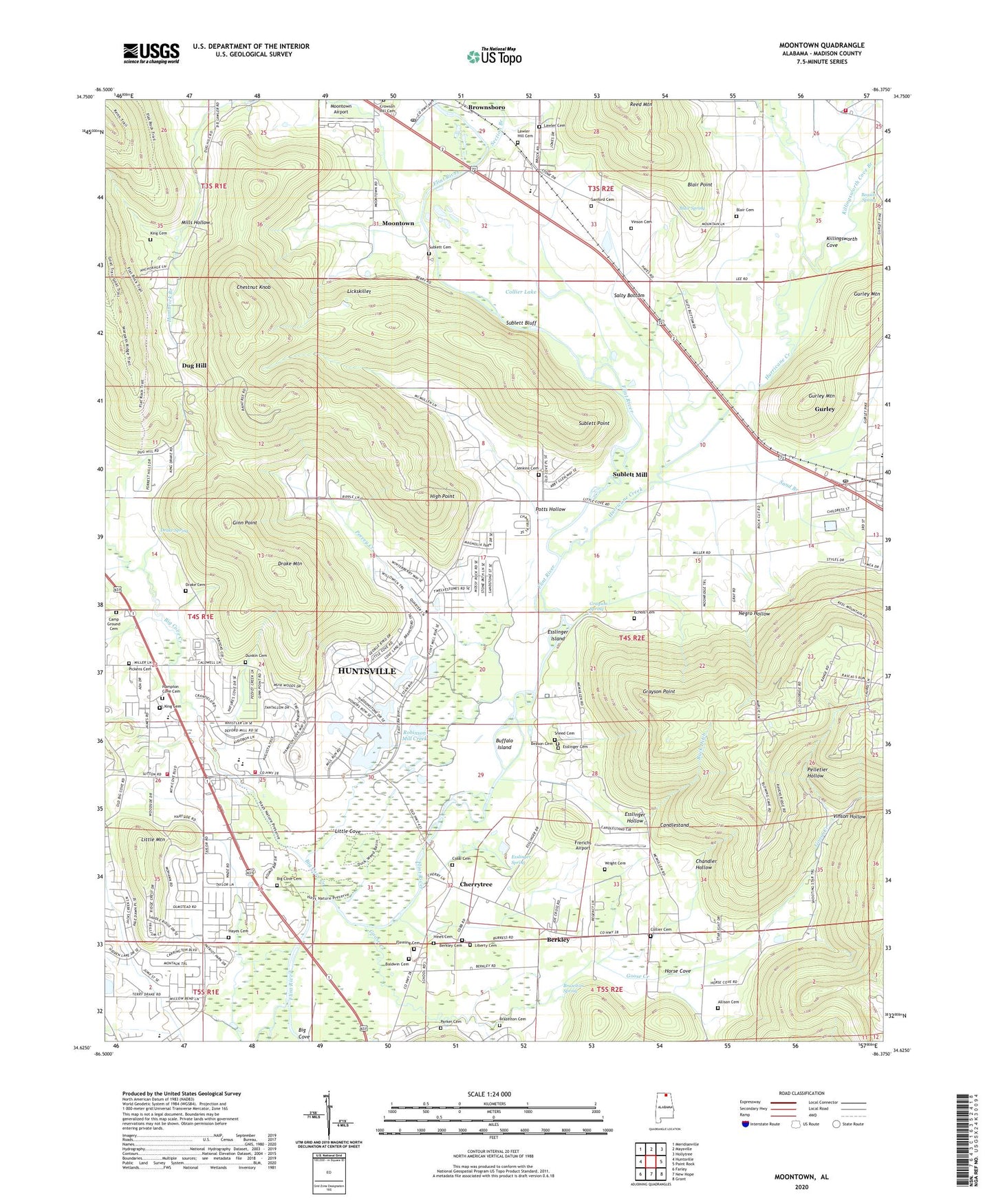
Moontown Alabama US Topo Map
Couldn't load pickup availability
2024 topographic map quadrangle Moontown in the state of Alabama. Scale: 1:24000. Based on the newly updated USGS 7.5' US Topo map series, this map is in the following counties: Madison. The map contains contour data, water features, and other items you are used to seeing on USGS maps, but also has updated roads and other features. This is the next generation of topographic maps. Printed on high-quality waterproof paper with UV fade-resistant inks.
Quads adjacent to this one:
West: Huntsville
Northwest: Meridianville
North: Maysville
Northeast: Hollytree
East: Paint Rock
Southeast: Grant
South: New Hope
Southwest: Farley
This map covers the same area as the classic USGS quad with code o34086f4.
Contains the following named places: Acklin Church, Adair Ford, Allison Cemetery, Beason Cemetery, Beason Spring, Beech Grove Church, Berkley, Berkley Center Head Start School, Berkley Junior High School, Big Cove, Big Cove Cemetery, Big Cove Creek, Big Cove Junior High School, Big Cove Presbyterian Church, Big Cove Volunteer Fire Department, Blair Cemetery, Blair Point, Blair Spring, Boles Point Church, Brazelton Cemetery, Brazelton Spring, Brownsboro, Brownsboro Post Office, Buck Ditch, Buffalo Island, Camp Ground, Candlestand, Chandler Hollow, Cherrytree, Chestnut Grove Methodist Church, Chestnut Grove School, Chestnut Knob, Chigger Ridge Farm, Cobb Bridge, Cobb Cemetery, Collier Cemetery, Collier Lake, Drake Cemetery, Drake Mountain, Drake Spring, Dug Hill, Dunkin Cemetery, Ebenezer Missionary Baptist Church, Echols Cemetery, Esslinger Hollow, Esslinger Island, Esslinger Spring, Fleming Cemetery, Frerichs Airport, Ginn Point, Goose Creek, Grayson Ford, Grayson Point, Grayson Spring, Gurley, Gurley Airport, Gurley Division, Gurley Mountain, Gurley Post Office, Hambrick Branch, Hayes Cemetery, Hayes Chapel School, High Point, Hines Cemetery, Horse Cove, Huntsville Fire and Rescue Department Station 17, Hurricane Creek, Jenkins Cemetery, Killingsworth Cove, Killingsworth Cove Branch, Killingsworth Cove Volunteer Fire Department Station 2, King Cemetery, Lawler Cemetery, Liberty Primitive Baptist Church, Lickskillet, Little Cove, Little Mountain, Madison County High School, Mills Hollow, Moontown, Moontown Airport, Negro Hollow, Nelson Chapel, Nunn Store, Parker Cemetery, Peevey Creek, Pelletier Hollow, Pickens Cemetery, Potts Cemetery, Potts Hollow, Reagan School, Reed Mountain, Robinson Mill Creek, Ross Chapel, Salty Bottom, Sand Branch, Sanford Cemetery, Section Branch, Shiloh Church, Shipp Park Church, Sublett Bluff, Sublett Cemetery, Sublett Mill, Sublett Point, Town of Gurley, Vinson Cemetery, Vinson Hollow, Wilson Reservation, Wood Airport, Wright Cemetery, ZIP Codes: 35741, 35748


