MyTopo
Paint Rock Alabama US Topo Map
Couldn't load pickup availability
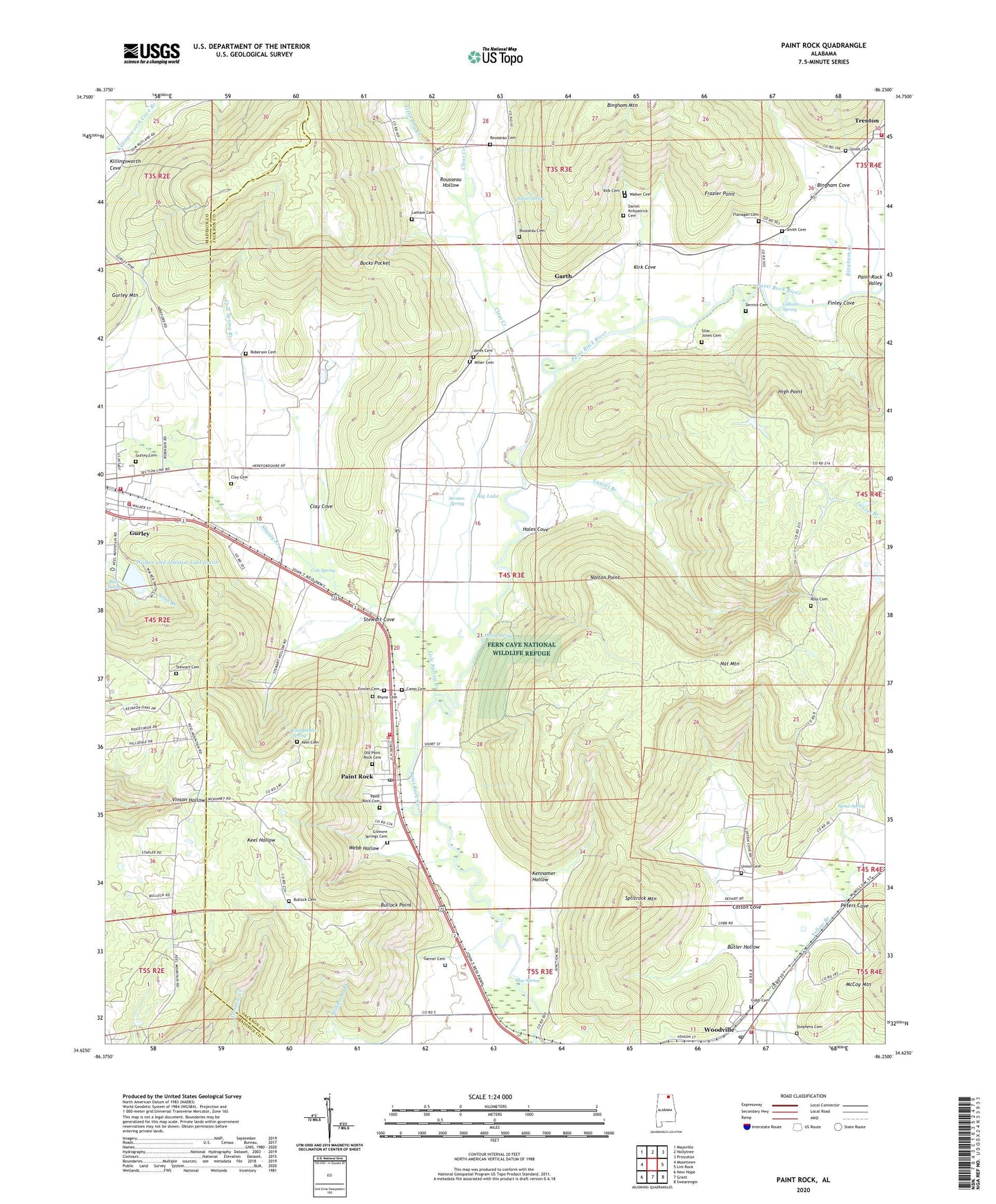
2024 topographic map quadrangle Paint Rock in the state of Alabama. Scale: 1:24000. Based on the newly updated USGS 7.5' US Topo map series, this map is in the following counties: Jackson, Madison. The map contains contour data, water features, and other items you are used to seeing on USGS maps, but also has updated roads and other features. This is the next generation of topographic maps. Printed on high-quality waterproof paper with UV fade-resistant inks.
Quads adjacent to this one:
West: Moontown
Northwest: Maysville
North: Hollytree
Northeast: Princeton
East: Lim Rock
Southeast: Swearengin
South: Grant
Southwest: New Hope
This map covers the same area as the classic USGS quad with code o34086f3.
Contains the following named places: Antioch Church, Big Lake, Bingham Cove, Bingham Creek, Blair Spring, Blue Spring, Bucks Pocket, Bullock Cemetery, Bullock Point, Butler Hollow, Chalybeate Spring, Clay Cemetery, Clay Cove, Clear Creek, Cole Spring, Cole Spring Branch, Conyers-Rosenwald School, Cotton Cove, Daniel Spring, Elliott Reservation, Fern Cave National Wildlife Refuge, Finley Cove, Flanagan Cemetery, Flippo Ford, Fowler Cemetery, Frazier Point, Garth, Garth Church, Gilliam Spring, Gurley Police Department, Gurley Volunteer Fire Department Station 1, Gurley Volunteer Fire Department Station 2, Hales Cove, Hales Cove School, Haley Spring, High Point, Holly Spring School, Holly Springs School, Jones Cemetery, Keel Mountain Volunteer Fire Department, Kennamer Hollow, Kirk Cemetery, Kirk Cove, Lacy Reservation, Latham Cemetery, Laurel Branch, Little Dry Creek, Naught Mine, Nolton Point, Paint Rock, Paint Rock Cemetery, Paint Rock Church, Paint Rock Division, Paint Rock Post Office, Paint Rock Valley, Paint Rock Volunteer Fire Department, Peters Cove, Pleasant Grove Baptist Church, Roberson Cemetery, Ross Cemetery, Rousseau Cemetery, Rousseau Hollow, Saint Clair Grist Mill, Serotas Spring, Shanty Branch, Shiloh Church, Smith Walker and Johnson Lake, Smith Walker and Johnson Lake Dam, Smith Cemetery, Smiths Mill, Splitrock Mountain, Spout Spring, Stephens Cemetery, Stevens Reservation, Stewart Cemetery, Stewart Cove, Town of Paint Rock, Town of Woodville, Trenton, Trenton Church, Union Cemetery, Union Church, Valley Volunteer Fire Department Station 2, Walker Cemetery, Walker Mill Ford, Walkers Mill, Webb Hollow, Wells Ford, Woodville, Woodville Post Office, Woodville School, Woodville Volunteer Fire Department, ZIP Code: 35764