MyTopo
Morvin Alabama US Topo Map
Couldn't load pickup availability
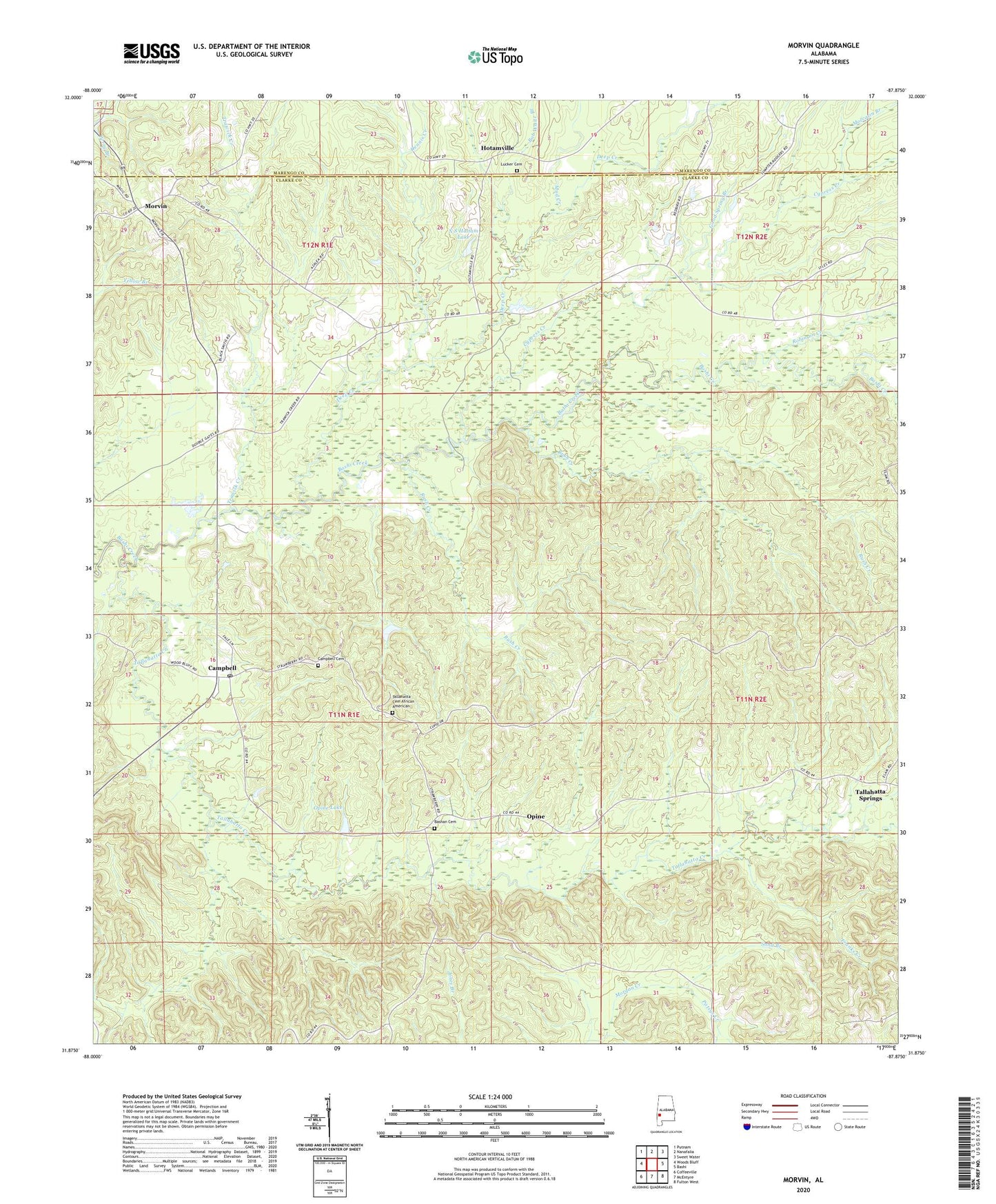
2024 topographic map quadrangle Morvin in the state of Alabama. Scale: 1:24000. Based on the newly updated USGS 7.5' US Topo map series, this map is in the following counties: Clarke, Marengo. The map contains contour data, water features, and other items you are used to seeing on USGS maps, but also has updated roads and other features. This is the next generation of topographic maps. Printed on high-quality waterproof paper with UV fade-resistant inks.
Quads adjacent to this one:
West: Woods Bluff
Northwest: Putnam
North: Nanafalia
Northeast: Sweet Water
East: Bashi
Southeast: Fulton West
South: McEntyre
Southwest: Coffeeville
This map covers the same area as the classic USGS quad with code o31087h8.
Contains the following named places: Bashan Baptist Church, Bashan Cemetery, Bashi Church, Bob White Branch, Campbell, Campbell Cemetery, Campbell Church, Campbell Hill Church, Christian Fellowship Baptist Church, Church of God, Creels Chapel Methodist Church, Cypress Creek, Deep Creek, Dennis Creek, Doctor Graysons Mill, Dry Branch, Franks Creek, Good Spring Branch, Hotamville, Lucker Cemetery, Moccasin Branch, Morris Springs Church, Morvin, Morvin Church of Christ, Morvin Post Office, Mud Creek, N S Haltam Lake, N S Haltam Lake Dam, Opine, Opine Community House, Opine Lake, Opine Timber Company Dam, Patsys Creek, Reid School, Robinson Creek, Rush Creek, Sand Branch, Scotch State Wildlife Management Area, Tallahata Methodist Church, Tallahatta African Methodist Episcopal Church, Tallahatta Cemetery African American, Tallahatta Creek, Tallahatta Springs, Trawick Creek, Walnut Grove Church