
MyTopo
Putnam Alabama US Topo Map
Couldn't load pickup availability
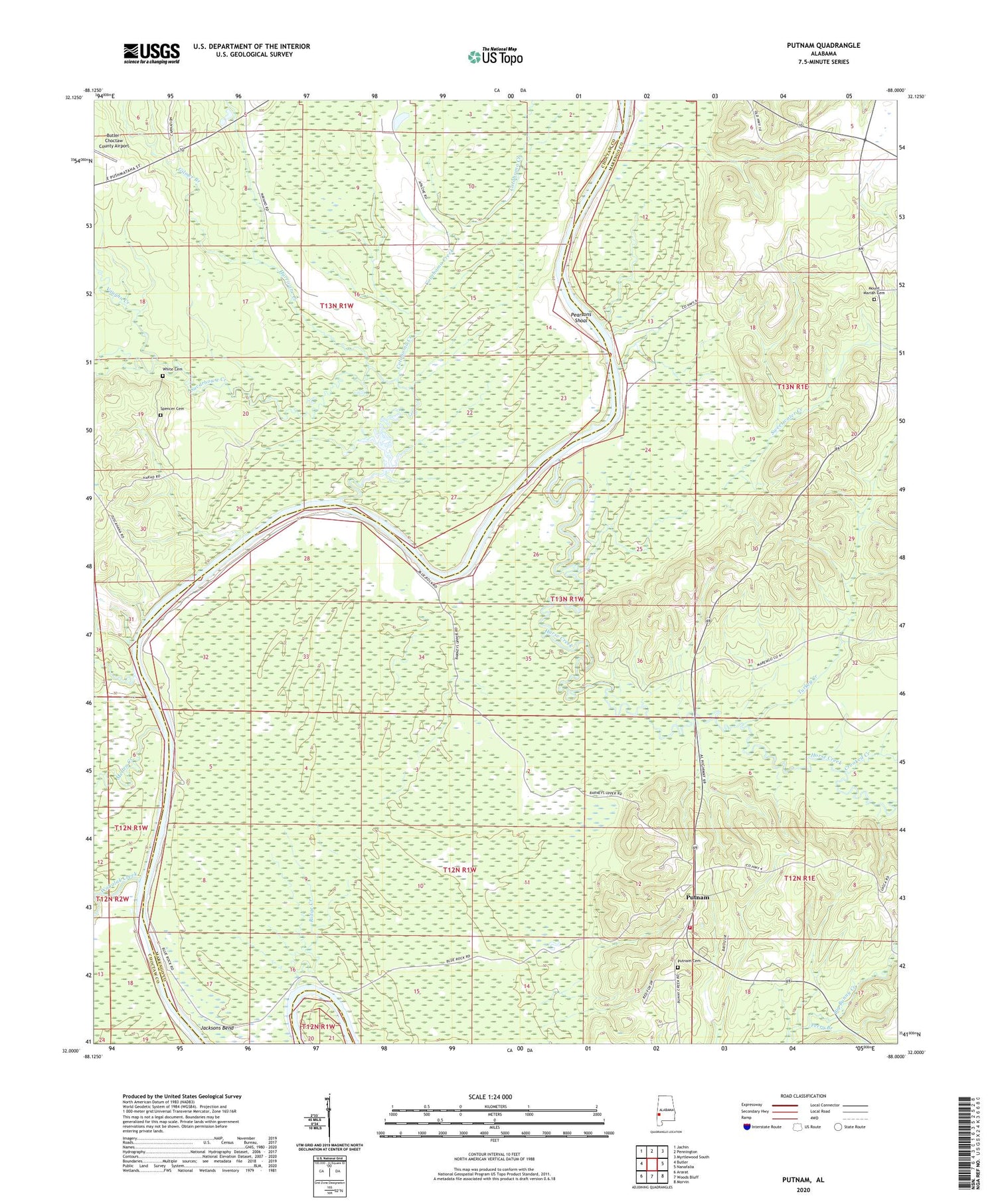
2024 topographic map quadrangle Putnam in the state of Alabama. Scale: 1:24000. Based on the newly updated USGS 7.5' US Topo map series, this map is in the following counties: Marengo, Choctaw. The map contains contour data, water features, and other items you are used to seeing on USGS maps, but also has updated roads and other features. This is the next generation of topographic maps. Printed on high-quality waterproof paper with UV fade-resistant inks.
Quads adjacent to this one:
West: Butler
Northwest: Jachin
North: Pennington
Northeast: Myrtlewood South
East: Nanafalia
Southeast: Morvin
South: Woods Bluff
Southwest: Ararat
This map covers the same area as the classic USGS quad with code o32088a1.
Contains the following named places: B L Turners Landing, Barneys Upper Landing, Barries Gin Landing, Bay Wash Landing, Blue Rock, Browns Landing, Butler-Choctaw County Airport, Cotahoma Creek, Crooked Creek, Democrat, Democrat Landing, East Choctaw High School, Gays Ferry, Gilmer Branch, Gooden Hill Church, Hornsboro, Horse Creek, Hurricane Creek, Jacksons Bend, Kansas, Lilly Grove Church, Magnolia Landing, Mellen Creek, Mount Mariah Cemetery, Mount Moriah Baptist Church, Pearsons Shoal, Perry Branch, Pineville Post Office, Pritchetts Landing, Putnam, Putnam Baptist Church, Putnam Cemetery, Putnam Census Designated Place, Putnam Elementary School, Putnam Volunteer Fire Department, Ridge Creek, Saint Mary United Methodist Church, Spencer Cemetery, Sucarbowa Creek, Sweetwater Creek, Turkey Creek, Turners, Tuscahoma Landing, Vaughn Creek, Wahalak Creek, Wahalak Landing, Walters Lower Landing, Walters Upper Landing, Waters Landing, White Cemetery


