MyTopo
Mount Vernon Alabama US Topo Map
Couldn't load pickup availability
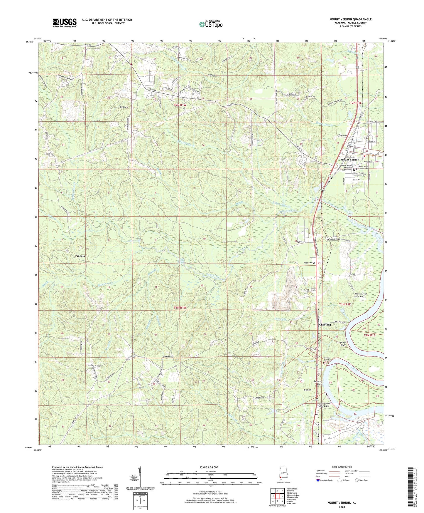
2024 topographic map quadrangle Mount Vernon in the state of Alabama. Scale: 1:24000. Based on the newly updated USGS 7.5' US Topo map series, this map is in the following counties: Mobile. The map contains contour data, water features, and other items you are used to seeing on USGS maps, but also has updated roads and other features. This is the next generation of topographic maps. Printed on high-quality waterproof paper with UV fade-resistant inks.
Quads adjacent to this one:
West: Citronelle East
Northwest: Sims Chapel
North: Calvert
Northeast: Bilbo Island
East: Stiggins Lake
Southeast: The Basin
South: Creola
Southwest: Chunchula
This map covers the same area as the classic USGS quad with code o31088a1.
Contains the following named places: Alabama Department of Mental Health Searcy Hospital Lagoon, Alabama Power Company Barry Steam Plant, Aldergate Church, Baptist Mission Camp, Barry Electric Generating Plant, Big Rock, Boggy Branch, Broad Branch, Bucks, Bucks Census Designated Place, Bucks Post Office, Bull Branch, Bush Coon Creek, Calcedeaver Elementary School, Calcedeaver Volunteer Fire Rescue Department, Calvert Business Park, Cedar Creek Baptist Church, Cedar Creek Falls, Cedar Creek Fish Camp, Chastang, Chastang Bluff, Chastang Landing, Conrad Creek, E T Belsaw-Mount Vernon School, First Baptist Missionary Church of Mount Vernon, Florida Gas Transmission Company Facility, Grady Hall Creek, Indian Grave Creek, Kingdom Hall Church, Little Zion African Methodist Episcopal Church, Lockler Memorial Baptist Church, Methodist Mission School, Mount Vernon, Mount Vernon Community Cemetery, Mount Vernon Division, Mount Vernon Methodist Church, Mount Vernon Post Office, Mount Vernon Public Library, Mount Vernon Senior Citizens Building, Mount Vernon Town Hall, Mount Vernon Volunteer Fire Department Simison Station, Movico, Movico Census Designated Place, North Fork Cedar Creek, Pineola, Roper Cemetery, Saint Peters Church, Saint Peters School, Saint Theresa School, Saint Theresas Church, Searcy Hospital, Seymour Bluff, Seymour Bluff Cemetery, Spring Branch, Spring Landing, Stage Coach Woods, Thirty One Mile Bluff, Thirty Seven Mile Bluff, Town of Mount Vernon, Williams Chapel, ZIP Code: 36560