MyTopo
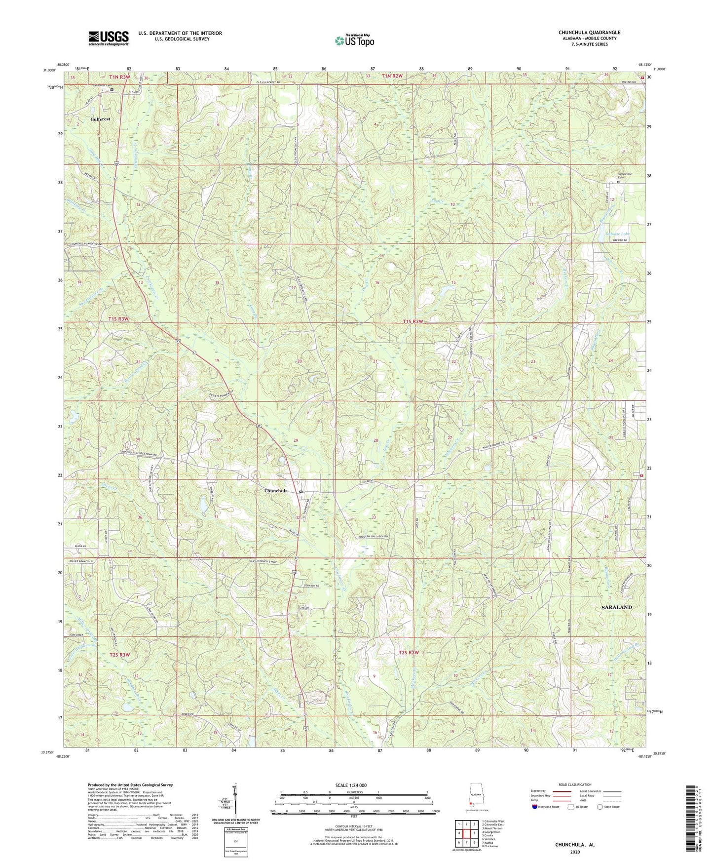
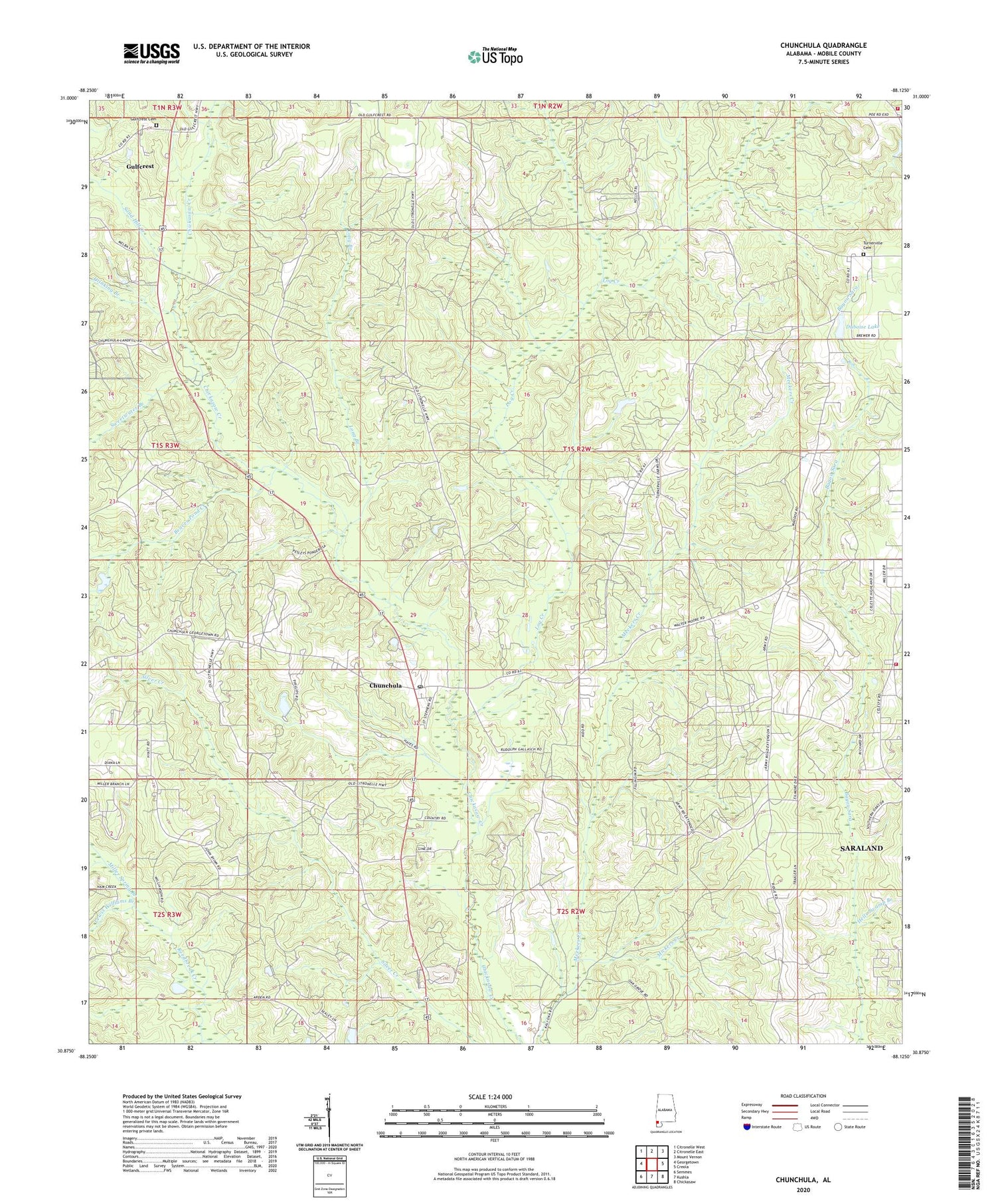
Chunchula Alabama US Topo Map
Couldn't load pickup availability
2024 topographic map quadrangle Chunchula in the state of Alabama. Scale: 1:24000. Based on the newly updated USGS 7.5' US Topo map series, this map is in the following counties: Mobile. The map contains contour data, water features, and other items you are used to seeing on USGS maps, but also has updated roads and other features. This is the next generation of topographic maps. Printed on high-quality waterproof paper with UV fade-resistant inks.
Quads adjacent to this one:
West: Georgetown
Northwest: Citronelle West
North: Citronelle East
Northeast: Mount Vernon
East: Creola
Southeast: Chickasaw
South: Kushla
Southwest: Semmes
This map covers the same area as the classic USGS quad with code o30088h2.
Contains the following named places: Adams Branch, Arden Church, Beaver Meadow, Beaver Pond Creek, Calvary Church, Chunchula, Chunchula Census Designated Place, Chunchula Gas Field, Chunchula Post Office, Dogwood Park, Drinking Branch, Dubois Lake Dam, Duboise Lake, East Chunchula School, Fellowship Baptist Church, Fred Hildesheim Dam, God Church, Gulf Crest Church, Gulfcrest, Gulfcrest Cemetery, Gulfcrest Census Designated Place, Larkin Spring Branch, Lewis Williams Branch, Log Creek, Long Branch, Maddox Mobile Home Park, Mickers Creek, Miller Spring Branch, Oak Grove School, Orvin Lookout Tower, Sand Hill Creek, Starlight Full Gospel Church, Starlight School, Sweetwater Branch, Turnerville, Turnerville Cemetery, Turnerville Church, Turnerville Volunteer Fire Department Station 1, Turnerville Volunteer Fire Department Station 2, ZIP Code: 36521