MyTopo
Nectar Alabama US Topo Map
Couldn't load pickup availability
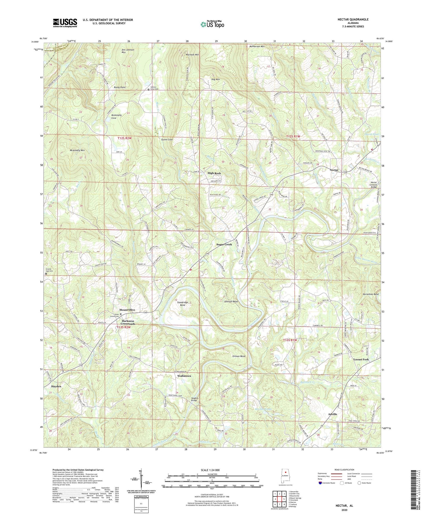
2024 topographic map quadrangle Nectar in the state of Alabama. Scale: 1:24000. Based on the newly updated USGS 7.5' US Topo map series, this map is in the following counties: Blount, Cullman. The map contains contour data, water features, and other items you are used to seeing on USGS maps, but also has updated roads and other features. This is the next generation of topographic maps. Printed on high-quality waterproof paper with UV fade-resistant inks.
Quads adjacent to this one:
West: Blount Springs
Northwest: Hanceville
North: Garden City
Northeast: Blountsville
East: Cleveland
Southeast: Remlap
South: Trafford
Southwest: Warrior
This map covers the same area as the classic USGS quad with code o33086h6.
Contains the following named places: Adville, Ann Johnson Mountain, Center Springs Church, Congregational Methodist Church, Copeland Ford, Cox Creek, Cumberland Church, Edgewood Church, Follett Creek, Gethsemane Baptist Church, Gilman Bend, Graves Gap Cemetery, Guinn Church, Guinn Cove, Guinns Cove Cemetery, Hagwood Dam, Hagwood Lake, Hallmark Creek, Harkness Crossroads, Hayes Church, High Rock, High Rock Church, Hog Mountain, Johnson Bend, Johnson Farm Lake, Johnson Farm Lake Dam, Johnson Pond Dam, Little Shenandoah, Little Warrior River, Marsh Pond, Marshes Ponds, Matt Hollow Creek, McAnnally Cove, McAnnally Mountain, McPherson Mountain, Mount Olive, Nectar, Nectar Covered Bridge, Nectar Fire Department, Nectar Heights Church, Nectar School, Neeley Creek, Oak Grove Church, Pannell Creek, Rocky Point, Sherell Pond, Sherell Pond Dam, Shoal Creek, Shoal Creek Church, Smith Ford, Standridge Bend, Sterling Cherry Farm Dam, Sterling Cherry Farm Pond, Sugar Creek, Sugar Creek Mine, Tabernacle United Methodist Church, Town of Locust Fork, Town of Nectar, Tucker Creek, Union Grove Baptist Church, Union Grove Cemetery, Vaughns Bridge, Wallstown, West Blount Fire Department Station 3, Whites Creek, Woods Lake Dam, Wornock Mountain, Youngblood Lake, Youngblood Lake Dam, ZIP Code: 35097