MyTopo
Butler Alabama US Topo Map
Couldn't load pickup availability
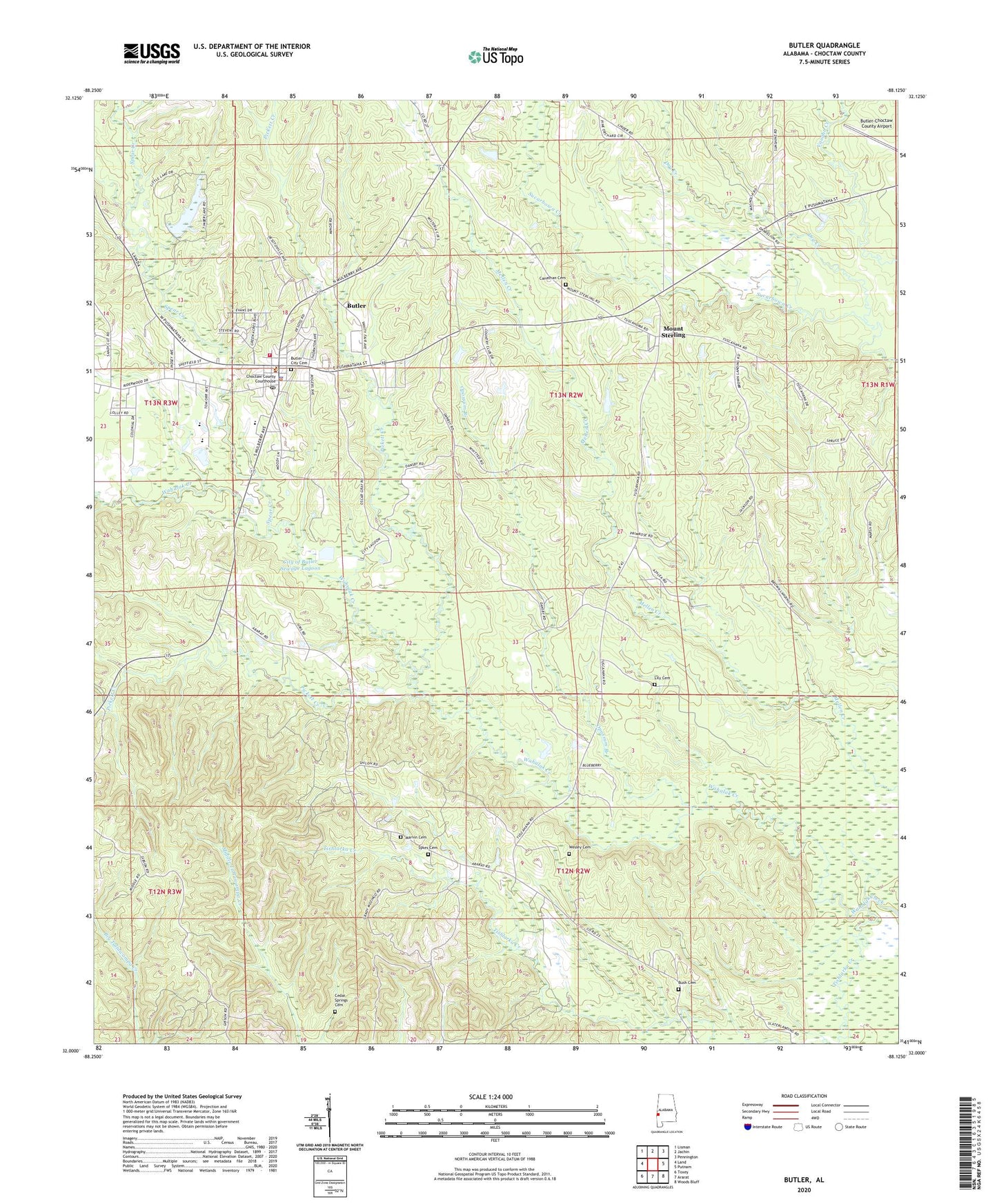
2024 topographic map quadrangle Butler in the state of Alabama. Scale: 1:24000. Based on the newly updated USGS 7.5' US Topo map series, this map is in the following counties: Choctaw. The map contains contour data, water features, and other items you are used to seeing on USGS maps, but also has updated roads and other features. This is the next generation of topographic maps. Printed on high-quality waterproof paper with UV fade-resistant inks.
Quads adjacent to this one:
West: Land
Northwest: Lisman
North: Jachin
Northeast: Pennington
East: Putnam
Southeast: Woods Bluff
South: Ararat
Southwest: Toxey
This map covers the same area as the classic USGS quad with code o32088a2.
Contains the following named places: Bush Cemetery, Butler, Butler City Cemetery, Butler City Hall, Butler Division, Butler Elementary School, Butler First United Methodist Church, Butler Police Department, Butler Post Office, Butler Volunteer Fire Department, Canathan Cemetery, Carnathan Mill, Cedar Spring School, Cedar Springs Cemetery, Choctaw Country Club, Choctaw County Courthouse, Choctaw County High School, Choctaw County Hospital, Choctaw County Public Library, Choctaw County Sheriff's Office, City of Butler Sewage Lagoon, City of Butler Sewage Lagoon Dam, Dry Creek, Fairview Baptist Church, Green Acres, Lily Baptist Church, Lily Cemetery, Marvin Cemetery, Mission School, Morgan Chapel, Morgan Chapel Baptist Church, Mount Sterling, Mount Sterling Baptist Church, Mount Sterling Community Center, Mount Sterling Methodist Church, Opossum Branch, Patrician Academy, Peaceway Assembly of God Church, Pickett Creek, Saint John Christian Methodist Episcopal Church, Salem Baptist Church, Skelton School, Spear Creek, Sykes Cemetery, Tishlarka Creek, Town of Butler, Wesley Cemetery, Wesley Chapel United Methodist Church, West Alabama Emergency Response Team, WPRN-AM (Butler), WQGL-FM (Butler)