MyTopo
Jachin Alabama US Topo Map
Couldn't load pickup availability
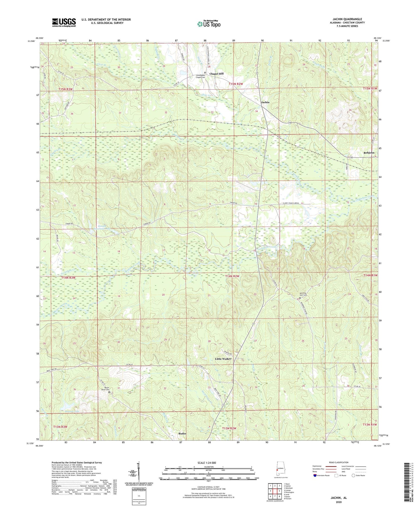
2024 topographic map quadrangle Jachin in the state of Alabama. Scale: 1:24000. Based on the newly updated USGS 7.5' US Topo map series, this map is in the following counties: Choctaw. The map contains contour data, water features, and other items you are used to seeing on USGS maps, but also has updated roads and other features. This is the next generation of topographic maps. Printed on high-quality waterproof paper with UV fade-resistant inks.
Quads adjacent to this one:
West: Lisman
Northwest: Ward
North: Gaston
Northeast: Whitfield
East: Pennington
Southeast: Putnam
South: Butler
Southwest: Land
This map covers the same area as the classic USGS quad with code o32088b2.
Contains the following named places: Allison Lookout Tower, Bogue Chitto, Chapel Hill, Christ Temple Church, Christopher Chapel Cemetery, Christopher Chapel United Methodist Church, Clear Creek, Clear Creek Baptist Church, D T Hannah Lake Dam, Donald Hesselman Lake, Donald Hesselman Lake Dam, Fuller Branch, Hannah Lake, Jachin, Keahey Hunting Club, Lisman Division, Little Walker, Little Walker Christian Methodist Episcopal Church, Morning Star Baptist Church, Morning Star Cemetery, Morning Star Church, Mount Olive Baptist Church, Mount Olive Cemetery, Neals Creek, Pleasant Valley Baptist Church, Robjohn, Shady Grove Christian Methodist Episcopal Church, Smith Branch, Sunshine School, Tanyard Creek, Townsend Branch, Townsend Creek, Williams Crossroads, Yantley Creek, ZIP Code: 36910