MyTopo
Rockford SW Alabama US Topo Map
Couldn't load pickup availability
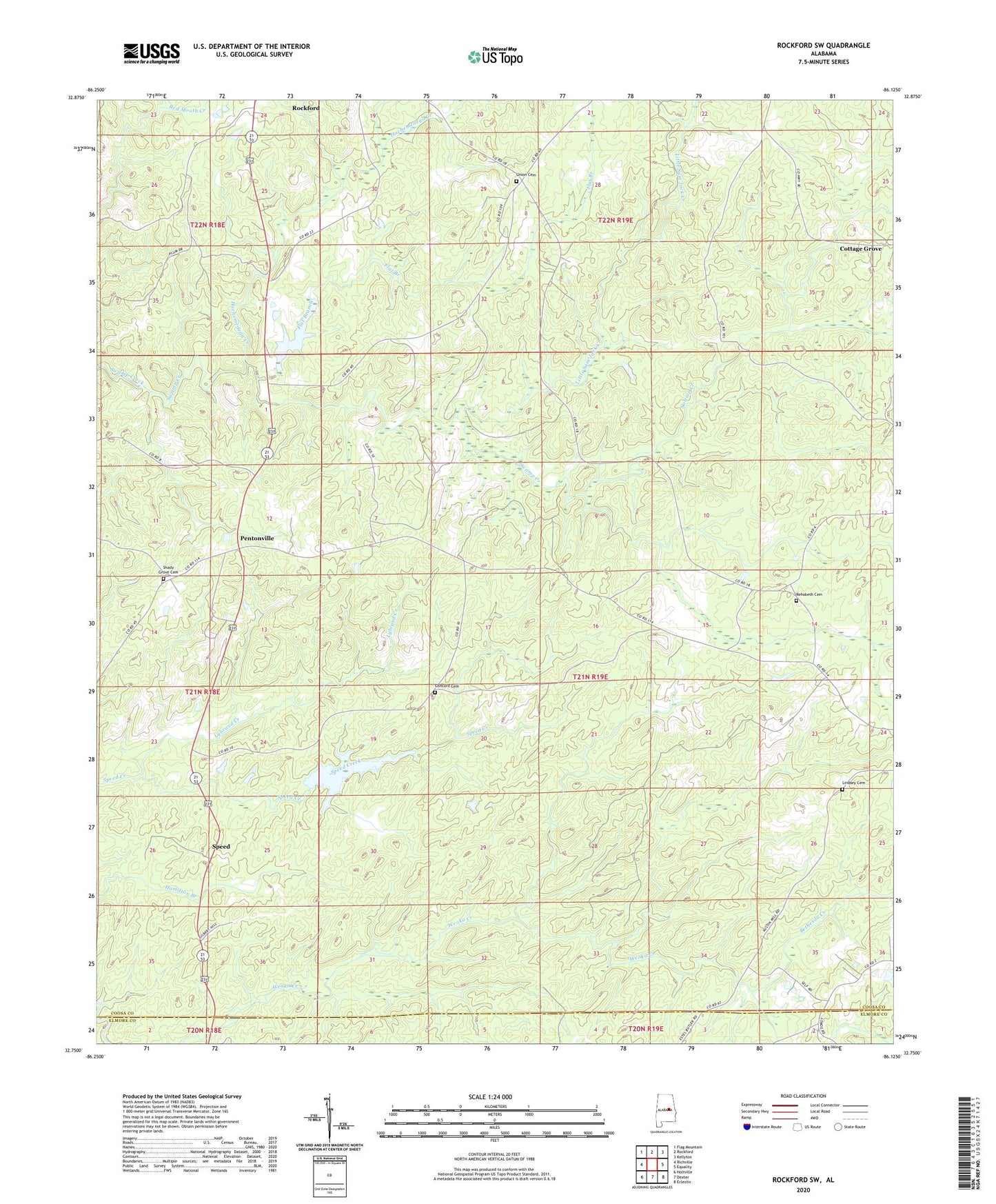
2024 topographic map quadrangle Rockford SW in the state of Alabama. Scale: 1:24000. Based on the newly updated USGS 7.5' US Topo map series, this map is in the following counties: Coosa, Elmore. The map contains contour data, water features, and other items you are used to seeing on USGS maps, but also has updated roads and other features. This is the next generation of topographic maps. Printed on high-quality waterproof paper with UV fade-resistant inks.
Quads adjacent to this one:
West: Richville
Northwest: Flag Mountain
North: Rockford
Northeast: Kellyton
East: Equality
Southeast: Eclectic
South: Dexter
Southwest: Holtville
This map covers the same area as the classic USGS quad with code o32086g2.
Contains the following named places: Bethesda Creek, Concord Baptist Church, Concord Cemetery, Flat Branch, Hachemedega Creek, Lindsey Cemetery, Little Sam Jack Creek, Lybrand Creek, Mount Nebo Church, New Life Church, Pentonville, Pinthlocco, Pleasant Hill Methodist Church, Rehobeth Cemetery, Rehobeth Methodist Church, Rockford Division, Shady Grove Baptist Church, Shady Grove Cemetery, Speed, Swift Creek Hunting Club, The Baptist Temple Church, Thomas Mine, Union Academy, Union Cemetery, Union Presbyterian Church, ZIP Code: 36026