MyTopo
Dexter Alabama US Topo Map
Couldn't load pickup availability
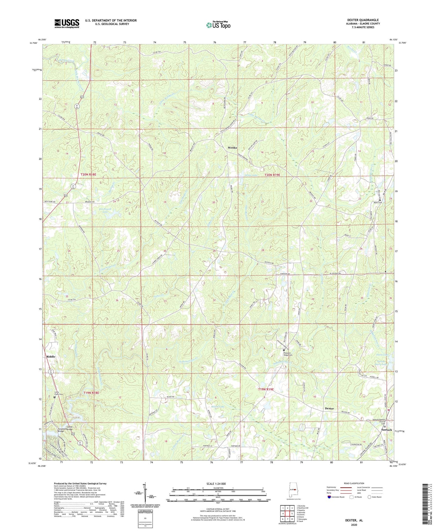
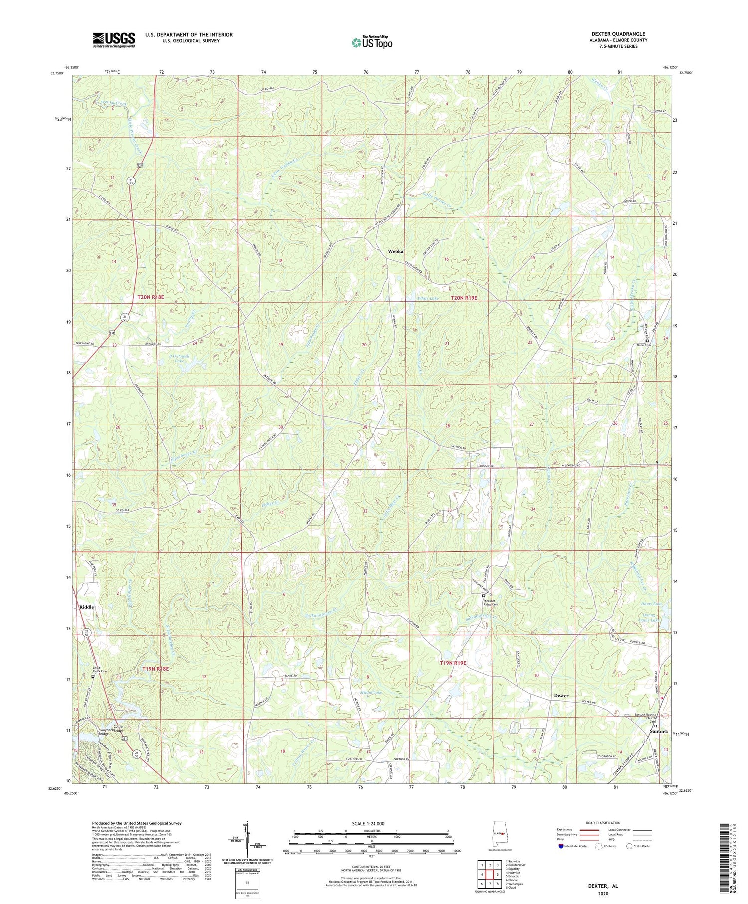
2024 topographic map quadrangle Dexter in the state of Alabama. Scale: 1:24000. Based on the newly updated USGS 7.5' US Topo map series, this map is in the following counties: Elmore. The map contains contour data, water features, and other items you are used to seeing on USGS maps, but also has updated roads and other features. This is the next generation of topographic maps. Printed on high-quality waterproof paper with UV fade-resistant inks.
Quads adjacent to this one:
West: Holtville
Northwest: Richville
North: Rockford SW
Northeast: Equality
East: Eclectic
Southeast: Claud
South: Wetumpka
Southwest: Elmore
This map covers the same area as the classic USGS quad with code o32086f2.
Contains the following named places: Antioch Baptist Church, B G Powell Lake, B G Powell Lake Dam, Balm of Gilead Church, Bethel Church, Bethlehem Church, Beulah Baptist Church, Collier Bridge, Danny Davis Lake, Danny Davis Lake Dam, Davis Dam, Davis Lake, Dexter, Evans Airport, Evergreen School, Faith Rescue Mission Farm, Fisher Creek, Gravel Creek, Greer, Griers Chapel, Hall Chapel School, John Bear Creek, Levins Store, Lipschogee Creek, Little Flock Cemetery, Little Weoka Creek, Mann Cemetery, Milam Lake, Milam Lake Dam, New Bethel Church, Paterson Creek, Pleasant Ridge Cemetery, Riddle, Saint James Church, Santuck, Santuck Baptist Church, Santuck Volunteer Fire Department Station 1, Sears Marina, Stewart Dam, Stewart Lakes, Swayback Bridge, Sweetwater Church, Sweetwater School, Ten Cedars Estates, Titus Division, Trinity United Methodist Church, Weoka, Weoka Junior High School, Whetstone Dam, Whits Lake