MyTopo
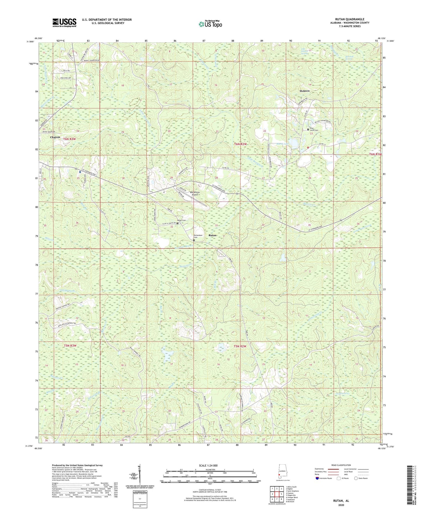
Rutan Alabama US Topo Map
Couldn't load pickup availability
2024 topographic map quadrangle Rutan in the state of Alabama. Scale: 1:24000. Based on the newly updated USGS 7.5' US Topo map series, this map is in the following counties: Washington. The map contains contour data, water features, and other items you are used to seeing on USGS maps, but also has updated roads and other features. This is the next generation of topographic maps. Printed on high-quality waterproof paper with UV fade-resistant inks.
Quads adjacent to this one:
West: Chatom
Northwest: Millry South
North: Bigbee
Northeast: Saint Stephens
East: Wagarville
Southeast: McIntosh
South: Seaboard
Southwest: Vinegar Bend
This map covers the same area as the classic USGS quad with code o31088d2.
Contains the following named places: Beach Store, Beaver Dam Creek, Beaverdam Creek, Bee Branch, Buck Branch, Bull Hall Swamp, Calf Pasture Swamp, Dearman Branch, Deerfield Country Club, Fairhope, Hobson, Hobson Assembly of God Church, Hobson Census Designated Place, Hobson Volunteer Fire Department, Johnson Creek, Lee Anderson Dam, Little Bassetts Creek, Marie Lake, Miles Creek, Mill Branch, Old Spring Branch, Pine Level Baptist Church, Pine Level Cemetery, Reed Branch, Richardson Cemetery, Roy Wilcox Airport, Rutan, Rutan Baptist Church, Rutan Cemetery, Rutan School, Simmons Creek, Town of Chatom, Washington County, Washington County Area Vocational Center, Washington County C and D Landfill, Washington County Hospital and Nursing Home, Washington County Public Library, Whiteoak Branch