MyTopo
Seaboard Alabama US Topo Map
Couldn't load pickup availability
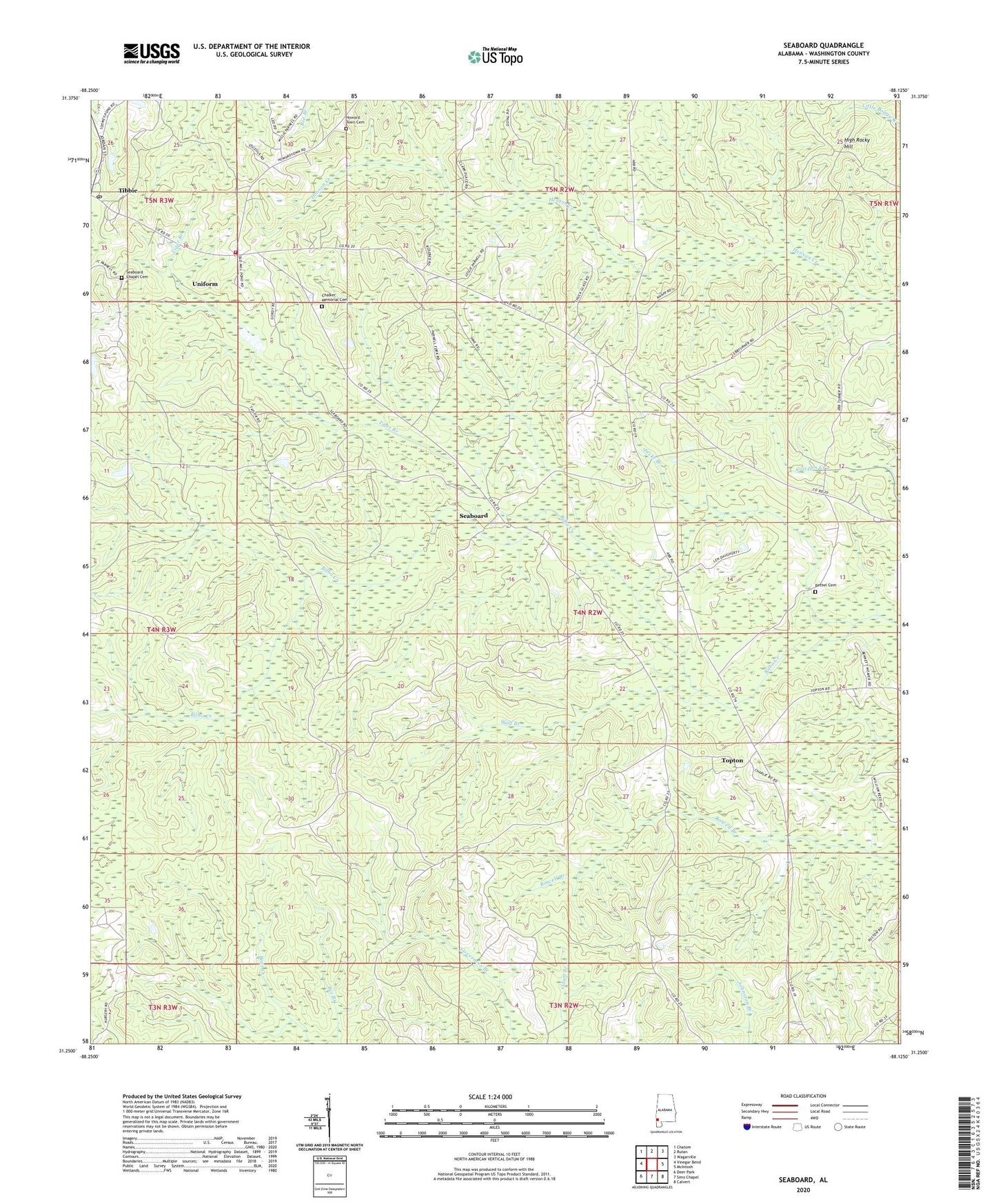
2024 topographic map quadrangle Seaboard in the state of Alabama. Scale: 1:24000. Based on the newly updated USGS 7.5' US Topo map series, this map is in the following counties: Washington. The map contains contour data, water features, and other items you are used to seeing on USGS maps, but also has updated roads and other features. This is the next generation of topographic maps. Printed on high-quality waterproof paper with UV fade-resistant inks.
Quads adjacent to this one:
West: Vinegar Bend
Northwest: Chatom
North: Rutan
Northeast: Wagarville
East: McIntosh
Southeast: Calvert
South: Sims Chapel
Southwest: Deer Park
This map covers the same area as the classic USGS quad with code o31088c2.
Contains the following named places: Bethel Cemetery, Bethel United Methodist Church, Chalker Memorial Cemetery, Chalker Memorial United Methodist Church, Hawthorn Road Church, High Rocky Hill, Howard Town Baptist Church, Howard Town Cemetery, Jacks Branch, Richardson School, Seaboard, Seaboard Chapel Cemetery, Tibbie, Tibbie Census Designated Place, Tibbie Post Office, Tibbie Volunteer Fire Department, Tiger Branch, Topton, Uniform, Violet Hill School, Wolf Branch, ZIP Codes: 36529, 36583