MyTopo
Saco Alabama US Topo Map
Couldn't load pickup availability
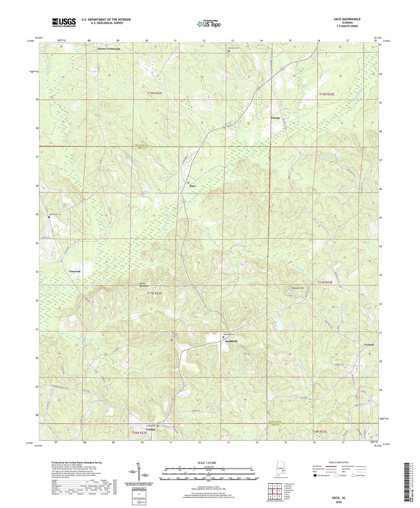
2024 topographic map quadrangle Saco in the state of Alabama. Scale: 1:24000. Based on the newly updated USGS 7.5' US Topo map series, this map is in the following counties: Pike, Bullock. The map contains contour data, water features, and other items you are used to seeing on USGS maps, but also has updated roads and other features. This is the next generation of topographic maps. Printed on high-quality waterproof paper with UV fade-resistant inks.
Quads adjacent to this one:
West: Needmore
Northwest: China Grove
North: Almeria
Northeast: Aberfoil
East: Perote
Southeast: Josie
South: Banks
Southwest: Troy
This map covers the same area as the classic USGS quad with code o31085h7.
Contains the following named places: Barnette Cemetery, Beans Crossroads, Buck Creek, Canaan Church, Carrs Chapel, Catalpa, Catalpa Cemetery, Colina, Corinth, Corinth Church, Devils Backbone, Dry Creek, Ebenezer Baptist Church, Ezell, Flat Creek, Gores Branch, Graddy Gin, Green Acres Lake, Green Dam, Greens Pond, Heads Store, Inverness Division, Jones Chapel, Kelley Cemetery, Linwood, Log Creek, Macedonia Church, Mill Creek, Morgan Branch, Mount Olive Church, Mount Pleasant Church, Mount Zion Church, Mountain View Church, New Hope Church, Old Canaan Cemetery, Omega, Pine Grove Baptist Church, Riley Store, Saco, Saco Volunteer Fire Department, Sandfield, Sandfield Cemetery, Sellers Crossroads, Thad Greens Lake, Troy Rod and Gun Club, Wolfpit Hill, Zebulon Church