MyTopo
Perote Alabama US Topo Map
Couldn't load pickup availability
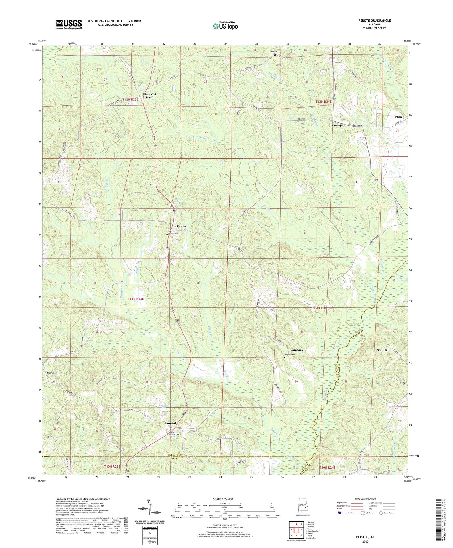
2024 topographic map quadrangle Perote in the state of Alabama. Scale: 1:24000. Based on the newly updated USGS 7.5' US Topo map series, this map is in the following counties: Bullock, Barbour, Pike. The map contains contour data, water features, and other items you are used to seeing on USGS maps, but also has updated roads and other features. This is the next generation of topographic maps. Printed on high-quality waterproof paper with UV fade-resistant inks.
Quads adjacent to this one:
West: Saco
Northwest: Almeria
North: Aberfoil
Northeast: Midway
East: Mount Andrew
Southeast: Louisville
South: Josie
Southwest: Banks
This map covers the same area as the classic USGS quad with code o31085h6.
Contains the following named places: Big Sandy Creek, Blues Old Stand, Bogue Chitta Creek, Boot Hill, Coles Store, Cope Cemetery, Copes Gin, Double Branch, Double Creek, Dry Creek, Indian Creek Baptist Church, Jamback, Little Sandy Creek, Littles Bridge, McClenny School, Mill Creek, Mount Harmon Baptist Church, Mount Harmon Cemetery, Mount Hilliard Church, Mount Olive Church, Mount Zion Church, New Bethsaida Church, Old Sellers Cemetery, Old Union Grove Church, Perote, Perote Cemetery, Perote Church, Perote Creek, Perote High School, Phillips School, Pickett, Pleasant Hill Church, Powells Church, Richardsons Bridge, Rogers Cemetery, Rogers Gin, Sellers Store, Smuteye, Star Hill, Tanyard, Union Grove Church, Webster Church, ZIP Code: 36005