MyTopo
Deer Park Alabama US Topo Map
Couldn't load pickup availability
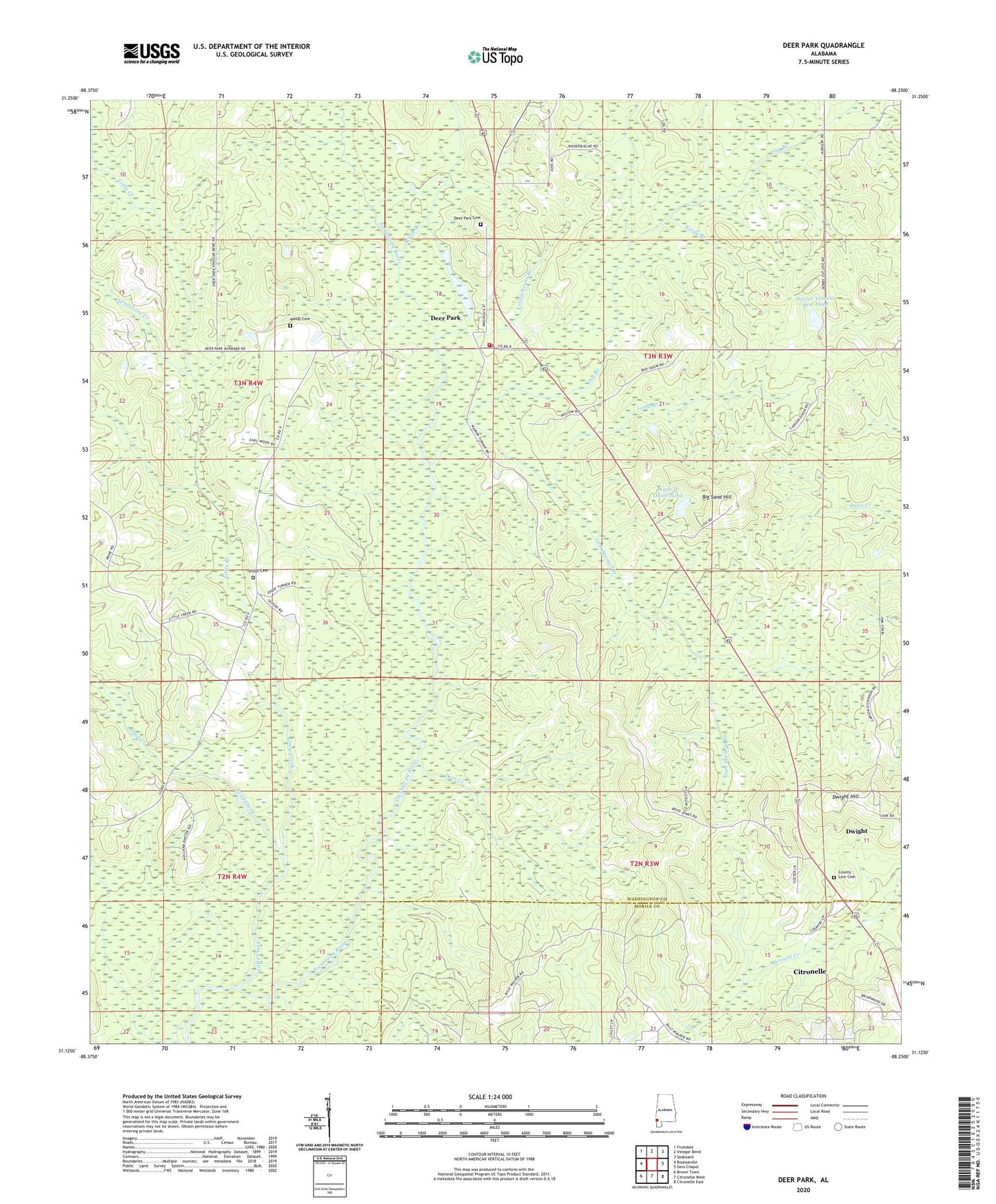
2024 topographic map quadrangle Deer Park in the state of Alabama. Scale: 1:24000. Based on the newly updated USGS 7.5' US Topo map series, this map is in the following counties: Washington, Mobile. The map contains contour data, water features, and other items you are used to seeing on USGS maps, but also has updated roads and other features. This is the next generation of topographic maps. Printed on high-quality waterproof paper with UV fade-resistant inks.
Quads adjacent to this one:
West: Rounsaville
Northwest: Fruitdale
North: Vinegar Bend
Northeast: Seaboard
East: Sims Chapel
Southeast: Citronelle East
South: Citronelle West
Southwest: Brown Town
This map covers the same area as the classic USGS quad with code o31088b3.
Contains the following named places: Beech Branch, Big Sand Hill, County Line Cemetery, County Line Missionary Baptist Church, Deer Creek, Deer Park, Deer Park Cemetery, Deer Park Census Designated Place, Deer Park Junior High School, Deer Park Methodist Church, Deer Park Post Office, Deer Park School, Doctor Vincent Best Dam, Doctor Vincent Best Pond, Dwight, Dwight Hill, Flat Branch, Freilburg, Grapevine Creek, Gum Springs Branch, Little Creek, Long Branch, New Light Baptist Church, Pond Creek, Reedy Branch, Shiloh Baptist Church, Shiloh Cemetery, Vinegar Bend Volunteer Fire Department, Wade H Odom Dam, Wade H Odom Pond, Weldy Cemetery, Yellowhouse Branch