MyTopo
Sigma Alabama US Topo Map
Couldn't load pickup availability
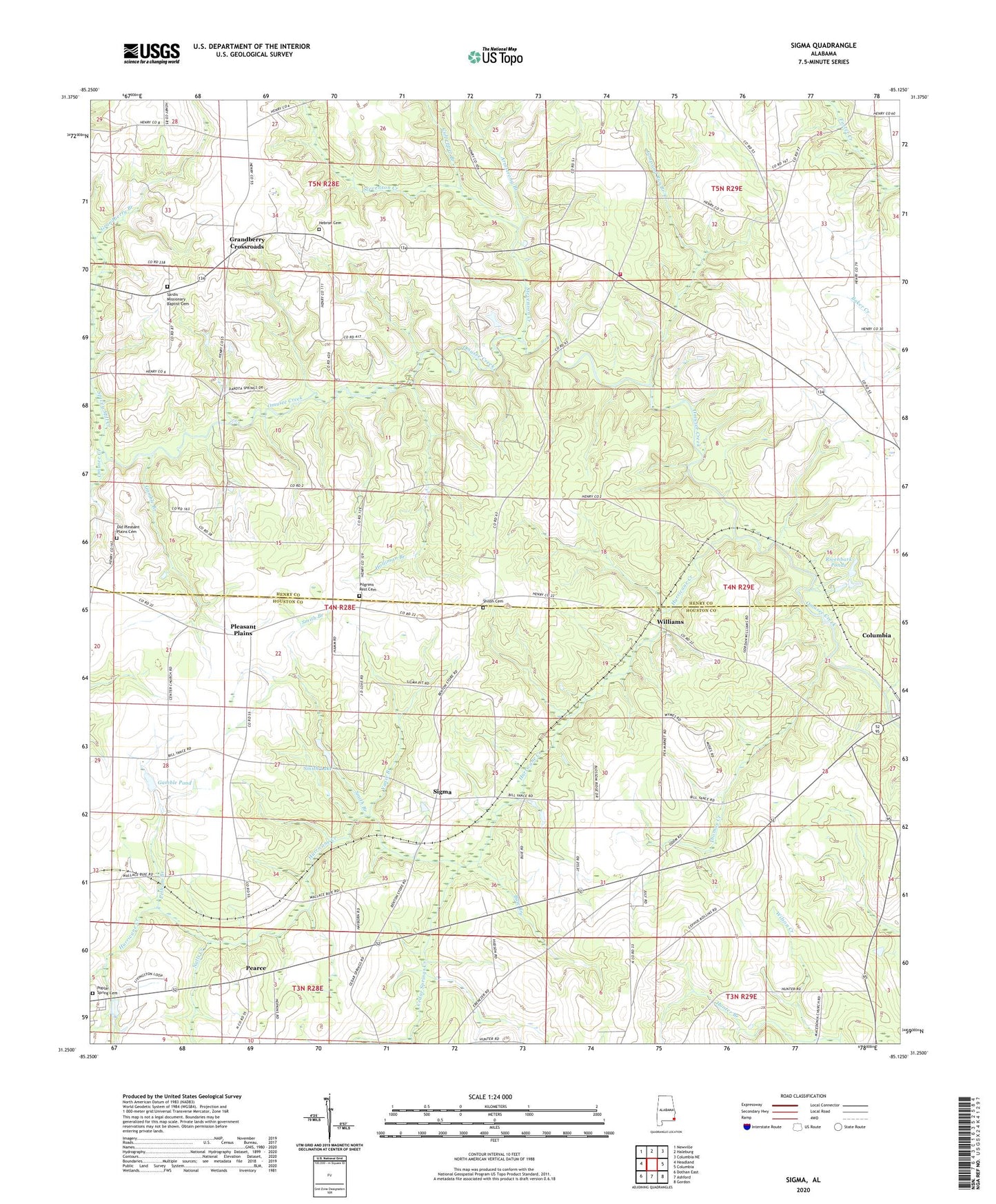
2024 topographic map quadrangle Sigma in the state of Alabama. Scale: 1:24000. Based on the newly updated USGS 7.5' US Topo map series, this map is in the following counties: Houston, Henry. The map contains contour data, water features, and other items you are used to seeing on USGS maps, but also has updated roads and other features. This is the next generation of topographic maps. Printed on high-quality waterproof paper with UV fade-resistant inks.
Quads adjacent to this one:
West: Headland
Northwest: Newville
North: Haleburg
Northeast: Columbia NE
East: Columbia
Southeast: Gordon
South: Ashford
Southwest: Dothan East
This map covers the same area as the classic USGS quad with code o31085c2.
Contains the following named places: Armstrong Branch, Bruner School, Buie Branch, Camp Abel Methodist Church Camp, Cedar Springs Creek, Center Baptist Church, Columbia Church Camp, Culpepper Branch, Ebenezer Church, Faith Church, Gamble Branch, Gamble Pond, Grandberry Branch, Grandberry Crossroads, Haleburg Fire Rescue Department Station 3, Hebron, Hebron Baptist Church, Hebron Cemetery, Holliman Branch, Hunter Branch, Hurricane Creek, Jump and Run Branch, Lansdale, Mount Zion Methodist Church, Mount Zion School, Nalls Creek, New Poplar Springs Church, Old Pleasant Plains Cemetery, Old Poplar Springs Church, Pearce, Pelham Branch, Pilgrims Rest Cemetery, Pleasant Plain School, Pleasant Plains, Pleasant Plains Church, Poplar Spring Cemetery, Poplar Springs Baptist Church, Rivenbark Ponds, Sardis Baptist Church, Sardis Missionary Baptist Cemetery, Shiloh Baptist Church, Shiloh Cemetery, Sigma, Smith Branch, Smith Lake, Spivey Mill Creek, Spring Hill Church, Stevenson Creek, Thomas Creek, Williams, Yance Branch, ZIP Code: 36319