MyTopo
Simcoe Alabama US Topo Map
Couldn't load pickup availability
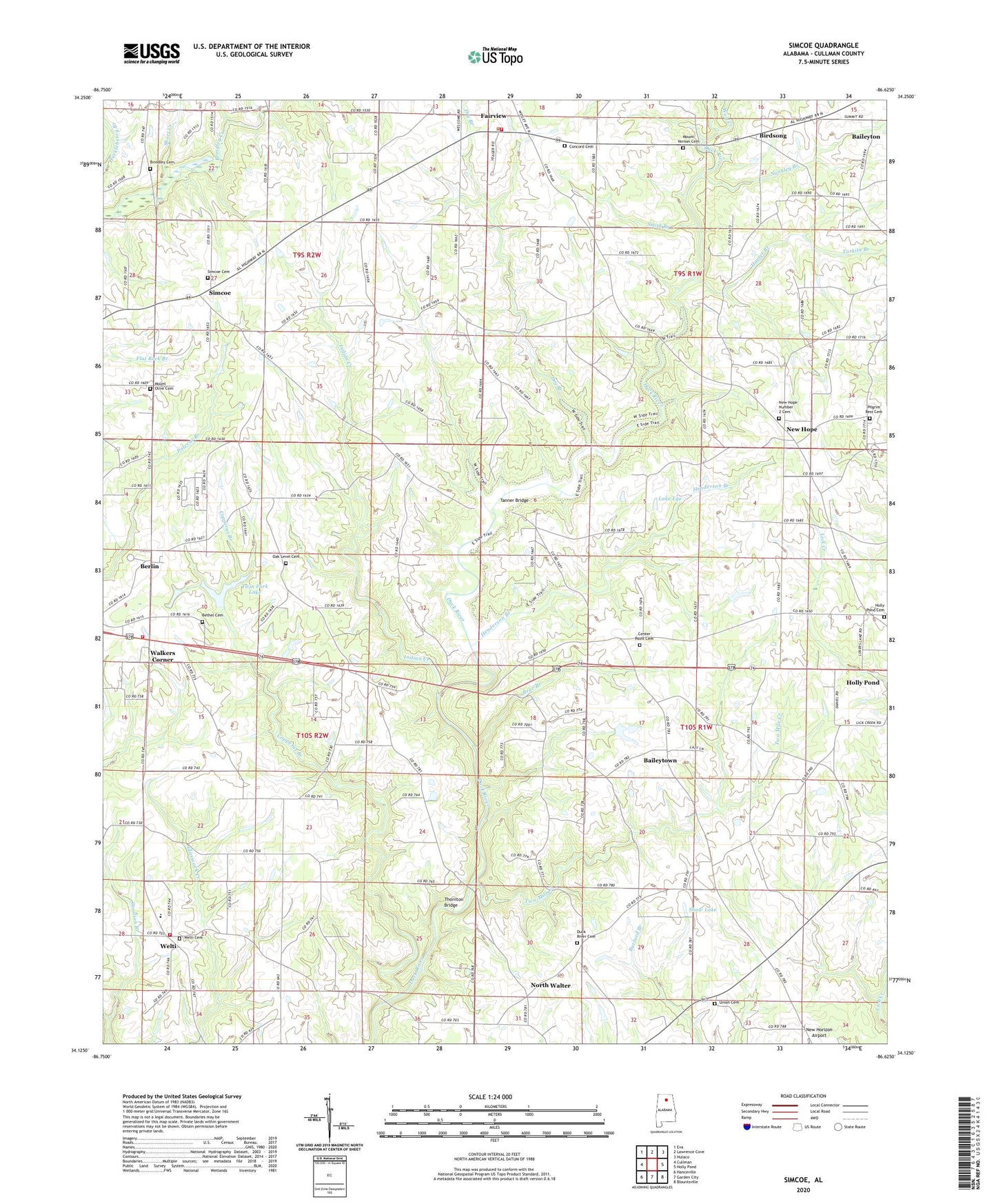
2024 topographic map quadrangle Simcoe in the state of Alabama. Scale: 1:24000. Based on the newly updated USGS 7.5' US Topo map series, this map is in the following counties: Cullman. The map contains contour data, water features, and other items you are used to seeing on USGS maps, but also has updated roads and other features. This is the next generation of topographic maps. Printed on high-quality waterproof paper with UV fade-resistant inks.
Quads adjacent to this one:
West: Cullman
Northwest: Eva
North: Lawrence Cove
Northeast: Hulaco
East: Holly Pond
Southeast: Blountsville
South: Garden City
Southwest: Hanceville
This map covers the same area as the classic USGS quad with code o34086b6.
Contains the following named places: Antioch Missionary Baptist Church, Antioch School, Baileytown, Bear Branch, Berlin, Berlin Baptist Church, Berlin Volunteer Fire Department Station 1, Berlin Volunteer Fire Department Station 2, Bethel Cemetery, Bethel Primitive Baptist Church, Bibleway Pentecostal Church, Birdsong, Brindley Cemetery, Brooklyn Holiness Church, Center Point Baptist Church, Center Point Baptist Church Cemetery, Church of Christ, Concord Baptist Church Cemetery, Concord Missionary Baptist Church, Copperas Branch, Dry Branch, Duck Creek, Duck River Baptist Church, Duck River Baptist Church Cemetery, Fairview Volunteer Fire and Rescue Station 1, Henderson Branch, Holly Pond Cemetery, Holly Pond Division, Hunter Branch, Indian Creek, Lake Ege, Lidy S Lake, Mount Olive Church Cemetery, Mount Olive Congregational Methodist Church, Mount Vernon Primitive Baptist Church, Mount Vernon Primitive Baptist Church Cemetery, Mount Zion Missionary Baptist Church, New Home Church, New Hope, New Hope Number 2 Baptist Church, New Hope Number 2 Cemetery, North Walter, Nunnley Branch, Oak Level, Oak Level Baptist Church, Oak Level Baptist Church Cemetery, Pilgrim Rest Cemetery, Plainview Baptist Church, Plainview Church, Rock Creek, Roy Shaw Dam, Shady Grove East Baptist Church, Shaw Lake, Short Creek, Simcoe, Simcoe Baptist Church, Simcoe Baptist Church Cemetery, Simcoe Church, Simcoe Division, Simcoe Elementary School, Simcoe United Methodist Church, Smith Branch, Tanner Bridge, Tarkiln Branch, Thornton Bridge, Tommy Ege Dam, Twin Fork Lake, Two Mile Creek, Union Cemetery, Union Freewill Baptist Church, Unity Baptist Church, W I Walker Dam, Walkers Corner, Welti, Welti Cemetery, Welti Cumberland Presbyterian Church, Welti Division, Welti Junior High School, Wolf Creek, ZIP Code: 35058