
MyTopo
Spruce Pine Alabama US Topo Map
Couldn't load pickup availability
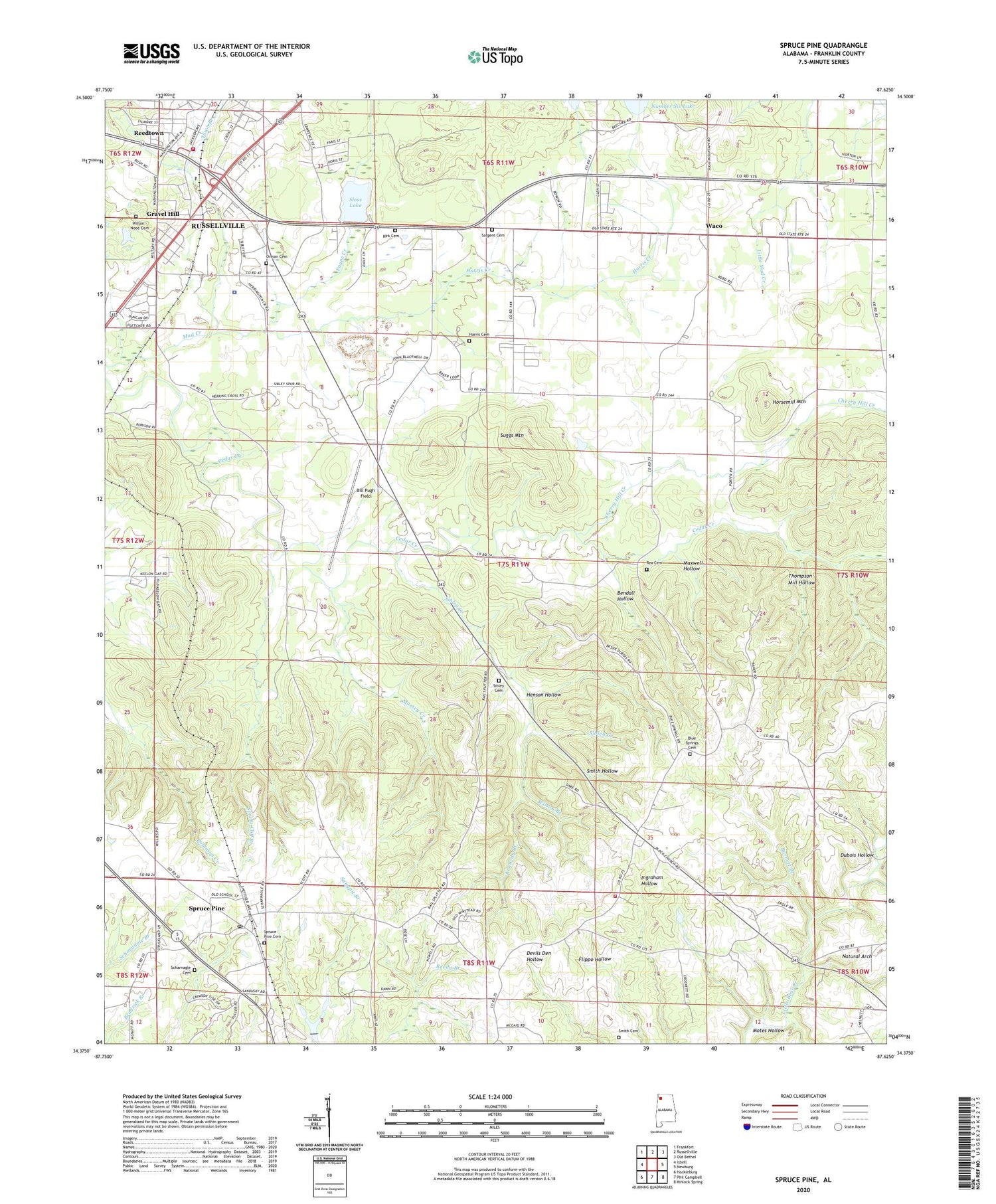
2024 topographic map quadrangle Spruce Pine in the state of Alabama. Scale: 1:24000. Based on the newly updated USGS 7.5' US Topo map series, this map is in the following counties: Franklin. The map contains contour data, water features, and other items you are used to seeing on USGS maps, but also has updated roads and other features. This is the next generation of topographic maps. Printed on high-quality waterproof paper with UV fade-resistant inks.
Quads adjacent to this one:
West: Isbell
Northwest: Frankfort
North: Russellville
Northeast: Old Bethel
East: Newburg
Southeast: Kinlock Spring
South: Phil Campbell
Southwest: Hackleburg
This map covers the same area as the classic USGS quad with code o34087d6.
Contains the following named places: Barnett Branch, Bendall Hollow, Big Branch, Bill Pugh Field, Block Church, Blue Springs Cemetery, Blue Springs Church, Blue Springs Volunteer Fire Department, Cedar Grove Church, Cherry Hill Creek, Churntown, Dooley Cemetery, Dubois Hollow, Enterprise School, Franklin County Sheriff's Office, Franklin Shopping Center, Frazier Dam, Frazier Lake, Gin Branch, Gravel Hill, Harris Cemetery, Harris Creek, Henson Hollow, Horsemill Mountain, Kennedy Branch, Kirk Cemetery, Massey Creek, Maxwell Hollow, Motes Hollow, Mount Olive Church, Natural Arch, Newtown, NorthStar Emergency Medical Services Franklin, Orman Cemetery, Payne Creek, Rea Cemetery, Reedtown, Russellville Division, Russellville Fire and Rescue Station 1, Russellville Reservoir, Sargent Cemetery, Scharnagle Cemetery, Sibley Cemetery, Sibley Creek, Sloss Lake, Sloss Lake Dam, Smith Cemetery, Smith Hollow, South Russellville Quarry, Southside Ball Field, Southside Church, Spring Cliff Branch, Spruce Pine, Spruce Pine Baptist Church, Spruce Pine Cemetery, Spruce Pine Census Designated Place, Spruce Pine Church of Christ, Spruce Pine Elementary School, Spruce Pine Post Office, Spruce Pine United Methodist Church, Suggs Mountain, Thompson Mill Hollow, Town Branch, Village Farm School, Waco, Waco Baptist Church, Waco Church of Christ, Waco Junior High School, Williams School, Wilson - Nooe Cemetery, Wilson Branch, ZIP Code: 35654


