MyTopo
Skipperville Alabama US Topo Map
Couldn't load pickup availability
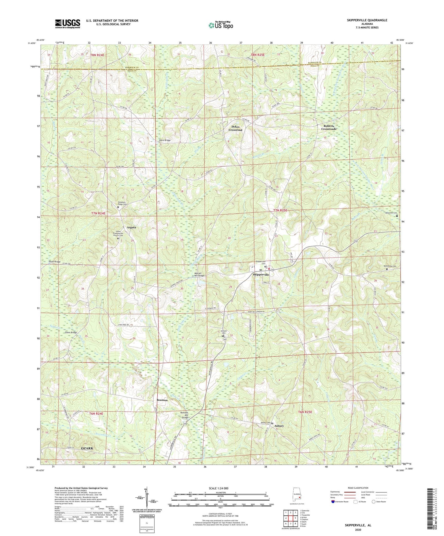
2024 topographic map quadrangle Skipperville in the state of Alabama. Scale: 1:24000. Based on the newly updated USGS 7.5' US Topo map series, this map is in the following counties: Dale, Barbour. The map contains contour data, water features, and other items you are used to seeing on USGS maps, but also has updated roads and other features. This is the next generation of topographic maps. Printed on high-quality waterproof paper with UV fade-resistant inks.
Quads adjacent to this one:
West: Ariton
Northwest: Elamville
North: Clio
Northeast: Texasville
East: Clopton
Southeast: Echo
South: Ewell
Southwest: Ozark
This map covers the same area as the classic USGS quad with code o31085e5.
Contains the following named places: Abbeville Cemetery, Allen Chapel, Antioch Cemetery, Arguta, Arguta Hunting Club, Asbury, Asbury Cemetery, Asbury Lookout Tower, Asbury United Methodist Church, Bakey Branch, Beamon, Beersheba Cemetery, Blacks Creek, Bordshaw Branch, Bottoms Mill Bridge, Bremon School, Burnt Mill Branch, Caney Branch, Concord Church, Cotton Creek, Davis Bridge, Dikes School, Dixon Bridge, Dry Branch, Dykes Crossroad, Glenn Bridge, Herring School, Little Judy Creek, Long School, McCalls Mill, Metcalf Mill Bridge, Morgan Baptist Church, Morgan School, Mount Pleasant Church, Phillips Crossroads, Pleasant Ridge Baptist Church, Roberts Branch, Roberts Crossroads, Saint Rose Church, Salem Baptist Church, Sandy Creek, Sikes Creek, Skipperville, Skipperville Cemetery, Skipperville Post Office, Skipperville School, Skipperville United Methodist Church, Skipperville Volunteer Fire Department, Summer Hill Church, Union Presbyterian Church, Union Presbyterian Church Cemetery