MyTopo
Clopton Alabama US Topo Map
Couldn't load pickup availability
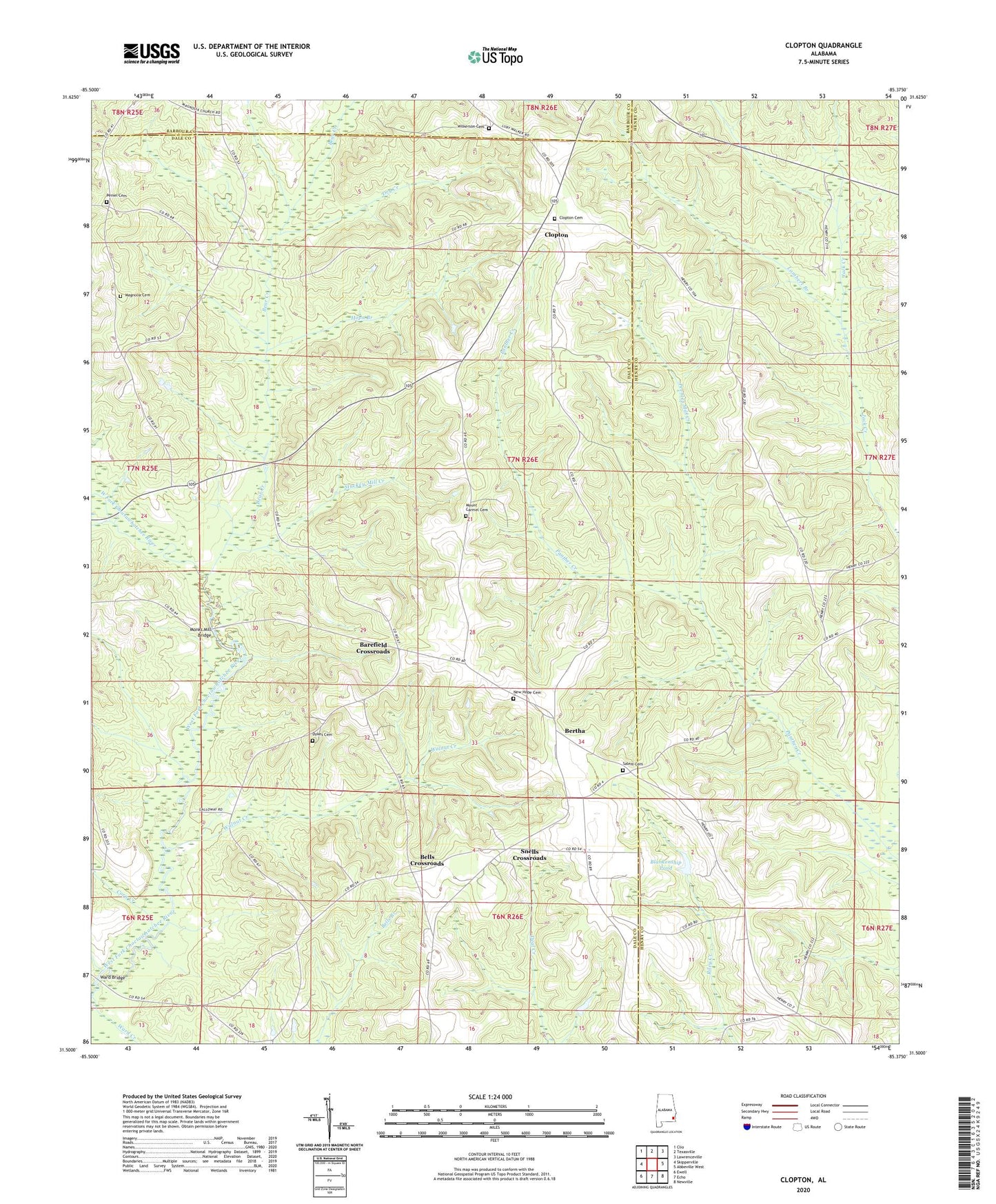
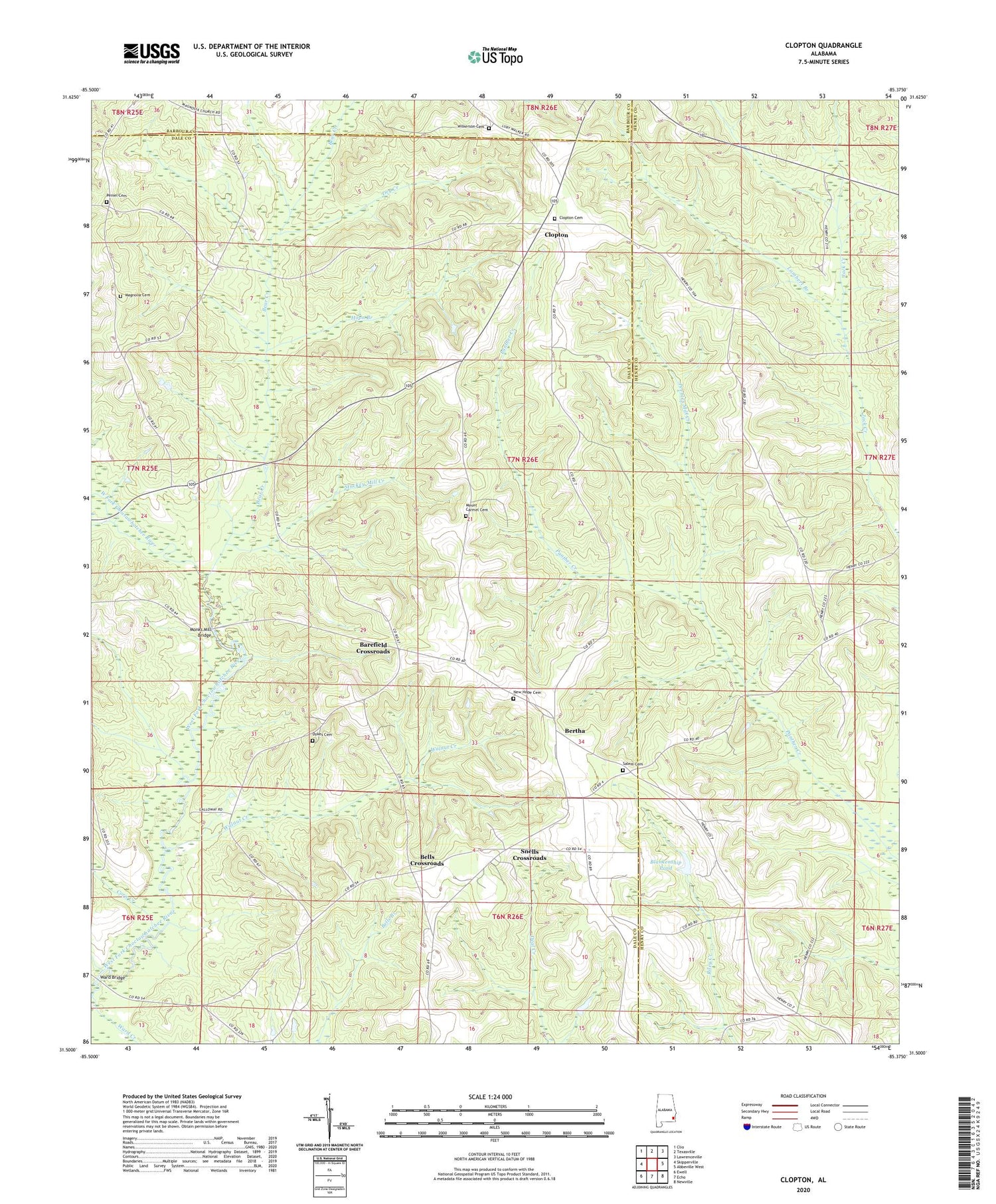
2024 topographic map quadrangle Clopton in the state of Alabama. Scale: 1:24000. Based on the newly updated USGS 7.5' US Topo map series, this map is in the following counties: Dale, Henry, Barbour. The map contains contour data, water features, and other items you are used to seeing on USGS maps, but also has updated roads and other features. This is the next generation of topographic maps. Printed on high-quality waterproof paper with UV fade-resistant inks.
Quads adjacent to this one:
West: Skipperville
Northwest: Clio
North: Texasville
Northeast: Lawrenceville
East: Abbeville West
Southeast: Newville
South: Echo
Southwest: Ewell
This map covers the same area as the classic USGS quad with code o31085e4.
Contains the following named places: Barefield Crossroads, Bear Creek, Bells Crossroads, Bells School, Bersheba School, Bertha, Blankenship Pond, Browns United Methodist Church, Clopton, Clopton Cemetery, Clopton Post Office, Clopton United Methodist Church, Corn Creek, Dry Creek, Dykes Cemetery, Friendship Baptist Church, G B Blankenship Dam, Good Tidings Church, Green Valley Church, Hopewell Church, Hopn Branch, Lambert Branch, Lewis Mill, Magnolia Cemetery, Magnolia Church, Magnolia School, Monks Mill Bridge, Mount Carmel Cemetery, Mount Carmel Church, New Hope Baptist Church, New Hope Cemetery, New Hope School, Peebles Mill Creek, Peniel Baptist Church, Peniel Cemetery, Saint Jeans Church, Salem Cemetery, Shiloh Church, Snells Crossroads, Stuckey Mill Creek, Walnut Creek, Ward Bridge, Ward Creek, Wesley Chapel United Methodist Church, Wilkerson Cemetery, ZIP Code: 36374