MyTopo
Uniontown East Alabama US Topo Map
Couldn't load pickup availability
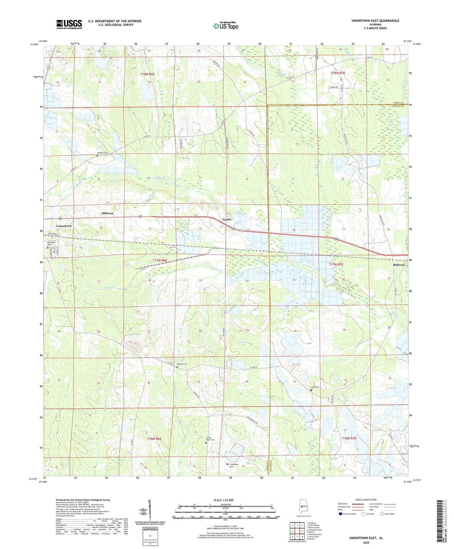
2024 topographic map quadrangle Uniontown East in the state of Alabama. Scale: 1:24000. Based on the newly updated USGS 7.5' US Topo map series, this map is in the following counties: Perry, Dallas. The map contains contour data, water features, and other items you are used to seeing on USGS maps, but also has updated roads and other features. This is the next generation of topographic maps. Printed on high-quality waterproof paper with UV fade-resistant inks.
Quads adjacent to this one:
West: Uniontown West
Northwest: Newbern
North: Scott Station
Northeast: Marion South
East: Browns
Southeast: Safford
South: Central Mills
Southwest: Thomaston East
This map covers the same area as the classic USGS quad with code o32087d4.
Contains the following named places: Antioch Church, Asbury Cemetery, Asbury Methodist Church, Bellevue, Coffee Creek, Duncan Branch, Ellawhite, Ellawhite Cemetery, Ellawhite Elementary School, Fairhope Plantation, Flatwood, Friendship Baptist Church, Friendship Cemetery, Henton, Hillcrest, Hinton School, Little Union Church, Living Hope Baptist Church, Living Hope Cemetery, Long Cemetery, Marion Weissinger Lake Dam Number 1, Marion Weissinger Lake Number One, New Hope, New Hope Church, Oak Grove Church, Pickens Cemetery, Providence, Rural Hill Plantation, Saint Marys Baptist Church, Second Baptist Church, Smiths Branch, Star Bethel Church, Tayloe, Tayloe Branch, Tayloe Creek, Taylor Station, The Village, Town of Uniontown, Trinity, Trinity Church, Uniontown Church of God, Uniontown Division, Uniontown Municipal Airport, Wares Grove, White Hill School, ZIP Code: 36786