MyTopo
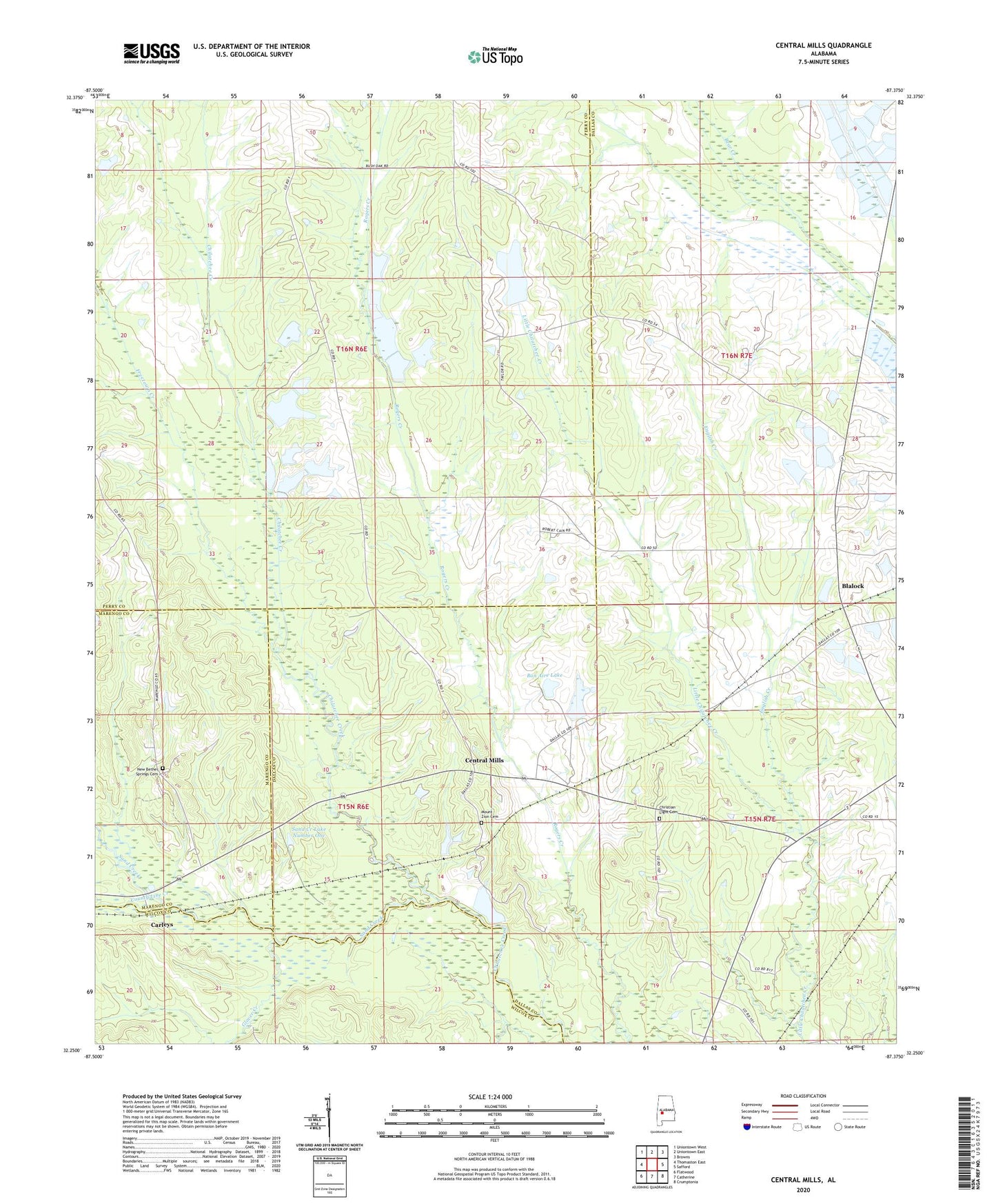
Central Mills Alabama US Topo Map
Couldn't load pickup availability
2024 topographic map quadrangle Central Mills in the state of Alabama. Scale: 1:24000. Based on the newly updated USGS 7.5' US Topo map series, this map is in the following counties: Dallas, Perry, Marengo, Wilcox. The map contains contour data, water features, and other items you are used to seeing on USGS maps, but also has updated roads and other features. This is the next generation of topographic maps. Printed on high-quality waterproof paper with UV fade-resistant inks.
Quads adjacent to this one:
West: Thomaston East
Northwest: Uniontown West
North: Uniontown East
Northeast: Browns
East: Safford
Southeast: Crumptonia
South: Catherine
Southwest: Flatwood
This map covers the same area as the classic USGS quad with code o32087c4.
Contains the following named places: Aimwell Baptist Church, Black Belt, Blalock, Bon Aire Lake, Bushy Oak, C Shuptrine Dam, Canaan Baptist Church, Carleys, Center Chapel, Central Mills, Central Mills Station, Christian Light Cemetery, Christian Light Church, Concord Church, County Line Creek, English Creek, Freetown Creek, Glover Creek, Johnsons Mill, Little Canaan School, Miller Brothers Dam Number One, Miller Brothers Dam Number Three, Miller Brothers Dam Number Two, Miller Brothers Lake Number One, Miller Brothers Lake Number Three, Miller Brothers Lake Number Two, Mount Zion Cemetery, New Bethel Spring Church, New Bethel Springs Cemetery, Pine Grove Church, Popes Beat School, Saint James Church, Sand Creek, Sand Creek Dam Number One, Sand Creek Lake Number One, Shady Grove Church, Signature Church, Triangle 6 Ranch Dam, Triangle 6 Ranch Lake, Walkers Quarter