MyTopo
Browns Alabama US Topo Map
Couldn't load pickup availability
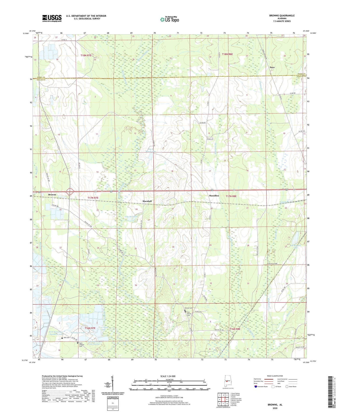
2024 topographic map quadrangle Browns in the state of Alabama. Scale: 1:24000. Based on the newly updated USGS 7.5' US Topo map series, this map is in the following counties: Dallas, Perry. The map contains contour data, water features, and other items you are used to seeing on USGS maps, but also has updated roads and other features. This is the next generation of topographic maps. Printed on high-quality waterproof paper with UV fade-resistant inks.
Quads adjacent to this one:
West: Uniontown East
Northwest: Scott Station
North: Marion South
Northeast: Suttle
East: Marion Junction
Southeast: Orrville
South: Safford
Southwest: Central Mills
This map covers the same area as the classic USGS quad with code o32087d3.
Contains the following named places: Bell Cemetery, Bells Church, Big B Ranch Lake, Browns, Brush Creek, C A Caines Lake, C A Caines Lake Dam, Caldwell Church, Central Baptist Church, Dry Creek, E F Randell Dam, E F Randell Lake, F W Pierce Lake Dam Number 2, F W Pierce Lake Number 2, Gary School, Gilmer Branch, Good Hope Church, Lake Walnutta, Macedonia Church, Marion Weissinger Lake Dam Number 2, Marion Weissinger Lake Number 2, Marshall, Massillon, Mount Zion Church, Nave, New Vernon Cemetery, New Vernon Church, Saint Chapter Cemetery, Saint Chapter Primitive Baptist Church, Saint Marks Church, Vernon Cemetery, W W Weissinger Lake Number 1, W W Weissinger Number 2 Dam, W W Weissinger Number 2 Lake, W W Weissinger Number 4 Dam, W W Weissinger Number 4 Lake, W W Wesssinger Number 1 Dam, Washington Creek, Weissinger Lakes, ZIP Code: 36759