MyTopo
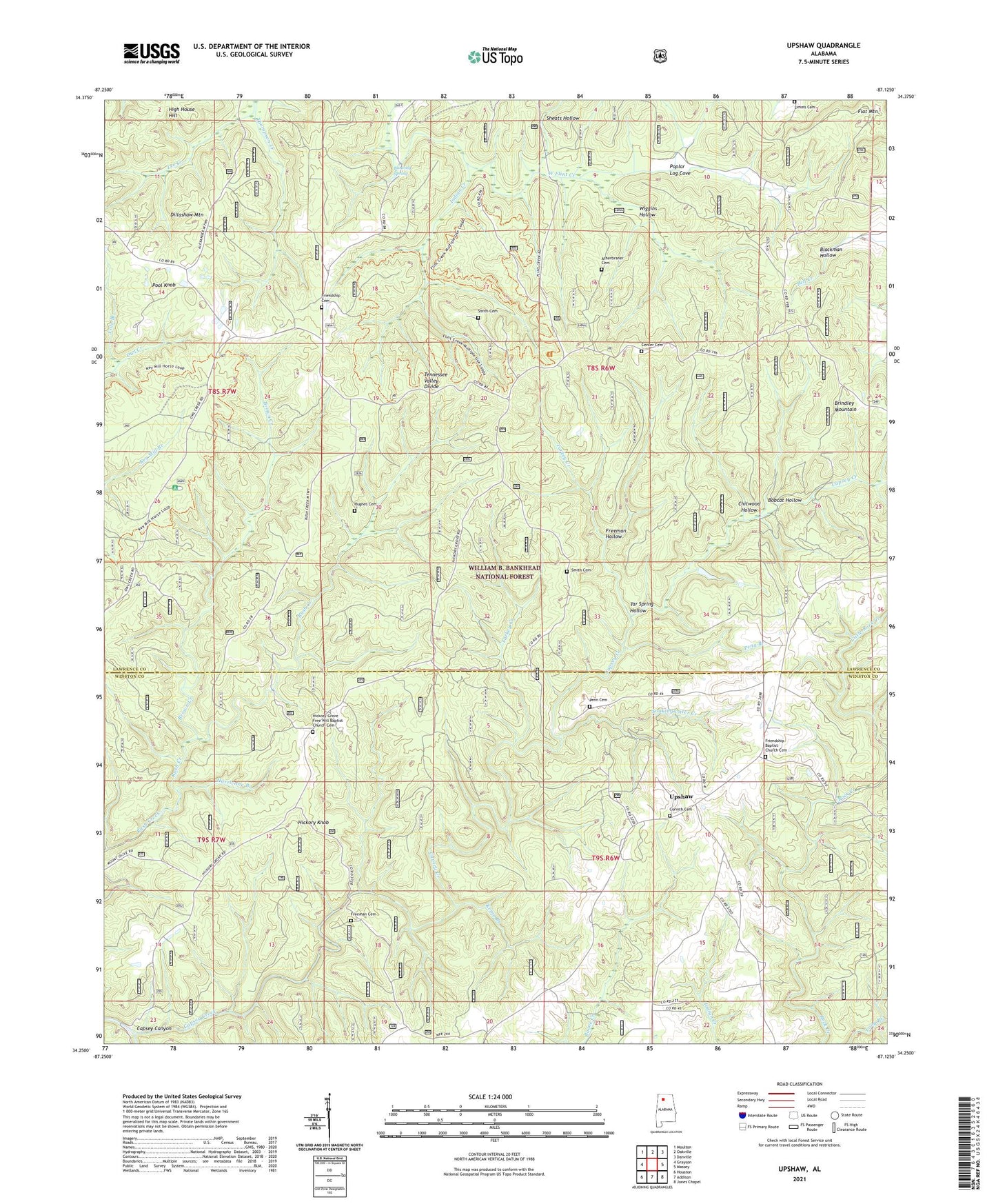
Upshaw Alabama US Topo Map
Couldn't load pickup availability
Also explore the Upshaw Forest Service Topo of this same quad for updated USFS data
2024 topographic map quadrangle Upshaw in the state of Alabama. Scale: 1:24000. Based on the newly updated USGS 7.5' US Topo map series, this map is in the following counties: Lawrence, Winston. The map contains contour data, water features, and other items you are used to seeing on USGS maps, but also has updated roads and other features. This is the next generation of topographic maps. Printed on high-quality waterproof paper with UV fade-resistant inks.
Quads adjacent to this one:
West: Grayson
Northwest: Moulton
North: Oakville
Northeast: Danville
East: Massey
Southeast: Jones Chapel
South: Addison
Southwest: Houston
This map covers the same area as the classic USGS quad with code o34087c2.
Contains the following named places: Asherbraner Cemetery, Blowing Spring, Bobcat Hollow, Brown Creek, Capsey Canyon, Capsey Creek, Center Cemetery, Center Church, Chitwood Hollow, Cole Branch, Corinth Cemetery, Dillashaw Mountain, Eastern Basham Lookout Tower, Fire Tower Number 3, Flat Mountain, Freeman Cemetery, Freeman Hollow, Friendship Baptist Church Cemetery, Friendship Cemetery, Friendship Church, Hickory Grove Church, Hickory Grove Free Will Baptist Church Cemetery, Hickory Grove School, Hickory Knob, High House Hill, Hughes Cemetery, Hurricane Branch, Indian Creek, Kemp Branch, Lindsey Hall Church, Looneys Tavern, Owl Creek Horse Camp, Penn Branch, Penn Cemetery, Pool, Pool Knob, Poplar Log Cove, Sheats Hollow, Sims Cemetery, Smith Cemetery, Soakingwater Creek, Tar Spring Hollow, Templeton School, Turkey Creek, Uby Post Office, Upshaw, Upshaw School, Wiggins Hollow