MyTopo
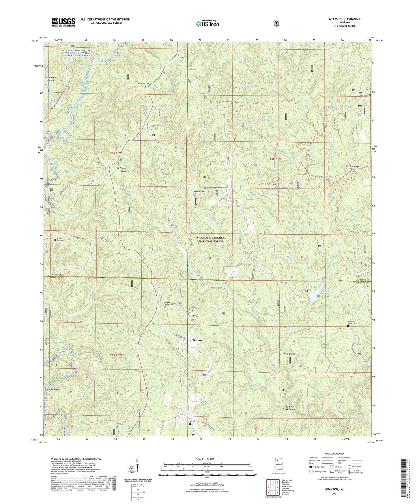
Grayson Alabama US Topo Map
Couldn't load pickup availability
Also explore the Grayson Forest Service Topo of this same quad for updated USFS data
2024 topographic map quadrangle Grayson in the state of Alabama. Scale: 1:24000. Based on the newly updated USGS 7.5' US Topo map series, this map is in the following counties: Lawrence, Winston. The map contains contour data, water features, and other items you are used to seeing on USGS maps, but also has updated roads and other features. This is the next generation of topographic maps. Printed on high-quality waterproof paper with UV fade-resistant inks.
Quads adjacent to this one:
West: Bee Branch
Northwest: Landersville
North: Moulton
Northeast: Oakville
East: Upshaw
Southeast: Addison
South: Houston
Southwest: Double Springs
This map covers the same area as the classic USGS quad with code o34087c3.
Contains the following named places: Beech Creek, Black Warrior Wildlife Management Area, Black Warrior Work Center, Brushy Creek Lake, Brushy Creek Lake Dam, Brushy Creek Recreational Area, Bunyan Hill Cemetery, Central Lookout Tower, Church of the Forest, Coal Branch, Collier Creek, Collier Creek Canyon, Collier Creek Post Office, Davis Creek, East Fork Beech Creek, Ellaville, Ellaville Post Office, Fairview Church, Grayson, Grayson Lake, Grayson Lake Dam, Grayson Post Office, Gum Pond, Hepsidam, Holmes Chapel Cemetery, Holmes Chapel School, Horse Creek, Hunter Camp, Hurricane Creek, Hurricane Creek Shooting Range, Key Mill Branch, Lloyds Canyon, Lloyds Creek, McDougal Hunter Camp, McDougal Ridge, McLemore Cemetery, Montgomery Creek, Morgan Cemetery, Mount Olive Cemetery, Mount Olive School, Mountain Springs Church, Oplee Post Office, Owl Creek, Owl Post Office, Paines Mill, Peters Mill, Pine Torch Church, Pine Torch School, Poplar Springs School, Rush Creek, Shiloh Cemetery, Shiloh Church, Stiles Cemetery, Tapsville Cemetery, West Fork Beech Creek