MyTopo
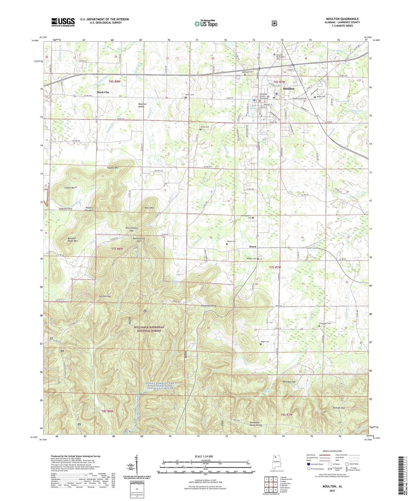
Moulton Alabama US Topo Map
Couldn't load pickup availability
Also explore the Moulton Forest Service Topo of this same quad for updated USFS data
2024 topographic map quadrangle Moulton in the state of Alabama. Scale: 1:24000. Based on the newly updated USGS 7.5' US Topo map series, this map is in the following counties: Lawrence. The map contains contour data, water features, and other items you are used to seeing on USGS maps, but also has updated roads and other features. This is the next generation of topographic maps. Printed on high-quality waterproof paper with UV fade-resistant inks.
Quads adjacent to this one:
West: Landersville
Northwest: Hatton
North: Masterson Mill
Northeast: Caddo
East: Oakville
Southeast: Upshaw
South: Grayson
Southwest: Bee Branch
This map covers the same area as the classic USGS quad with code o34087d3.
Contains the following named places: Almon Branch, Almon Cemetery, Bera School, Beulah Church, Bill Stewart Activity Center, Blowing Springs, Boger Cemetery, Brown School, Buzzard Roost Mountain, Cantrell Cove, Cheatham Cemetery, Cheatham Knob, City of Moulton, Community Bible Church, Cowen Mountain, Deer Run Golf Course, Delashaw School, East Side Shopping Center, Elam Church, First United Methodist Church, Gibson Cemetery, Goodlett Pools, Heflin Cemetery, Hickory Flat Mountain, Irving Pond, Lawrence County Christian School, Lawrence County Courthouse, Lawrence County Emergency Medical Services, Lawrence County High School, Lawrence Medical Center, Leola, McDonald Cemetery, Milam Campground Cemetery, Montgomery Cemetery, Moulton, Moulton Baptist Church, Moulton Church of Christ, Moulton Division, Moulton Elementary School, Moulton Fire Department, Moulton Memory Gardens, Moulton Middle School, Moulton Police Department, Moulton Post Office, Mountain Spring School, Mountain View School, Muck City, Mulligan Gap, Muxy City School, Penitentiary Gap, Penitentiary Mountain, Pinhook, Pinhook Branch, Pinhook Church, Pinhook Gap, Pinhook School, Pleasant Grove Church, Pleasant Ridge Church, Priest Pond, Roberts Cemetery, Simms Cemetery, Sledge Creek, Srygley Branch, Srygley Mountain, Suttons Gap, Town Spring, Union Chapel, Warren Springs, WFIQ-TV, WHIY-AM (Moulton), Wren, Wren Elementary School, Wren Mountain, ZIP Code: 35650