MyTopo
Anvil Rock Ranch Arizona US Topo Map
Couldn't load pickup availability
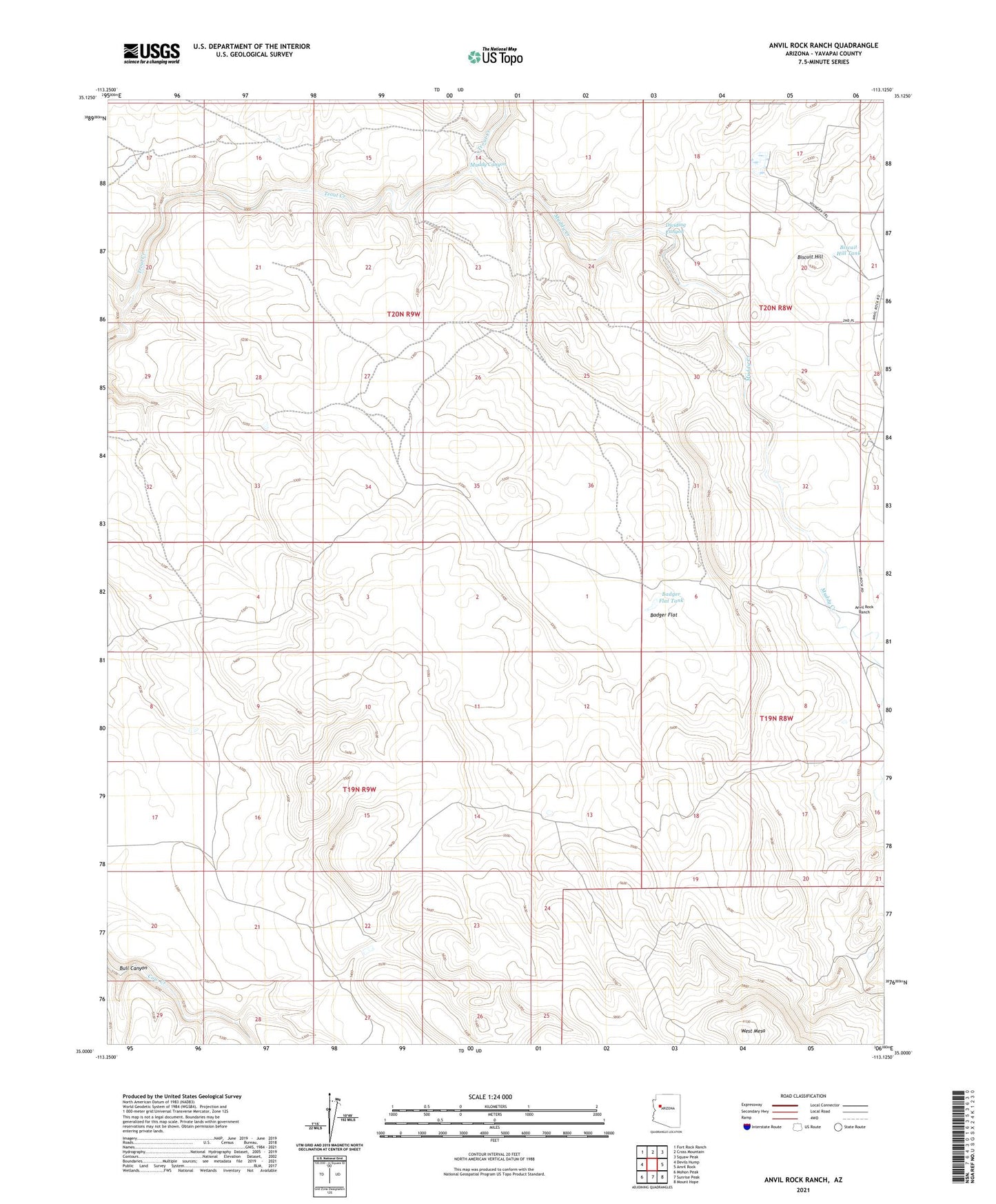
2021 topographic map quadrangle Anvil Rock Ranch in the state of Arizona. Scale: 1:24000. Based on the newly updated USGS 7.5' US Topo map series, this map is in the following counties: Yavapai. The map contains contour data, water features, and other items you are used to seeing on USGS maps, but also has updated roads and other features. This is the next generation of topographic maps. Printed on high-quality waterproof paper with UV fade-resistant inks.
Quads adjacent to this one:
West: Devils Hump
Northwest: Fort Rock Ranch
North: Cross Mountain
Northeast: Squaw Peak
East: Anvil Rock
Southeast: Mount Hope
South: Sunrise Peak
Southwest: Mohon Peak
This map covers the same area as the classic USGS quad with code o35113a2.
Contains the following named places: Anvil Rock Ranch, Badger Flat, Badger Flat Tank, Badger Flat Windmill, Biscuit Hill, Biscuit Hill Tank, Broken Foot Well, Bull Canyon, Bull Pasture Tank, Dividing Canyon, Dividing Canyon Tank, E L Well, Eagle Tank, Hackberry Tank, Hay Dam, Little South Tank, Lower Badger Tank, Muddy Canyon, Muddy Creek, One More Day Tank, Trap Tank, Well Number Four, Well Number Three, West Mesa