MyTopo
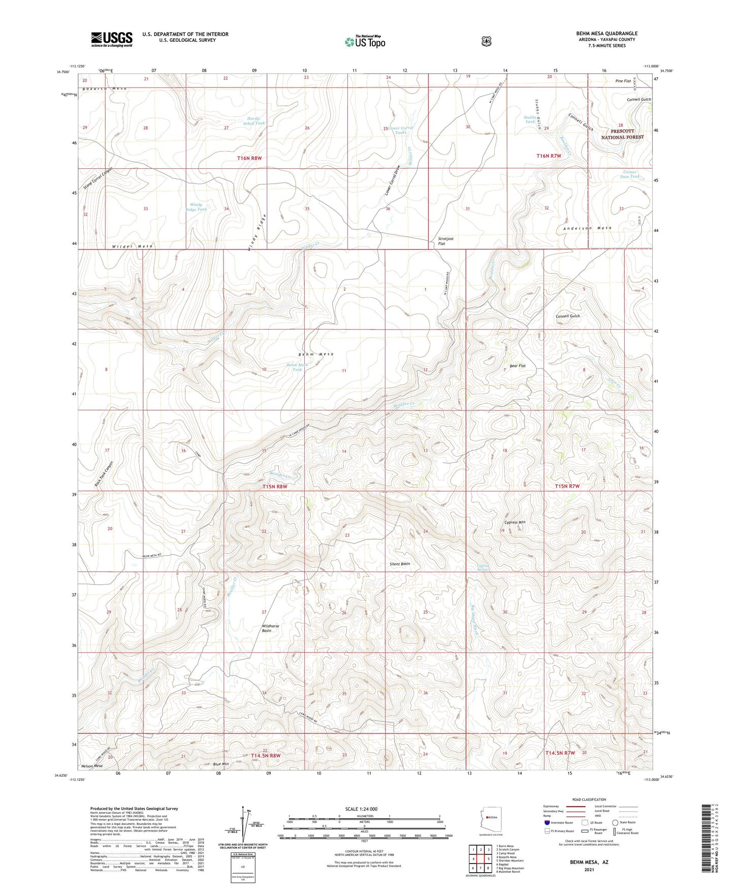
Behm Mesa Arizona US Topo Map
Couldn't load pickup availability
Also explore the Behm Mesa Forest Service Topo of this same quad for updated USFS data
2021 topographic map quadrangle Behm Mesa in the state of Arizona. Scale: 1:24000. Based on the newly updated USGS 7.5' US Topo map series, this map is in the following counties: Yavapai. The map contains contour data, water features, and other items you are used to seeing on USGS maps, but also has updated roads and other features. This is the next generation of topographic maps. Printed on high-quality waterproof paper with UV fade-resistant inks.
Quads adjacent to this one:
West: Bozarth Mesa
Northwest: Burro Mesa
North: Scratch Canyon
Northeast: Camp Wood
East: Sheridan Mountain
Southeast: Muleshoe Ranch
South: Big Shipp Mountain
Southwest: Bagdad
This map covers the same area as the classic USGS quad with code o34113f1.
Contains the following named places: Anderson Mesa, Bear Flat, Behm Mesa, Behm Mesa Tank, Black Pearl Mine, Blue Mountain, Connell Gulch, Corner Dam Tank, Cypress Mountain, Cypress Spring, Hardy-Schell Tank, Lower Corral Draw, Lower Corral Tanks, Pine Flat, Silent Basin, Strotjost Flat, Stubbs Gulch, Stubbs Tank, Wilder Mesa, Wildhorse Basin, Windy Ridge Tank