
MyTopo
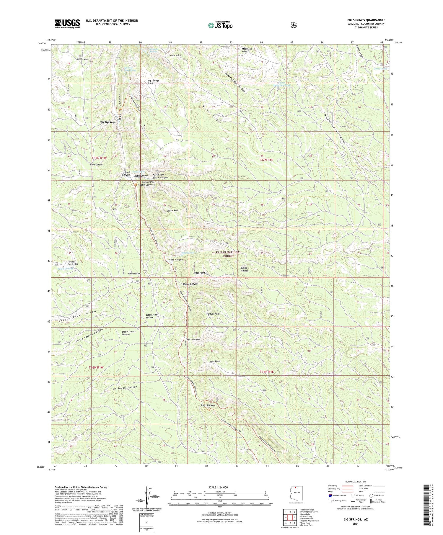
Big Springs Arizona US Topo Map
Couldn't load pickup availability
Also explore the Big Springs Forest Service Topo of this same quad for updated USFS data
2021 topographic map quadrangle Big Springs in the state of Arizona. Scale: 1:24000. Based on the newly updated USGS 7.5' US Topo map series, this map is in the following counties: Coconino. The map contains contour data, water features, and other items you are used to seeing on USGS maps, but also has updated roads and other features. This is the next generation of topographic maps. Printed on high-quality waterproof paper with UV fade-resistant inks.
Quads adjacent to this one:
West: Sowats Spring
Northwest: Toothpick Ridge
North: Warm Springs Canyon
Northeast: Jacob Lake
East: Telephone Hill
Southeast: De Motte Park
South: Timp Point
Southwest: Tapeats Amphitheater
This map covers the same area as the classic USGS quad with code o36112e3.
Contains the following named places: Big Springs, Big Springs Point, Big Springs Ranger Station, Castle Canyon, Castle Point, Castle Spring, Corral Lake, Cross Over Tank, Little Mountain, Lookout Canyon, Lost Canyon, Lost Point, Lower Moquitch Tank, Mangum Springs, Morning Dove Spring, North Fork Castle Canyon, Oquer Canyon, Oquer Point, Oquer Tank, Pratt Canyon, Pressure Tank, Riggs Canyon, Riggs Point, Riggs Spring, Sawmill Tank, South Fork Castle Canyon, Sowats Gravel Pit, Upper Moquitch Tank, Willie Apron


