MyTopo
Timp Point Arizona US Topo Map
Couldn't load pickup availability
Also explore the Timp Point Forest Service Topo of this same quad for updated USFS data
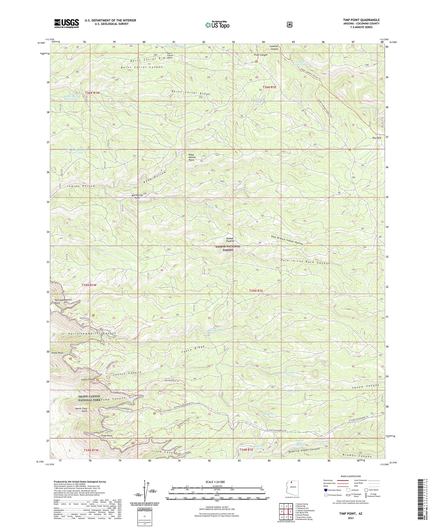
2023 topographic map quadrangle Timp Point in the state of Arizona. Scale: 1:24000. Based on the newly updated USGS 7.5' US Topo map series, this map is in the following counties: Coconino. The map contains contour data, water features, and other items you are used to seeing on USGS maps, but also has updated roads and other features. This is the next generation of topographic maps. Printed on high-quality waterproof paper with UV fade-resistant inks.
Quads adjacent to this one:
West: Tapeats Amphitheater
Northwest: Sowats Spring
North: Big Springs
Northeast: Telephone Hill
East: De Motte Park
Southeast: Kanabownits Spring
South: King Arthur Castle
Southwest: Powell Plateau
This map covers the same area as the classic USGS quad with code o36112d3.
Contains the following named places: Bee Spring, Bee Spring Point, Browns Canyon, Burnt Corral Apron, Burnt Corral Ridge, Burnt Corral Rim, Burnt Corral Tank, Dugway Tank, East Branch Indian Hollow, Fence Ridge, Hole-in-the-Rock Canyon, Locust Canyon, Locust Point, Locust Spring, Lookout Canyon Tank, Middle Burnt Corral Tank, North Big Saddle Trick Tank, North Timp Point, Parissawampitts Spring, Pasture Spring, Quaking Aspen, Quaking Aspen Spring, Road Hollow, Road Hollow Point, Road Hollow Tank, Squaw Canyon, Squaw Spring, Timp Point, Timp Spring, Watts Spring