
MyTopo
New River SE Arizona US Topo Map
Couldn't load pickup availability
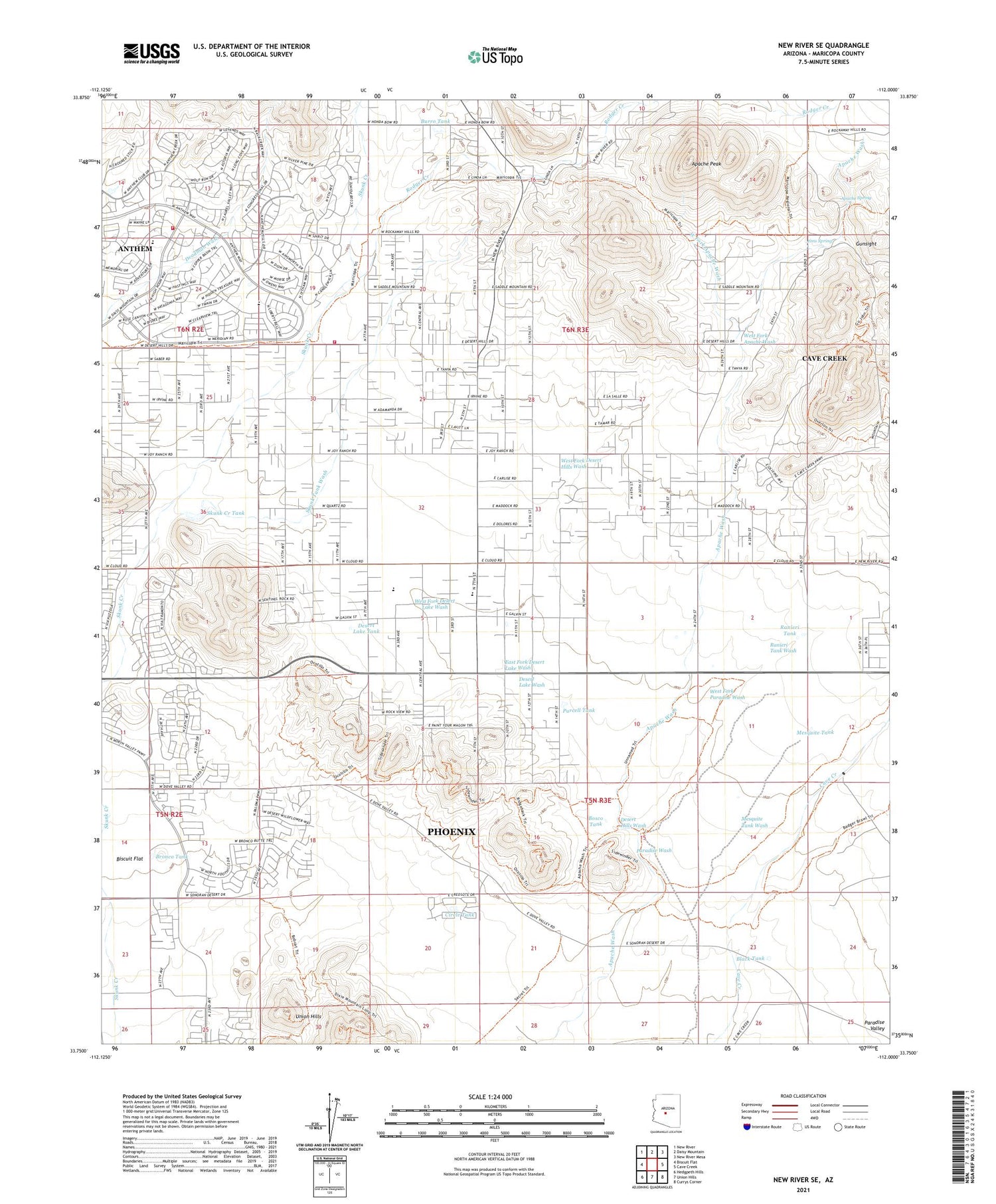
2021 topographic map quadrangle New River SE in the state of Arizona. Scale: 1:24000. Based on the newly updated USGS 7.5' US Topo map series, this map is in the following counties: Maricopa. The map contains contour data, water features, and other items you are used to seeing on USGS maps, but also has updated roads and other features. This is the next generation of topographic maps. Printed on high-quality waterproof paper with UV fade-resistant inks.
Quads adjacent to this one:
West: Biscuit Flat
Northwest: New River
North: Daisy Mountain
Northeast: New River Mesa
East: Cave Creek
Southeast: Currys Corner
South: Union Hills
Southwest: Hedgpeth Hills
This map covers the same area as the classic USGS quad with code o33112g1.
Contains the following named places: Anthem Census Designated Place, Anthem Golf and Country Club, Apache Peak, Apache Spring, Bentley Well, Black Tank, Bosco Tank, Bronco Tank, Burro Tank, Calvary Chapel of Deseret Hills, Circle Tank, Crossroads Christian Fellowship, Daisy Mountain Fire Department Station 142, Daisy Mountain Fire Department Station 145, Deer Valley Division, Desert Hills Fellowship Church, Desert Hills Wash, Desert Lake Tank, Desert Lake Wash, Desert Mountain School, Desert View Bible Church, Diamond Canyon School, East Fork Desert Lake Wash, East Joy Well, Gavilan Peak School, Gunsight, Jims Spring, Mesquite Tank, Paradise Wash, Purcell Tank, Ranieri Tank, Ranieri Tank Wash, Rodger Creek, Skunk Creek Tank, Skunk Tank Wash, Stepping Stones Academy, West Fork Apache Wash, West Fork Desert Hills Wash, West Fork Desert Lake Wash, West Fork Paradise Wash, ZIP Codes: 85085, 85086


