MyTopo
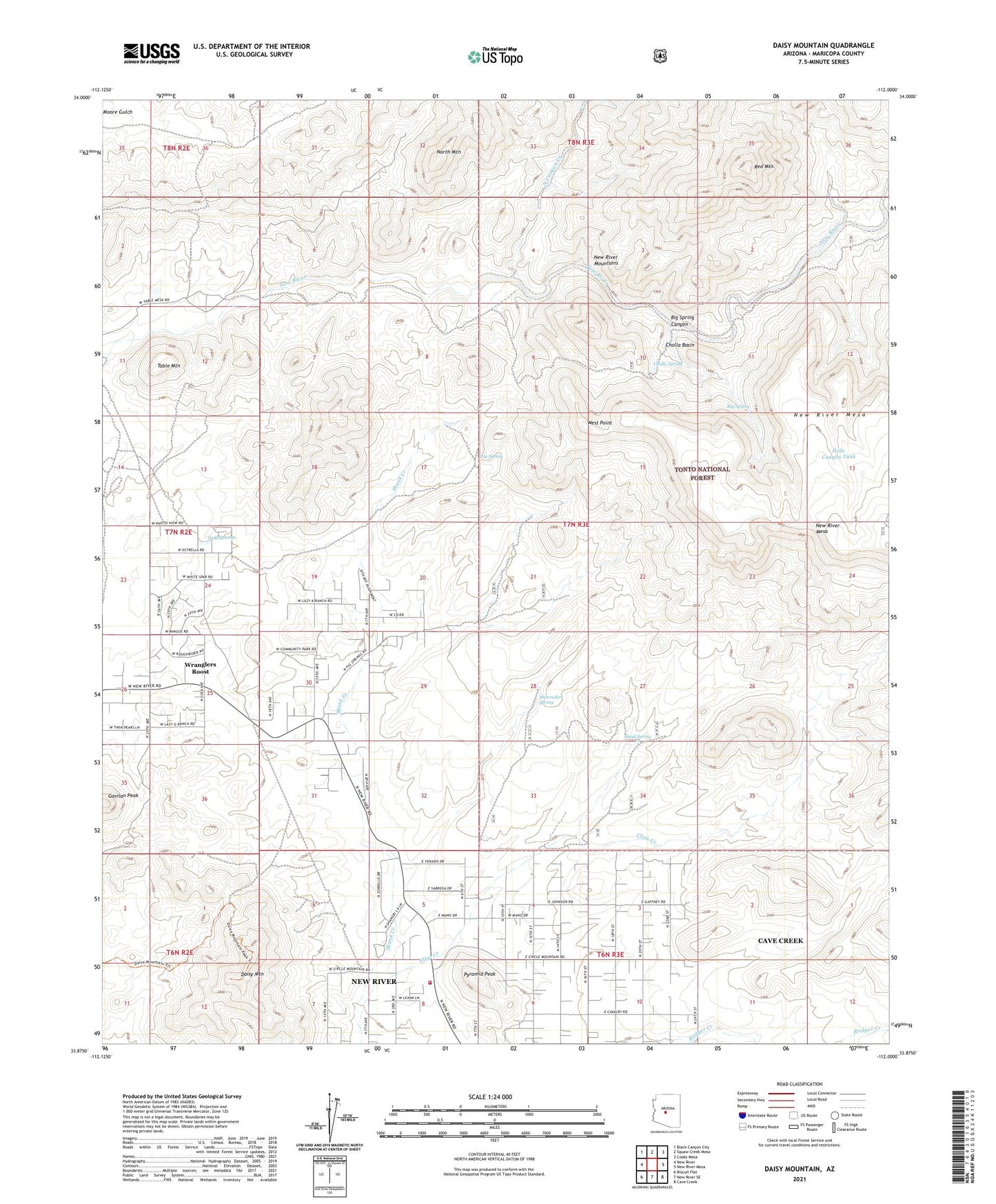
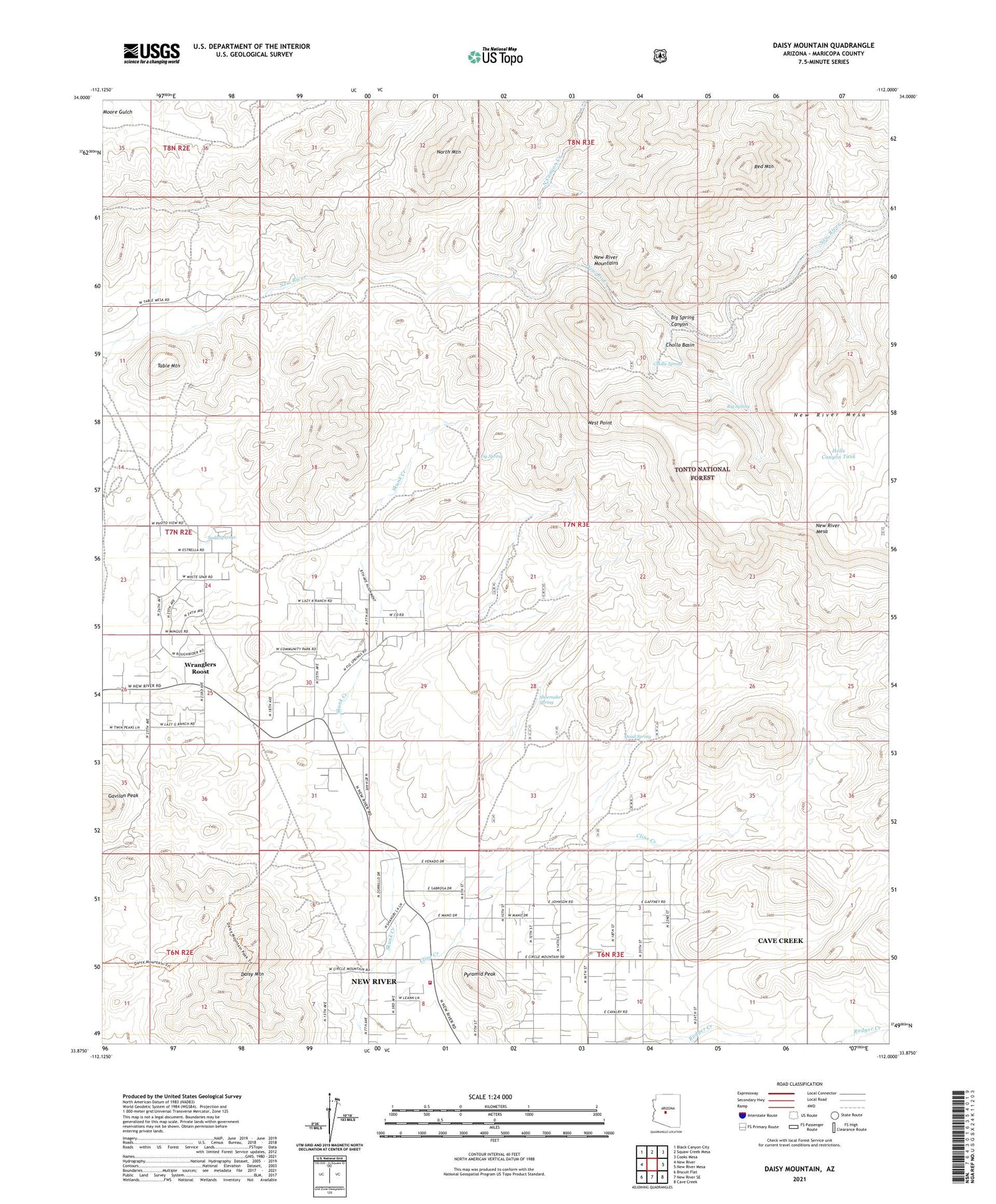
Daisy Mountain Arizona US Topo Map
Couldn't load pickup availability
Also explore the Daisy Mountain Forest Service Topo of this same quad for updated USFS data
2021 topographic map quadrangle Daisy Mountain in the state of Arizona. Scale: 1:24000. Based on the newly updated USGS 7.5' US Topo map series, this map is in the following counties: Maricopa. The map contains contour data, water features, and other items you are used to seeing on USGS maps, but also has updated roads and other features. This is the next generation of topographic maps. Printed on high-quality waterproof paper with UV fade-resistant inks.
Quads adjacent to this one:
West: New River
Northwest: Black Canyon City
North: Squaw Creek Mesa
Northeast: Cooks Mesa
East: New River Mesa
Southeast: Cave Creek
South: New River SE
Southwest: Biscuit Flat
This map covers the same area as the classic USGS quad with code o33112h1.
Contains the following named places: Big Spring, Big Spring Canyon, Catholic Community of the Good Shepherd, Cholla Basin, Cholla Spring, Cline Creek, Cline Well, Daisy Mine, Daisy Mountain, Daisy Mountain Fire Department Station 141, East Fork North Canyon Creek, Fig Spring, Gavilan Peak, Hells Canyon Tank, King Well, Moore Well, New River Bible Chapel, New River Census Designated Place, New River First Assembly of God Church, North Canyon Creek, North Mountain, Odell Well, Pyramid Peak, Quail Spring, Red Mountain, Shangri La Ranch, Sharman Landing Strip, Shoemaker Spring, Soda Springs, Table Mountain, Tee Ranch, The Church of Jesus Christ of Latter Day Saints, Thirtytwo Well, Upper Well, West Point, Wranglers Roost