MyTopo
Markham Creek Arizona US Topo Map
Couldn't load pickup availability
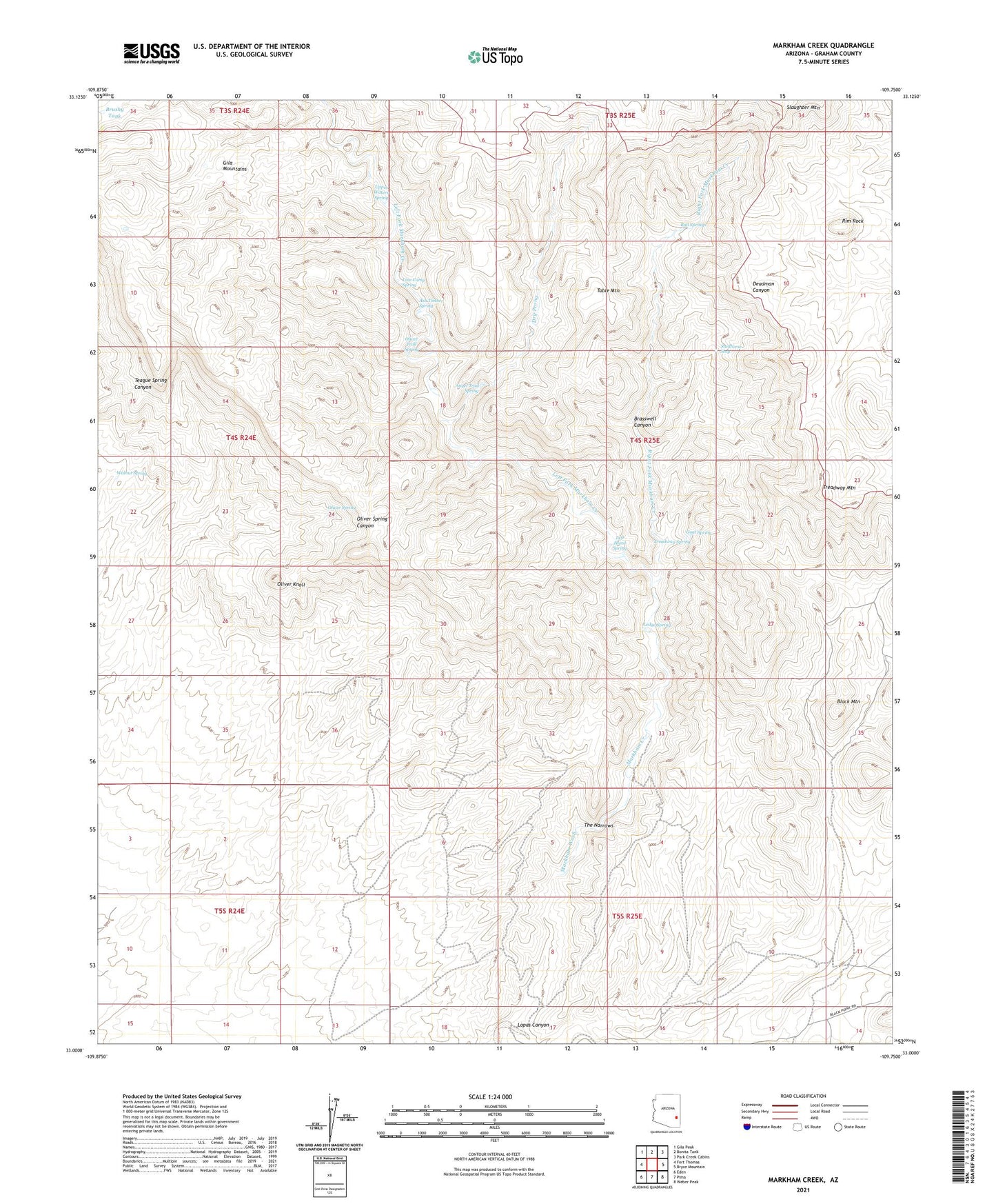
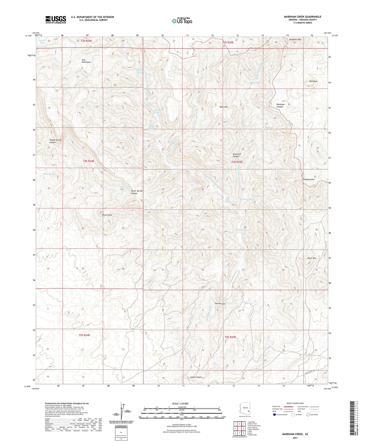
2021 topographic map quadrangle Markham Creek in the state of Arizona. Scale: 1:24000. Based on the newly updated USGS 7.5' US Topo map series, this map is in the following counties: Graham. The map contains contour data, water features, and other items you are used to seeing on USGS maps, but also has updated roads and other features. This is the next generation of topographic maps. Printed on high-quality waterproof paper with UV fade-resistant inks.
Quads adjacent to this one:
West: Fort Thomas
Northwest: Gila Peak
North: Bonita Tank
Northeast: Park Creek Cabins
East: Bryce Mountain
Southeast: Weber Peak
South: Pima
Southwest: Eden
This map covers the same area as the classic USGS quad with code o33109a7.
Contains the following named places: Angel Trail Spring, Ash Timber Spring, Big Spring Wash, Black Mountain, Brasswell Canyon, Brushy Tank, Bull Springs, Dry Prong, Gila Mountains, Goat Spring, Hot Springs Tank, Ledge Spring, Left Fork Markham Creek, Left Hand Spring, Line Camp Spring, Lopas Canyon, Lopez Windmill, Markham Creek, Oliver Knoll, Oliver Spring, Oliver Trail Spring, Right Fork Markham Creek, Rim Rock, Slaughter Mountain, Studhorse Seep, Table Mountain, The Narrows, Treadway Mountain, Treadway Spring, Upper Waters Spring, Walnut Spring