MyTopo
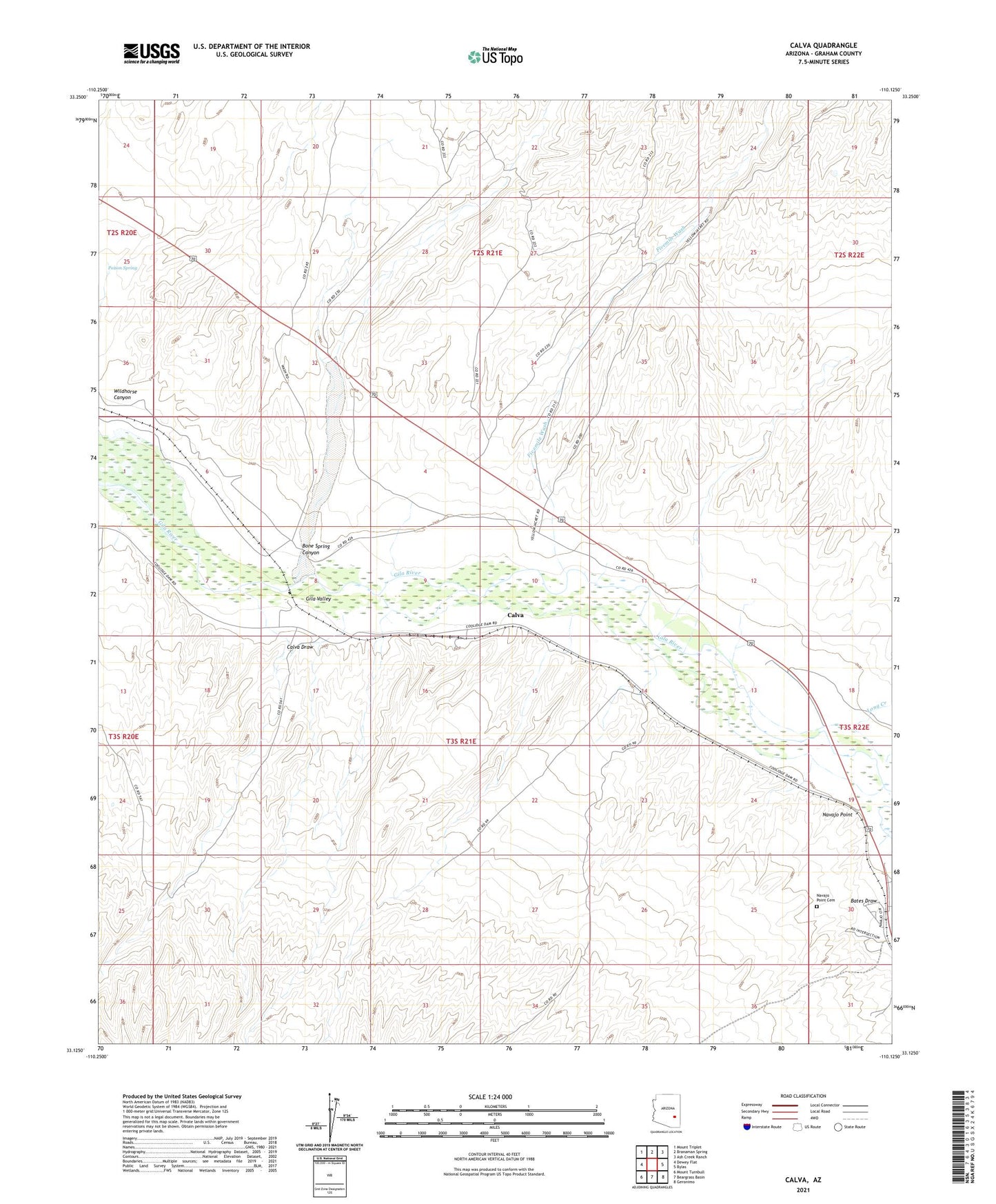
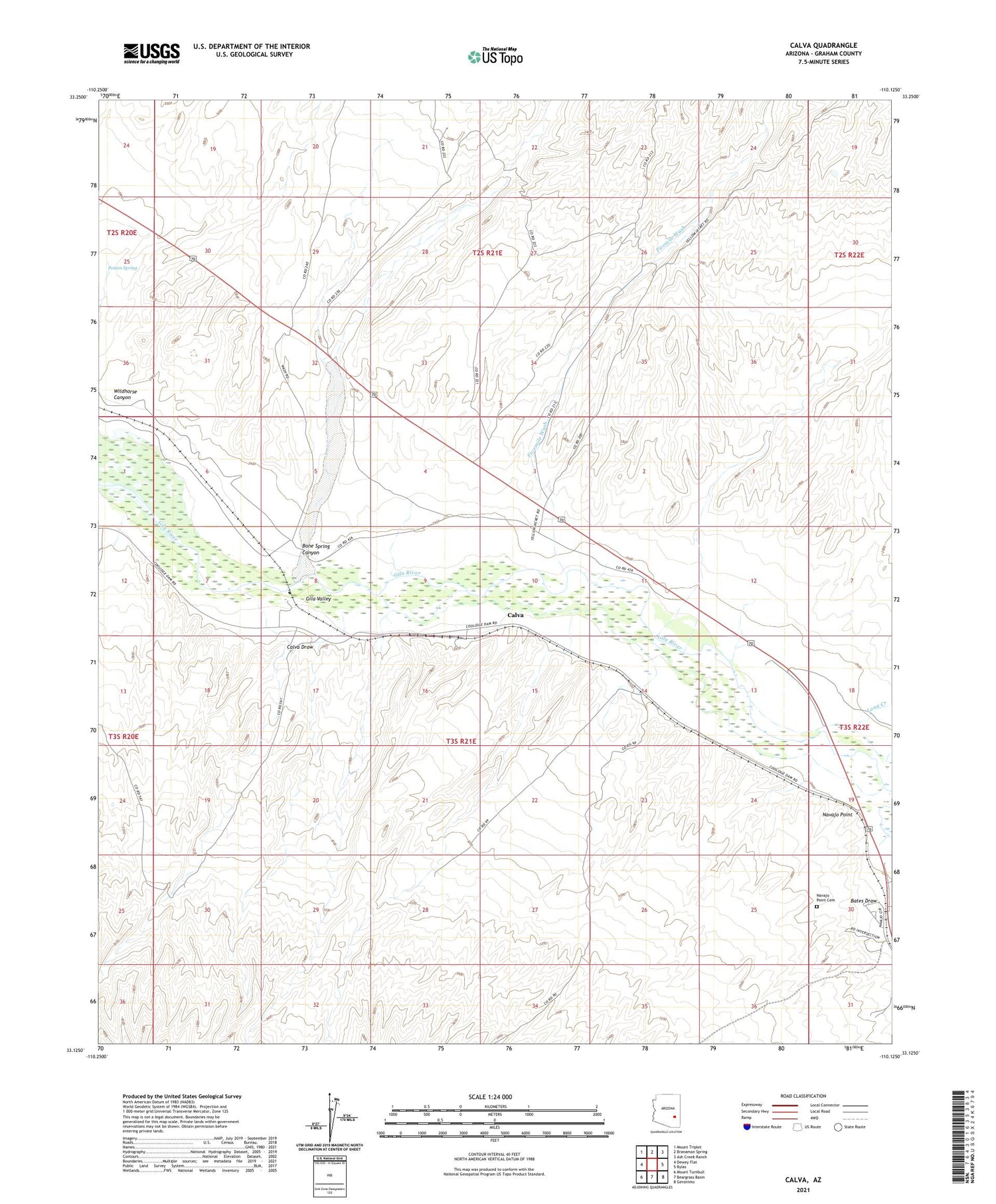
Calva Arizona US Topo Map
Couldn't load pickup availability
2021 topographic map quadrangle Calva in the state of Arizona. Scale: 1:24000. Based on the newly updated USGS 7.5' US Topo map series, this map is in the following counties: Graham. The map contains contour data, water features, and other items you are used to seeing on USGS maps, but also has updated roads and other features. This is the next generation of topographic maps. Printed on high-quality waterproof paper with UV fade-resistant inks.
Quads adjacent to this one:
West: Dewey Flat
Northwest: Mount Triplet
North: Branaman Spring
Northeast: Ash Creek Ranch
East: Bylas
Southeast: Geronimo
South: Beargrass Basin
Southwest: Mount Turnbull
This map covers the same area as the classic USGS quad with code o33110b2.
Contains the following named places: Bates Draw, Bone Spring Canyon, Bone Spring Well, Calva, Calva Draw, Calva Railroad Station, Charley Well, Fivemile Wash, Gila Valley, Long Creek, Navajo Point, Navajo Point Cemetery, Pikes Well, Poison Spring, Wildhorse Canyon, Yellowjacket Well