
MyTopo
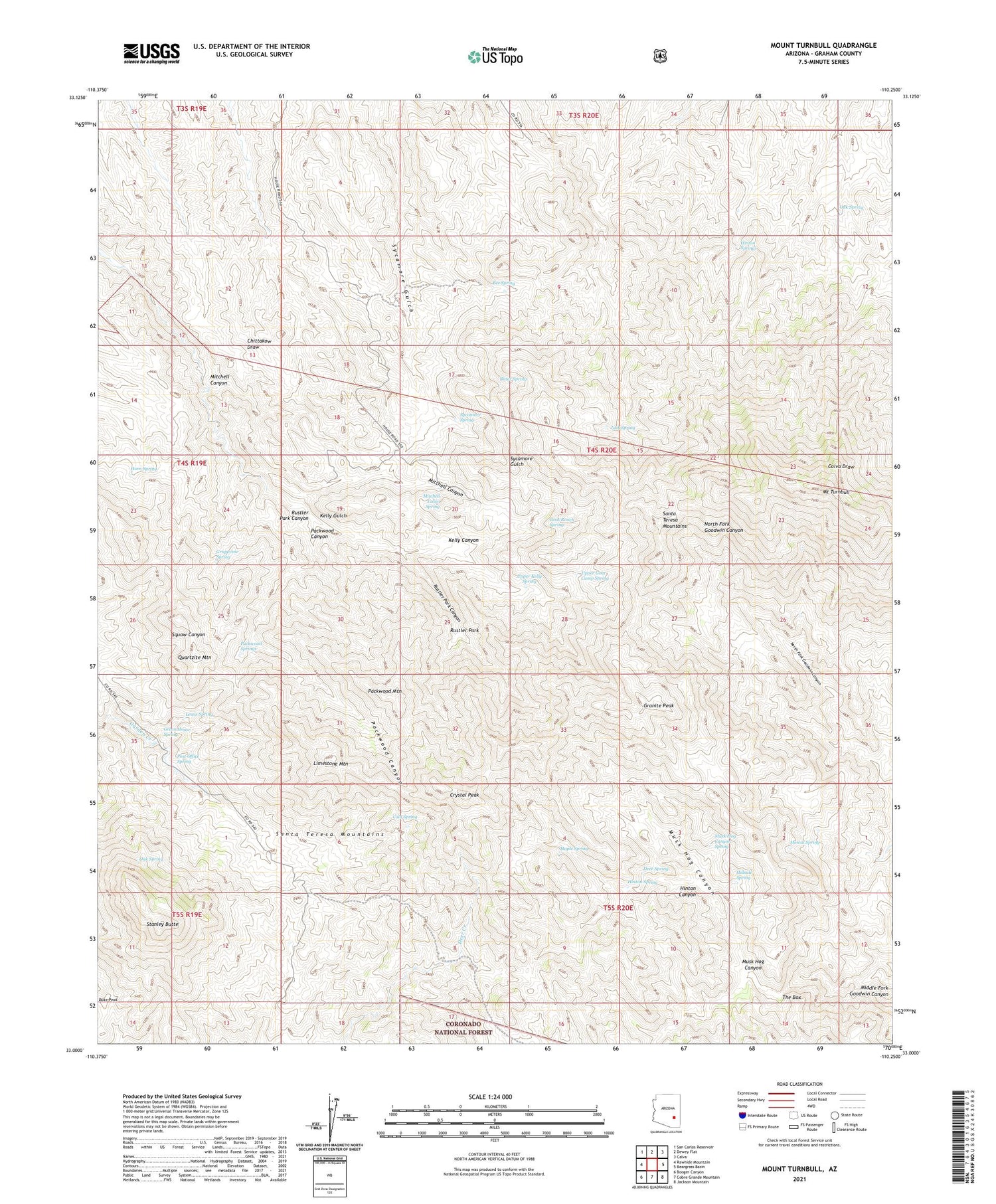
Mount Turnbull Arizona US Topo Map
Couldn't load pickup availability
Also explore the Mount Turnbull Forest Service Topo of this same quad for updated USFS data
2023 topographic map quadrangle Mount Turnbull in the state of Arizona. Scale: 1:24000. Based on the newly updated USGS 7.5' US Topo map series, this map is in the following counties: Graham. The map contains contour data, water features, and other items you are used to seeing on USGS maps, but also has updated roads and other features. This is the next generation of topographic maps. Printed on high-quality waterproof paper with UV fade-resistant inks.
Quads adjacent to this one:
West: Rawhide Mountain
Northwest: San Carlos Reservoir
North: Dewey Flat
Northeast: Calva
East: Beargrass Basin
Southeast: Jackson Mountain
South: Cobre Grande Mountain
Southwest: Booger Canyon
This map covers the same area as the classic USGS quad with code o33110a3.
Contains the following named places: Bee Spring, Bitter Spring, Cold Spring, Crystal Peak, Deer Spring, Duke Peak, Ellison Cabin Two hundred eighty three Trail, Ellison Place, Goat Ranch Spring, Granite Peak, Grapevine Spring, Green House Spring, Hillside Spring, Hinton Canyon, Hinton Spring, Hinton Springs, Horn Spring, House Ranch, House Tank, Jack Spring, Kelly Canyon, Lewis Spring, Limestone Mountain, Maple Spring, Mescal Spring, Mitchell Cabin Spring, Mitchell Canyon, Mount Turnbull, Musk Hog Canyon, Musk Hog Canyon Spring, Oak Spring, Packwood Canyon, Packwood Mountain, Packwood Springs, Post Office Spring, Quartzite Mountain, Rustler Park, Rustler Park Canyon, Safford Ranger District, Santa Teresa Mountains, Stanley Butte, Starlight Mine, Sycamore Spring, The Box, Upper Goat Camp Spring, Upper Kelly Spring, Weaver Ranch


