
MyTopo
Sacaton Arizona US Topo Map
Couldn't load pickup availability
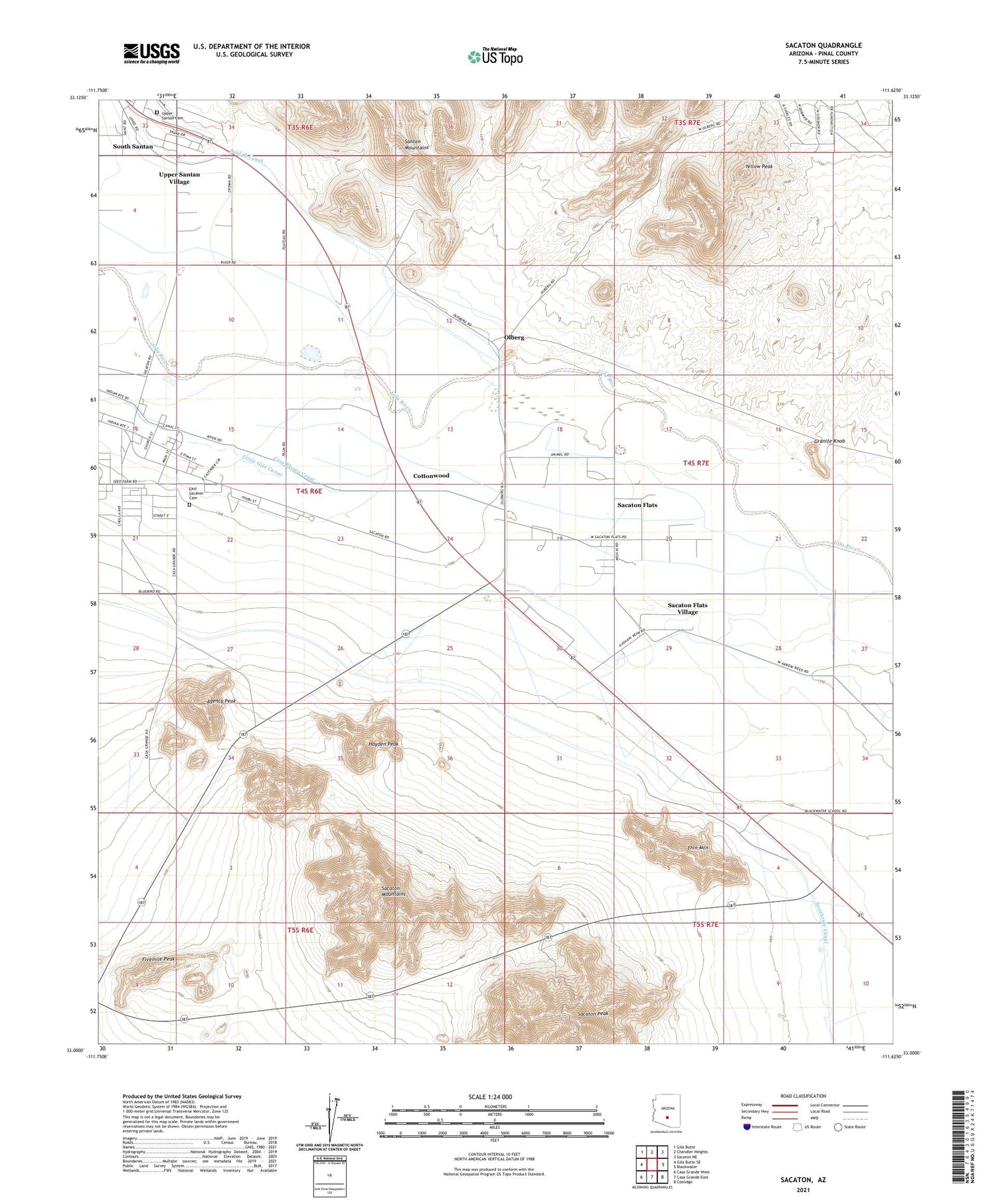
2021 topographic map quadrangle Sacaton in the state of Arizona. Scale: 1:24000. Based on the newly updated USGS 7.5' US Topo map series, this map is in the following counties: Pinal. The map contains contour data, water features, and other items you are used to seeing on USGS maps, but also has updated roads and other features. This is the next generation of topographic maps. Printed on high-quality waterproof paper with UV fade-resistant inks.
Quads adjacent to this one:
West: Gila Butte SE
Northwest: Gila Butte
North: Chandler Heights
Northeast: Sacaton NE
East: Blackwater
Southeast: Coolidge
South: Casa Grande East
Southwest: Casa Grande West
This map covers the same area as the classic USGS quad with code o33111a6.
Contains the following named places: Agency Peak, Casa Blanca Canal, Cottonwood, District 2, East Sacaton Cemetery, Fivemile Peak, Granite Knob, Hayden Peak, Little Gila Canal, McClellan Wash, Olberg, Olberg Trading Post, Pima Central School, Sacaton, Sacaton Ball Field Park, Sacaton Community Church, Sacaton Fairgrounds, Sacaton Flats, Sacaton Flats Community Center, Sacaton Flats Village Census Designated Place, Sacaton Peak, Sacaton Post Office, South Santan, Southside Canal, Thin Mountain, Upper Santan Cemetery, Upper Santan Village Census Designated Place, Yellow Peak


