MyTopo
Coolidge Dam Arizona US Topo Map
Couldn't load pickup availability
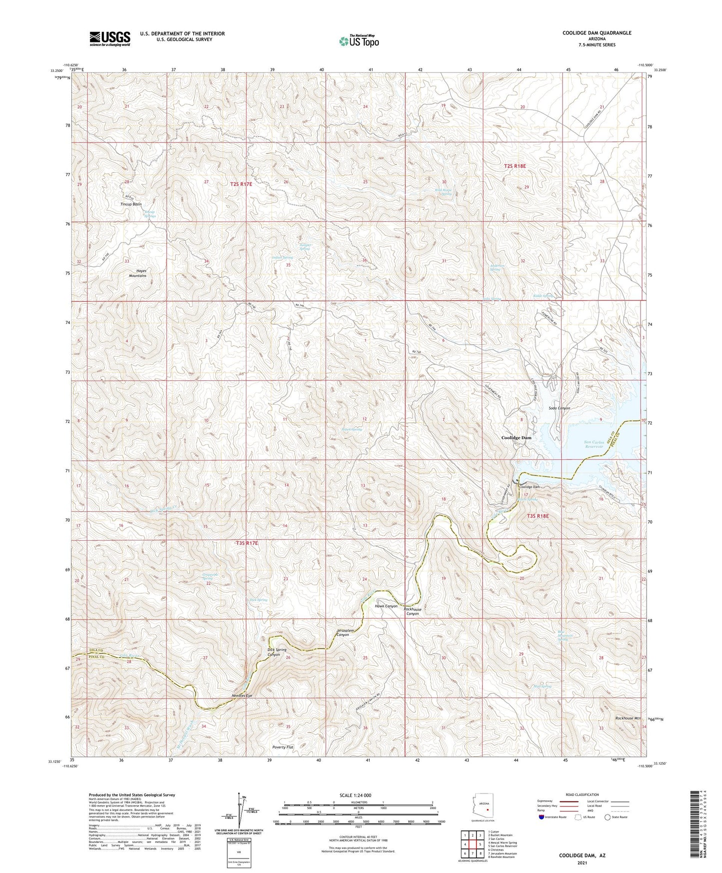
2021 topographic map quadrangle Coolidge Dam in the state of Arizona. Scale: 1:24000. Based on the newly updated USGS 7.5' US Topo map series, this map is in the following counties: Gila, Pinal. The map contains contour data, water features, and other items you are used to seeing on USGS maps, but also has updated roads and other features. This is the next generation of topographic maps. Printed on high-quality waterproof paper with UV fade-resistant inks.
Quads adjacent to this one:
West: Mescal Warm Spring
Northwest: Cutter
North: Bucket Mountain
Northeast: San Carlos
East: San Carlos Reservoir
Southeast: Rawhide Mountain
South: Jerusalem Mountain
Southwest: Christmas
This map covers the same area as the classic USGS quad with code o33110b5.
Contains the following named places: Anderson Spring, Baker Well, Blue Mountain Spring, Coolidge Dam, Dick Spring, Dick Spring Canyon, Dick Spring Creek, Grapevine Spring, Hawk Canyon, Hawk Spring, Hayes Mountains, Hill Well, Hook and Line Ranch, Indian Spring, Jerusalem Canyon, Juniper Spring, Kidde Spring, McDougal Wash, Mud Spring, Needles Eye, Needle's Eye Wilderness, Poverty Flat, Rockhouse Canyon, Rockhouse Mountain, Soda Canyon, Soda Spring, Standing Rock Catchment Basin, Stockton Well, Tincup Basin, Tincup Springs, Warm Spring, Wild Horse Spring