MyTopo
Mescal Warm Spring Arizona US Topo Map
Couldn't load pickup availability
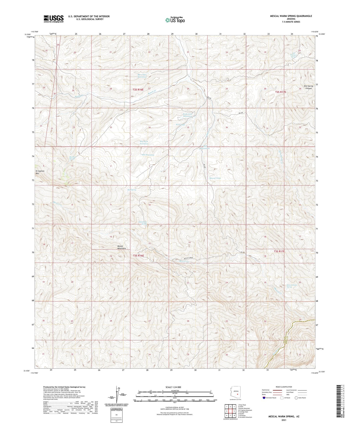
2021 topographic map quadrangle Mescal Warm Spring in the state of Arizona. Scale: 1:24000. Based on the newly updated USGS 7.5' US Topo map series, this map is in the following counties: Gila, Pinal. The map contains contour data, water features, and other items you are used to seeing on USGS maps, but also has updated roads and other features. This is the next generation of topographic maps. Printed on high-quality waterproof paper with UV fade-resistant inks.
Quads adjacent to this one:
West: El Capitan Mountain
Northwest: Pinal Peak
North: Cutter
Northeast: Bucket Mountain
East: Coolidge Dam
Southeast: Jerusalem Mountain
South: Christmas
Southwest: Hayden
This map covers the same area as the classic USGS quad with code o33110b6.
Contains the following named places: Bar F Bar Detention, Bar F Bar Detention Dam, Big Rock Detention, Big Rock Spring, Elk Detention, Hill Detention, Mescal Creek, Mescal Dam, Mescal Mountains, Mescal Tank, Mescal Warm Spring, Mud Spring, Naltazan Well, Red Whiskers Spring, Rock Gate Detention, Tulapai Creek, Van Winkle Ranch, Wagon Wheel Well, Wild Horse Spring, Wob Tank